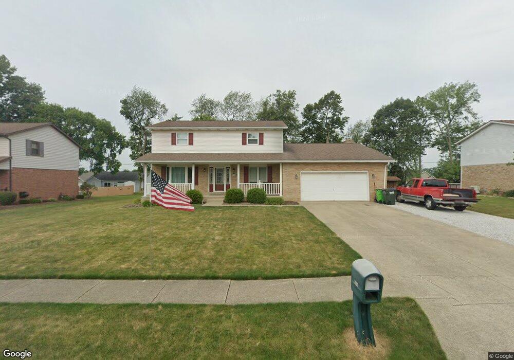
905 Hillcliff St Louisville, OH 44641
Estimated Value: $291,780 - $318,000
3
Beds
2
Baths
2,104
Sq Ft
$147/Sq Ft
Est. Value
About This Home
This home is located at 905 Hillcliff St, Louisville, OH 44641 and is currently estimated at $308,695, approximately $146 per square foot. 905 Hillcliff St is a home located in Stark County with nearby schools including Louisville High School and St. Thomas Aquinas High School & Middle School.
Ownership History
Date
Name
Owned For
Owner Type
Purchase Details
Closed on
Jun 26, 2008
Sold by
Beltz Kathryn A
Bought by
Conway Donald M and Conway Gina M
Current Estimated Value
Home Financials for this Owner
Home Financials are based on the most recent Mortgage that was taken out on this home.
Original Mortgage
$160,725
Interest Rate
6.05%
Mortgage Type
FHA
Create a Home Valuation Report for This Property
The Home Valuation Report is an in-depth analysis detailing your home's value as well as a comparison with similar homes in the area
Home Values in the Area
Average Home Value in this Area
Purchase History
| Date | Buyer | Sale Price | Title Company |
|---|---|---|---|
| Conway Donald M | $162,000 | Mk Land Title Inc |
Source: Public Records
Mortgage History
| Date | Status | Borrower | Loan Amount |
|---|---|---|---|
| Closed | Conway Donald M | $160,725 |
Source: Public Records
Tax History Compared to Growth
Tax History
| Year | Tax Paid | Tax Assessment Tax Assessment Total Assessment is a certain percentage of the fair market value that is determined by local assessors to be the total taxable value of land and additions on the property. | Land | Improvement |
|---|---|---|---|---|
| 2025 | -- | $89,080 | $17,920 | $71,160 |
| 2024 | -- | $89,080 | $17,920 | $71,160 |
| 2023 | $2,964 | $68,990 | $16,910 | $52,080 |
| 2022 | $2,971 | $68,990 | $16,910 | $52,080 |
| 2021 | $2,979 | $68,990 | $16,910 | $52,080 |
| 2020 | $2,462 | $61,920 | $15,260 | $46,660 |
| 2019 | $2,330 | $58,350 | $15,260 | $43,090 |
| 2018 | $2,321 | $58,350 | $15,260 | $43,090 |
| 2017 | $2,147 | $52,090 | $13,410 | $38,680 |
| 2016 | $2,191 | $52,090 | $13,410 | $38,680 |
| 2015 | $2,198 | $52,090 | $13,410 | $38,680 |
| 2014 | $43 | $45,020 | $11,590 | $33,430 |
| 2013 | $1,025 | $45,020 | $11,590 | $33,430 |
Source: Public Records
Map
Nearby Homes
- 1812 E Broad St
- 1715 High St
- 2110 Edmar St
- 641 S Nickelplate St
- 2015 E Main St
- 308 Superior St
- 520 S Silver St
- 0 Michigan Blvd
- 728 E Broad St
- 3390 Meese Rd NE
- 908 Sand Lot Cir
- 510 S Bauman Ct
- 204 E Broad St
- 107 E Broad St
- 325 Lincoln Ave
- 1170 Winding Ridge Ave
- 910 Crosswyck Cir
- 8225 Georgetown St
- 1702 View Pointe Ave
- 1639 Horizon Dr
- 825 Hillcliff St
- 915 Hillcliff St
- 950 Cypress Ave
- 970 Cypress Ave
- 970 Cypress Ave
- 1000 Cypress Ave
- 1906 Briarwood St
- 0 Briarwood St Unit 3768345
- 910 Hillcliff St
- 1011 Hillcliff St
- 1905 Tanglewood Cir
- 1916 Briarwood St
- 1857 Briarwood St
- 1867 Briarwood St
- 1847 Briarwood St
- 1050 Cypress Ave
- 1021 Hillcliff St
- 1905 Briarwood St
- 975 Cypress Ave
- 935 Cypress Ave