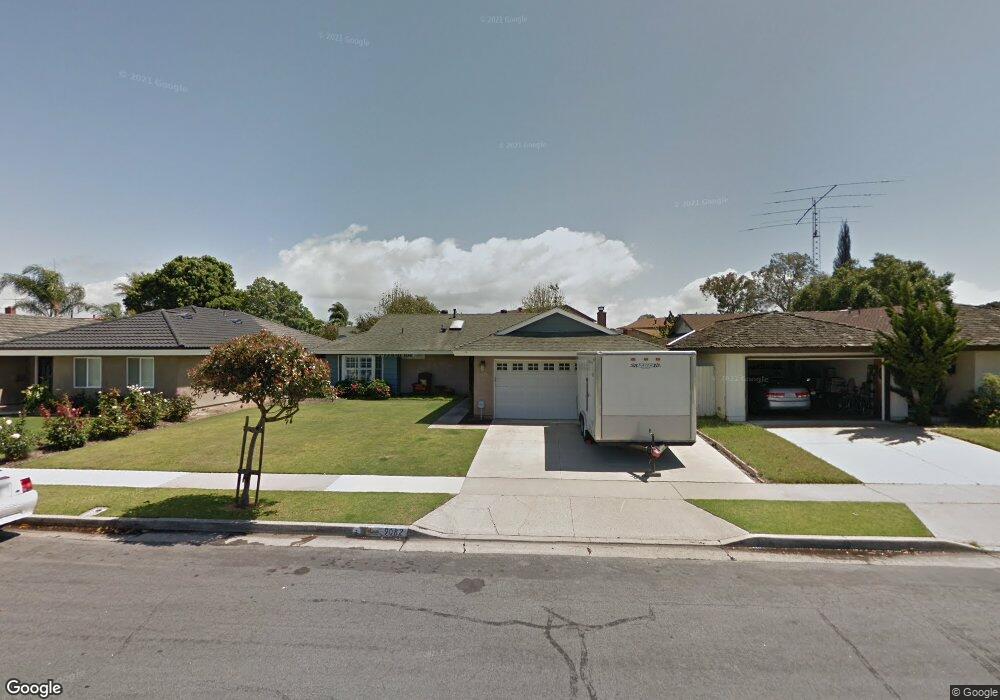
9082 Veronica Dr Huntington Beach, CA 92646
Estimated Value: $1,226,000 - $1,378,000
4
Beds
2
Baths
1,486
Sq Ft
$874/Sq Ft
Est. Value
About This Home
This home is located at 9082 Veronica Dr, Huntington Beach, CA 92646 and is currently estimated at $1,298,241, approximately $873 per square foot. 9082 Veronica Dr is a home located in Orange County with nearby schools including William T. Newland Elementary, Talbert Middle School, and Huntington Beach High School.
Ownership History
Date
Name
Owned For
Owner Type
Purchase Details
Closed on
Jan 13, 2021
Sold by
Flynn Joan La Vonne and Flynn Joan L
Bought by
Flynn Joan L and Flynn Joan L
Current Estimated Value
Purchase Details
Closed on
Sep 14, 2006
Sold by
Flynn Joan La Vonne and Carlson Joan L
Bought by
Flynn Joan La Vonne
Home Financials for this Owner
Home Financials are based on the most recent Mortgage that was taken out on this home.
Original Mortgage
$250,000
Outstanding Balance
$148,822
Interest Rate
6.51%
Mortgage Type
Credit Line Revolving
Estimated Equity
$1,149,420
Purchase Details
Closed on
Nov 9, 1998
Sold by
Carlson Richard S
Bought by
Flynn Joan Lavanne
Create a Home Valuation Report for This Property
The Home Valuation Report is an in-depth analysis detailing your home's value as well as a comparison with similar homes in the area
Home Values in the Area
Average Home Value in this Area
Purchase History
| Date | Buyer | Sale Price | Title Company |
|---|---|---|---|
| Flynn Joan L | -- | None Available | |
| Flynn Joan La Vonne | -- | United Title Company | |
| Flynn Joan Lavanne | -- | -- |
Source: Public Records
Mortgage History
| Date | Status | Borrower | Loan Amount |
|---|---|---|---|
| Open | Flynn Joan La Vonne | $250,000 |
Source: Public Records
Tax History Compared to Growth
Tax History
| Year | Tax Paid | Tax Assessment Tax Assessment Total Assessment is a certain percentage of the fair market value that is determined by local assessors to be the total taxable value of land and additions on the property. | Land | Improvement |
|---|---|---|---|---|
| 2025 | $1,533 | $279,682 | $158,975 | $120,707 |
| 2024 | $1,533 | $274,199 | $155,858 | $118,341 |
| 2023 | $3,230 | $268,823 | $152,802 | $116,021 |
| 2022 | $3,179 | $263,552 | $149,805 | $113,747 |
| 2021 | $3,118 | $258,385 | $146,868 | $111,517 |
| 2020 | $3,097 | $255,736 | $145,362 | $110,374 |
| 2019 | $3,037 | $250,722 | $142,512 | $108,210 |
| 2018 | $2,979 | $245,806 | $139,717 | $106,089 |
| 2017 | $2,931 | $240,987 | $136,978 | $104,009 |
| 2016 | $2,810 | $236,262 | $134,292 | $101,970 |
| 2015 | $2,766 | $232,714 | $132,275 | $100,439 |
| 2014 | -- | $228,156 | $129,684 | $98,472 |
Source: Public Records
Map
Nearby Homes
- 9172 Veronica Dr
- 9121 Madeline Dr
- 19202 Hickory Ln
- 8582 Salt Lake Dr
- 19846 Lures Ln
- 20111 Marina Ln
- 9462 Litchfield Dr
- 9594 Pettswood Dr Unit 4
- 20071 Moontide Cir
- 18963 Acacia St
- 19901 Burnley Ln
- 19854 Leighton Ln
- 20131 Crown Reef Ln
- 9667 Durham Dr
- 20258 Lantana Dr
- 9695 Adams Ave
- 9745 Cornwall Dr
- 19843 Coventry Ln
- 20191 Imperial Cove Ln
- 8291 Polk Cir
- 9092 Veronica Dr
- 9062 Veronica Dr
- 9081 Warfield Dr
- 9091 Warfield Dr
- 9102 Veronica Dr
- 9052 Veronica Dr
- 19571 Sanderson Ln
- 9101 Warfield Dr
- 9081 Veronica Dr
- 9091 Veronica Dr
- 9112 Veronica Dr
- 9061 Veronica Dr
- 9101 Veronica Dr
- 9042 Veronica Dr
- 19562 Roderick Ln
- 9111 Warfield Dr
- 9051 Veronica Dr
- 19581 Sanderson Ln
- 9111 Veronica Dr
- 19572 Roderick Ln