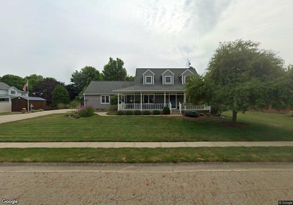
910 Hillcliff St Louisville, OH 44641
Estimated Value: $217,000 - $352,000
4
Beds
3
Baths
2,352
Sq Ft
$119/Sq Ft
Est. Value
About This Home
This home is located at 910 Hillcliff St, Louisville, OH 44641 and is currently estimated at $280,503, approximately $119 per square foot. 910 Hillcliff St is a home located in Stark County with nearby schools including Louisville High School and St. Thomas Aquinas High School & Middle School.
Ownership History
Date
Name
Owned For
Owner Type
Purchase Details
Closed on
Aug 14, 2003
Sold by
Beltz Jodi L and Stover Jodi L
Bought by
Beltz David A and Beltz Jodi L
Current Estimated Value
Home Financials for this Owner
Home Financials are based on the most recent Mortgage that was taken out on this home.
Original Mortgage
$77,000
Interest Rate
5.62%
Mortgage Type
Stand Alone Second
Purchase Details
Closed on
Jun 27, 1991
Create a Home Valuation Report for This Property
The Home Valuation Report is an in-depth analysis detailing your home's value as well as a comparison with similar homes in the area
Home Values in the Area
Average Home Value in this Area
Purchase History
| Date | Buyer | Sale Price | Title Company |
|---|---|---|---|
| Beltz David A | -- | Firstmerit Title Agency | |
| -- | -- | -- |
Source: Public Records
Mortgage History
| Date | Status | Borrower | Loan Amount |
|---|---|---|---|
| Closed | Beltz David A | $77,000 |
Source: Public Records
Tax History Compared to Growth
Tax History
| Year | Tax Paid | Tax Assessment Tax Assessment Total Assessment is a certain percentage of the fair market value that is determined by local assessors to be the total taxable value of land and additions on the property. | Land | Improvement |
|---|---|---|---|---|
| 2025 | -- | $98,000 | $21,070 | $76,930 |
| 2024 | -- | $98,000 | $21,070 | $76,930 |
| 2023 | $3,130 | $82,010 | $19,880 | $62,130 |
| 2022 | $3,155 | $82,010 | $19,880 | $62,130 |
| 2021 | $3,163 | $82,010 | $19,880 | $62,130 |
| 2020 | $2,675 | $76,020 | $17,920 | $58,100 |
| 2019 | $2,687 | $76,060 | $17,920 | $58,140 |
| 2018 | $2,677 | $76,060 | $17,920 | $58,140 |
| 2017 | $2,480 | $68,920 | $15,750 | $53,170 |
| 2016 | $2,531 | $68,920 | $15,750 | $53,170 |
| 2015 | $2,539 | $68,920 | $15,750 | $53,170 |
| 2014 | $305 | $59,540 | $13,580 | $45,960 |
| 2013 | $1,156 | $59,540 | $13,580 | $45,960 |
Source: Public Records
Map
Nearby Homes
- 1812 E Broad St
- 1715 High St
- 2110 Edmar St
- 2015 E Main St
- 641 S Nickelplate St
- 308 Superior St
- 520 S Silver St
- 0 Michigan Blvd
- 728 E Broad St
- 3390 Meese Rd NE
- 908 Sand Lot Cir
- 510 S Bauman Ct
- 204 E Broad St
- 107 E Broad St
- 325 Lincoln Ave
- 1170 Winding Ridge Ave
- 910 Crosswyck Cir
- 8225 Georgetown St
- 1702 View Pointe Ave
- 1639 Horizon Dr
- 1905 Tanglewood Cir
- 1906 Briarwood St
- 1916 Briarwood St
- 905 Bentwood Cir
- 1926 Briarwood St
- 915 Hillcliff St
- 905 Hillcliff St
- 1913 Tanglewood Cir
- 0 Briarwood St Unit 3768345
- 825 Hillcliff St
- 1923 Tanglewood Cir
- 1011 Hillcliff St
- 1916 Tanglewood Cir
- 1900 Tanglewood Cir
- 906 Bentwood Cir
- 1931 Tanglewood Cir
- 1021 Hillcliff St
- 1905 Briarwood St
- 1915 Briarwood St
- 2006 Briarwood St