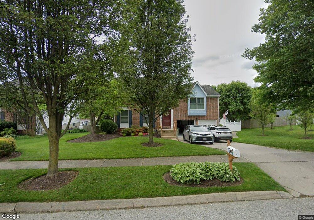
912 Meadow Ridge Ct Bel Air, MD 21014
Estimated Value: $500,000 - $623,000
--
Bed
3
Baths
2,156
Sq Ft
$251/Sq Ft
Est. Value
About This Home
This home is located at 912 Meadow Ridge Ct, Bel Air, MD 21014 and is currently estimated at $541,077, approximately $250 per square foot. 912 Meadow Ridge Ct is a home located in Harford County with nearby schools including Homestead-Wakefield Elementary School, Bel Air Middle School, and Bel Air High School.
Ownership History
Date
Name
Owned For
Owner Type
Purchase Details
Closed on
Dec 21, 1987
Sold by
Paramount Enterprises Inc
Bought by
Blinke Craig and Blinke Donna
Current Estimated Value
Home Financials for this Owner
Home Financials are based on the most recent Mortgage that was taken out on this home.
Original Mortgage
$67,000
Interest Rate
10.69%
Purchase Details
Closed on
Jan 12, 1987
Sold by
Bel Air Land Development Iii
Bought by
Paramount Enterprises Inc
Purchase Details
Closed on
Jun 4, 1986
Sold by
Gerrett Company Inc The
Bought by
Bel Air Land Development Iii
Create a Home Valuation Report for This Property
The Home Valuation Report is an in-depth analysis detailing your home's value as well as a comparison with similar homes in the area
Home Values in the Area
Average Home Value in this Area
Purchase History
| Date | Buyer | Sale Price | Title Company |
|---|---|---|---|
| Blinke Craig | $132,900 | -- | |
| Paramount Enterprises Inc | $28,500 | -- | |
| Bel Air Land Development Iii | $716,400 | -- |
Source: Public Records
Mortgage History
| Date | Status | Borrower | Loan Amount |
|---|---|---|---|
| Closed | Blinke Craig | $67,000 |
Source: Public Records
Tax History Compared to Growth
Tax History
| Year | Tax Paid | Tax Assessment Tax Assessment Total Assessment is a certain percentage of the fair market value that is determined by local assessors to be the total taxable value of land and additions on the property. | Land | Improvement |
|---|---|---|---|---|
| 2025 | $4,295 | $410,300 | $110,100 | $300,200 |
| 2024 | $3,940 | $394,033 | $0 | $0 |
| 2023 | $3,940 | $377,767 | $0 | $0 |
| 2022 | $3,940 | $361,500 | $110,100 | $251,400 |
| 2021 | $4,014 | $354,667 | $0 | $0 |
| 2020 | $4,014 | $347,833 | $0 | $0 |
| 2019 | $3,935 | $341,000 | $120,000 | $221,000 |
| 2018 | $3,897 | $340,733 | $0 | $0 |
| 2017 | $3,894 | $341,000 | $0 | $0 |
| 2016 | -- | $340,200 | $0 | $0 |
| 2015 | $3,762 | $338,633 | $0 | $0 |
| 2014 | $3,762 | $337,067 | $0 | $0 |
Source: Public Records
Map
Nearby Homes
- 4 Ashley Way
- 12 Overbrook Ln
- 1039 Wingate Ct
- 916 Cheswold Ct
- 1312 Scottsdale Dr Unit H
- 1818 Selvin Dr Unit 202
- 1314 Scottsdale Dr Unit G
- 1310 Scottsdale Dr Unit R
- 1307 Scottsdale Dr Unit J
- 1307 Scottsdale Dr Unit G
- 1600 Martha Ct Unit 304
- 1600 Martha Ct Unit 301
- 1219 Starmount Ln
- 1308 Scottsdale Dr Unit L
- 1304 Scottsdale Dr Unit P
- 1309 Sheridan Place Unit 99
- 1313 Kelsey Ct
- 1310 Sheridan Place Unit 108-17
- 906 Whispering Ridge Ln
- 929 Todd Rd
- 914 Meadow Ridge Ct
- 910 Meadow Ridge Ct
- 917 Fallen Stone Ct
- 919 Fallen Stone Ct
- 913 Meadow Ridge Ct
- 915 Meadow Ridge Ct
- 913 Fallen Stone Ct
- 908 Meadow Ridge Ct
- 911 Meadow Ridge Ct
- 911 Fallen Stone Ct
- 909 Meadow Ridge Ct
- 963 E Ring Factory Rd
- 969 E Ring Factory Rd
- 967 E Ring Factory Rd
- 910 Hedgerow Ct
- 906 Meadow Ridge Ct
- 912 Hedgerow Ct
- 971 E Ring Factory Rd
- 920 Fallen Stone Ct
- 918 Fallen Stone Ct