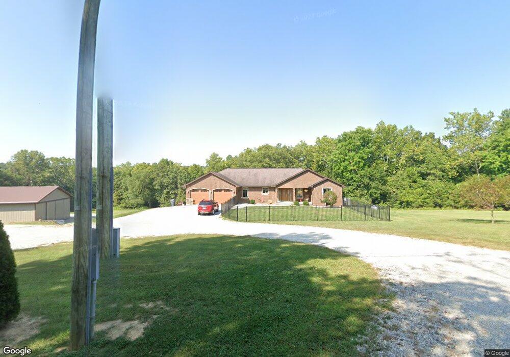
9122 N County Road 400 W Freetown, IN 47235
Estimated Value: $284,000 - $678,719
3
Beds
3
Baths
2,980
Sq Ft
$142/Sq Ft
Est. Value
About This Home
This home is located at 9122 N County Road 400 W, Freetown, IN 47235 and is currently estimated at $424,573, approximately $142 per square foot. 9122 N County Road 400 W is a home located in Jackson County with nearby schools including Brownstown Elementary School, Brownstown Central Middle School, and Brownstown Central High School.
Ownership History
Date
Name
Owned For
Owner Type
Purchase Details
Closed on
Oct 25, 2017
Sold by
Fish Richard B and Fish Stephanie L
Bought by
Fish Richard B and Fish Stephanie L
Current Estimated Value
Purchase Details
Closed on
Sep 21, 2010
Sold by
James A
Bought by
Richard B
Create a Home Valuation Report for This Property
The Home Valuation Report is an in-depth analysis detailing your home's value as well as a comparison with similar homes in the area
Home Values in the Area
Average Home Value in this Area
Purchase History
| Date | Buyer | Sale Price | Title Company |
|---|---|---|---|
| Fish Richard B | -- | None Available | |
| Richard B | $110,000 | Lorenzo Law Office |
Source: Public Records
Tax History Compared to Growth
Tax History
| Year | Tax Paid | Tax Assessment Tax Assessment Total Assessment is a certain percentage of the fair market value that is determined by local assessors to be the total taxable value of land and additions on the property. | Land | Improvement |
|---|---|---|---|---|
| 2024 | $3,075 | $347,500 | $42,400 | $305,100 |
| 2023 | $2,411 | $264,400 | $37,500 | $226,900 |
| 2022 | $2,419 | $255,500 | $32,300 | $223,200 |
| 2021 | $1,833 | $215,400 | $29,600 | $185,800 |
| 2020 | $1,828 | $218,400 | $29,500 | $188,900 |
| 2019 | $1,817 | $224,000 | $33,100 | $190,900 |
| 2018 | $1,813 | $227,700 | $33,800 | $193,900 |
| 2017 | $2,127 | $235,100 | $42,800 | $192,300 |
| 2016 | $1,831 | $239,900 | $44,600 | $195,300 |
| 2014 | $2,044 | $225,200 | $46,000 | $179,200 |
| 2013 | $2,044 | $225,000 | $41,300 | $183,700 |
Source: Public Records
Map
Nearby Homes
- 3000 W Block Co Rd 900 N
- 9649 N County Road 450 W
- 2000 Block W 1125 N
- 2221 Indiana 258
- 11000 N County Road 650 W
- 8515 N County Road 100 W
- 6000 W County Road 700 N
- 6725 W County Road 700 N
- 7594 W County Road 925 N
- 9601 Buffalo Pike
- 8650 Mount Nebo Rd
- 00 Lutheran Lake Rd
- 8000 W County Road 625 Tract 4 N
- 8000 W County Road 625 N Unit LotWP004
- 14000 W Lake Rd
- 7693 S Bob Allen Rd
- 4325 N County Road 650 W
- XXXX Keith Donaldson Rd
- 7275 Hamilton Creek Rd
- 0 W Mt Healthy Rd Unit MBR21884970
- 4100 W County Road 900 N
- 9173 N County Road 400 W
- XXX N County Road 400 W
- 3003 W Block County Rd 900 N
- 3753 W County Road 900 N
- 3001 W Block County Rd 900 N
- 3000 W Block County Rd 900 N
- 3002 W Block County Rd 900 N
- 9310 N County Road 400 W
- 9268 N County Road 450 W
- 9520 N County Road 400 W
- 9537 N County Road 400 W
- 9319 N County Road 400 W
- 8508 N County Road 375 W
- 3000 W County Road 900 N Unit W
- 3000 W County Road 900 N
- 8748 N County Road 375 W
- 8478 N County Road 425 W
- 8458 N County Road 425 W
- 8438 N County Road 425 W