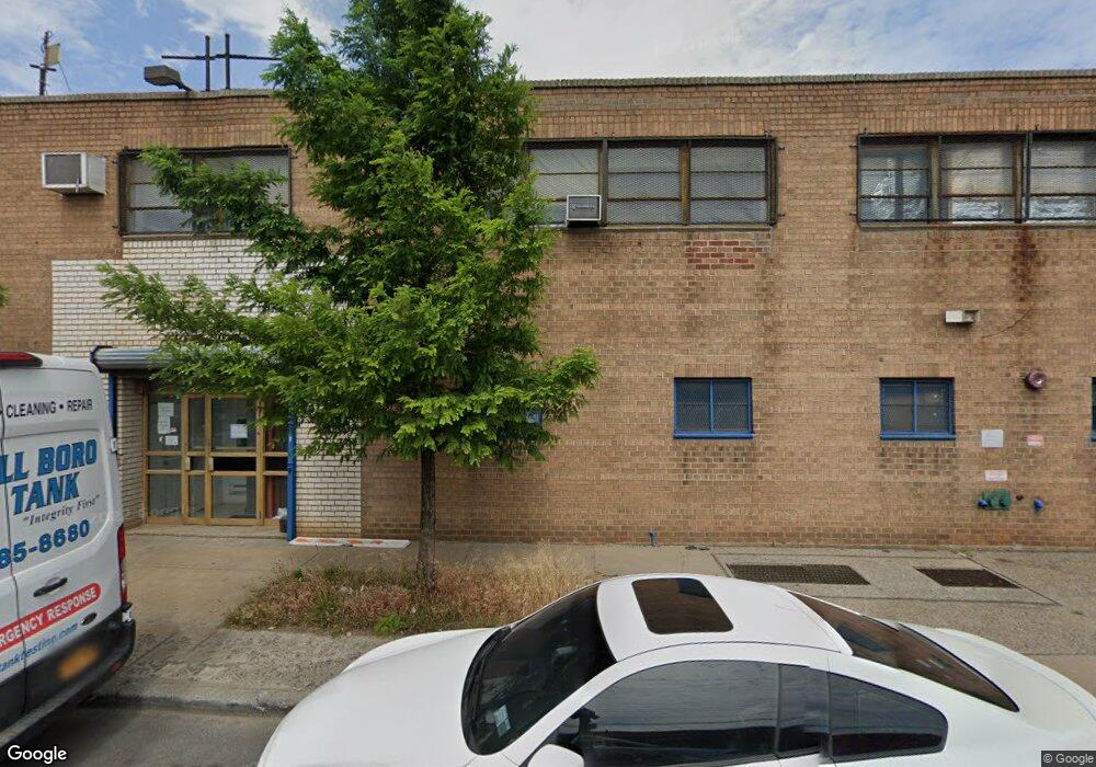
913-927 Shepherd Ave Brooklyn, NY 11208
East New York Neighborhood
--
Bed
--
Bath
2,500
Sq Ft
0.28
Acres
About This Home
This home is located at 913-927 Shepherd Ave, Brooklyn, NY 11208. 913-927 Shepherd Ave is a home located in Kings County with nearby schools including P.S. 224 Hale A Woodruff, Van Siclen Community Middle School, and Achievement First Aspire Charter.
Ownership History
Date
Name
Owned For
Owner Type
Purchase Details
Closed on
Jan 4, 2022
Sold by
Jp Wank Industrial Real Estate Llc
Bought by
913-927 Shepherd Avenue Llc
Purchase Details
Closed on
Jan 29, 2002
Sold by
Wank Murray
Bought by
Wank Murray and Murray Wank Living Trust
Purchase Details
Closed on
Oct 5, 2001
Sold by
Wank Irving
Bought by
Wank Irving and Wank Judith
Purchase Details
Closed on
Aug 6, 2001
Sold by
Goshen Sylvia R
Bought by
Goshen Sylvia R and Goshen Bernard M
Purchase Details
Closed on
Jun 18, 2001
Sold by
Wank Louis Nathan
Bought by
Wank Louis N and Wank Sylvia
Create a Home Valuation Report for This Property
The Home Valuation Report is an in-depth analysis detailing your home's value as well as a comparison with similar homes in the area
Home Values in the Area
Average Home Value in this Area
Purchase History
| Date | Buyer | Sale Price | Title Company |
|---|---|---|---|
| 913-927 Shepherd Avenue Llc | -- | -- | |
| Wank Murray | -- | -- | |
| Wank Irving | -- | -- | |
| Goshen Sylvia R | -- | -- | |
| Wank Louis N | -- | -- |
Source: Public Records
Tax History Compared to Growth
Tax History
| Year | Tax Paid | Tax Assessment Tax Assessment Total Assessment is a certain percentage of the fair market value that is determined by local assessors to be the total taxable value of land and additions on the property. | Land | Improvement |
|---|---|---|---|---|
| 2025 | $61,777 | $688,050 | $90,000 | $598,050 |
| 2024 | $61,777 | $665,100 | $90,000 | $575,100 |
| 2023 | $56,822 | $648,900 | $90,000 | $558,900 |
| 2022 | $26,454 | $583,650 | $90,000 | $493,650 |
| 2021 | $47,536 | $482,400 | $90,000 | $392,400 |
| 2020 | $23,768 | $562,950 | $90,000 | $472,950 |
| 2019 | $36,687 | $417,600 | $90,000 | $327,600 |
| 2018 | $33,214 | $413,100 | $90,000 | $323,100 |
| 2017 | $29,381 | $346,500 | $90,000 | $256,500 |
| 2016 | $25,533 | $301,950 | $90,000 | $211,950 |
| 2015 | $9,580 | $265,500 | $90,000 | $175,500 |
| 2014 | $9,580 | $252,450 | $90,000 | $162,450 |
Source: Public Records
Map
Nearby Homes
- 846 Stanley Ave Unit 4383/1
- 846 Stanley Ave
- 586 Milford St
- 589 Milford St
- 819 Ashford St
- 956 Hegeman Ave
- 12427 Flatlands Ave Unit 1A
- 2476 Linden Blvd
- 2461 Linden Blvd
- 517 Milford St
- 12441 Flatlands Ave Unit BA
- 801 Logan St
- 701 Fountain Ave
- 738 Shepherd Ave
- 495 Milford St
- 913 Euclid Ave
- 12399 Flatlands Ave Unit 9L
- 12421 Flatlands Ave Unit 1F
- 12399 Flatlands Ave Unit 1L
- 12399 Flatlands Ave
- 907 Shepherd Ave
- 670-672 Berriman St
- 660-668 Berriman St
- 654 Berriman St
- 901 Essex St Unit 917
- 549 Wortman Ave
- 646 Berriman St
- 901-917 Essex St
- 885-897 Shepherd Ave
- 900-908 Shepherd Ave
- 898 Shepherd Ave
- 669-671 Berriman St
- 505-527 Wortman Ave
- 663-665 Berriman St
- 894 Shepherd Ave
- 673-685 Berriman St
- 892 Shepherd Ave
- 645 Berriman St
- 889 Essex St
- 894 Stanley Ave