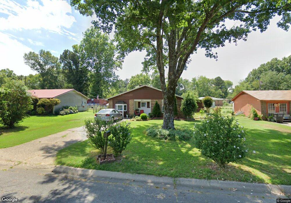
913 Lehman Dr Jacksonville, AR 72076
Estimated Value: $123,408 - $148,000
--
Bed
3
Baths
1,418
Sq Ft
$93/Sq Ft
Est. Value
About This Home
This home is located at 913 Lehman Dr, Jacksonville, AR 72076 and is currently estimated at $132,102, approximately $93 per square foot. 913 Lehman Dr is a home located in Pulaski County with nearby schools including Murrell Taylor Elementary School, Jacksonville Middle School, and Jacksonville High School.
Ownership History
Date
Name
Owned For
Owner Type
Purchase Details
Closed on
Aug 19, 2005
Sold by
Cutlip Timothy H and Moore Cutlip Thessley
Bought by
Harris Tonnie and Harris Willie M
Current Estimated Value
Home Financials for this Owner
Home Financials are based on the most recent Mortgage that was taken out on this home.
Original Mortgage
$64,390
Outstanding Balance
$34,150
Interest Rate
5.81%
Mortgage Type
FHA
Estimated Equity
$97,952
Purchase Details
Closed on
Oct 30, 1998
Sold by
White Lloyd R
Bought by
Cutlip Timothy H
Home Financials for this Owner
Home Financials are based on the most recent Mortgage that was taken out on this home.
Original Mortgage
$56,100
Interest Rate
6.57%
Mortgage Type
VA
Create a Home Valuation Report for This Property
The Home Valuation Report is an in-depth analysis detailing your home's value as well as a comparison with similar homes in the area
Home Values in the Area
Average Home Value in this Area
Purchase History
| Date | Buyer | Sale Price | Title Company |
|---|---|---|---|
| Harris Tonnie | $65,000 | Stewart Title Of Arkansas | |
| Cutlip Timothy H | -- | United Abstract & Title Co |
Source: Public Records
Mortgage History
| Date | Status | Borrower | Loan Amount |
|---|---|---|---|
| Open | Harris Tonnie | $64,390 | |
| Previous Owner | Cutlip Timothy H | $56,100 |
Source: Public Records
Tax History Compared to Growth
Tax History
| Year | Tax Paid | Tax Assessment Tax Assessment Total Assessment is a certain percentage of the fair market value that is determined by local assessors to be the total taxable value of land and additions on the property. | Land | Improvement |
|---|---|---|---|---|
| 2025 | $819 | $17,732 | $1,200 | $16,532 |
| 2024 | $657 | $17,732 | $1,200 | $16,532 |
| 2023 | $657 | $17,732 | $1,200 | $16,532 |
| 2022 | $716 | $17,732 | $1,200 | $16,532 |
| 2021 | $682 | $11,100 | $600 | $10,500 |
| 2020 | $307 | $11,100 | $600 | $10,500 |
| 2019 | $307 | $11,100 | $600 | $10,500 |
| 2018 | $332 | $11,100 | $600 | $10,500 |
| 2017 | $332 | $11,100 | $600 | $10,500 |
| 2016 | $408 | $12,350 | $2,100 | $10,250 |
| 2015 | $664 | $12,350 | $2,100 | $10,250 |
| 2014 | $664 | $12,350 | $2,100 | $10,250 |
Source: Public Records
Map
Nearby Homes
- 720 Southeastern Ave
- 600 Sorrells Dr
- 1404 Southeastern Ave
- 219 Lonsdale Cir
- 1401 Tamara Park
- 0 S J P Wright Loop Rd
- 13 Michelle Ln Unit A
- 1302 King St
- 32 Ross Cir
- 26 Wright Cir
- 2003 Old Military Rd
- 2209 Old Military Rd
- 1305 Glenn Rd
- 1110 Wright St
- 910 Ray Rd
- 203 Boston St
- 419 Church St
- 221 Pearl St
- 203 Northeastern Ave
- 134 Pike Ave
- 1001 Lehman Dr
- 909 Lehman Dr
- 1005 Lehman Dr
- 905 Lehman Dr
- 912 Sorrells Dr
- 1000 Sorrells Dr
- 908 Sorrells Dr
- 912 Lehman Dr
- 1000 Lehman Dr
- 1004 Sorrells Dr
- 904 Sorrells Dr
- 908 Lehman Dr
- 1009 Lehman Dr
- 901 Lehman Dr
- 1004 Lehman Dr
- 904 Lehman Dr
- 1008 Lehman Dr
- 1008 Sorrells Dr
- 900 Sorrells Dr
- 917 Ruth Ann Dr