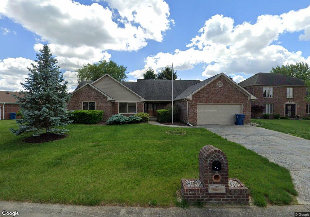
9131 New Harmony Cir Indianapolis, IN 46231
Chapel Hill-Ben Davis NeighborhoodEstimated Value: $328,525 - $361,000
3
Beds
3
Baths
2,239
Sq Ft
$155/Sq Ft
Est. Value
About This Home
This home is located at 9131 New Harmony Cir, Indianapolis, IN 46231 and is currently estimated at $346,631, approximately $154 per square foot. 9131 New Harmony Cir is a home located in Marion County with nearby schools including Bridgeport Elementary School, Lynhurst 7th & 8th Grade Center, and Ben Davis University High School.
Ownership History
Date
Name
Owned For
Owner Type
Purchase Details
Closed on
Apr 6, 2022
Sold by
Sheriff Of Marion County
Bought by
Mowbray Family Revocable Living Trust
Current Estimated Value
Purchase Details
Closed on
Mar 22, 2022
Sold by
Sheriff Of Marion County
Bought by
Mowbray Family Revocable Living Trust
Purchase Details
Closed on
Sep 24, 2007
Sold by
Mowbray Robert D and Mowbray Phyllis M
Bought by
Mowbray Robert D and Mowbray Phyllis May
Home Financials for this Owner
Home Financials are based on the most recent Mortgage that was taken out on this home.
Original Mortgage
$277,500
Interest Rate
5.15%
Mortgage Type
Reverse Mortgage Home Equity Conversion Mortgage
Create a Home Valuation Report for This Property
The Home Valuation Report is an in-depth analysis detailing your home's value as well as a comparison with similar homes in the area
Home Values in the Area
Average Home Value in this Area
Purchase History
| Date | Buyer | Sale Price | Title Company |
|---|---|---|---|
| Mowbray Family Revocable Living Trust | $273,000 | Manley Deas Kochalski Llc | |
| Mowbray Family Revocable Living Trust | $273,000 | Manley Deas Kochalski Llc | |
| Mowbray Robert D | -- | Lenders First Choice |
Source: Public Records
Mortgage History
| Date | Status | Borrower | Loan Amount |
|---|---|---|---|
| Previous Owner | Mowbray Robert D | $277,500 |
Source: Public Records
Tax History Compared to Growth
Tax History
| Year | Tax Paid | Tax Assessment Tax Assessment Total Assessment is a certain percentage of the fair market value that is determined by local assessors to be the total taxable value of land and additions on the property. | Land | Improvement |
|---|---|---|---|---|
| 2024 | $6,897 | $345,400 | $27,500 | $317,900 |
| 2023 | $6,897 | $288,000 | $27,500 | $260,500 |
| 2022 | $3,489 | $282,600 | $27,500 | $255,100 |
| 2021 | $3,166 | $224,900 | $27,500 | $197,400 |
| 2020 | $3,273 | $232,500 | $27,500 | $205,000 |
| 2019 | $3,295 | $234,200 | $27,500 | $206,700 |
| 2018 | $2,581 | $210,500 | $27,500 | $183,000 |
| 2017 | $2,399 | $195,900 | $27,500 | $168,400 |
| 2016 | $2,314 | $189,200 | $27,500 | $161,700 |
| 2014 | $1,841 | $184,100 | $27,500 | $156,600 |
| 2013 | $1,722 | $172,200 | $27,500 | $144,700 |
Source: Public Records
Map
Nearby Homes
- 1249 Tenor Place
- 1256 Tenor Place
- 1442 Bank Place
- 606 Bakeway Cir
- 8853 Stonewall Dr
- 10699 Crane Dr
- 1633 Composer Way
- 1640 Walpole Way
- 1660 Orchestra Way
- 403 Bagley Ln
- 8605 Spring Valley Ln
- 421 Bridgeport Rd
- 1449 Danielle Dr
- 10882 Zimmerman Ln
- 10795 Albertson Dr
- 1353 New Field Ln
- 10816 Zimmerman Ln
- 8945 Poppy Ln
- 1392 Broyles Ln
- 813 Aerostar Ct
- 9121 New Harmony Cir
- 9141 New Harmony Cir
- 1160 New Harmony Dr
- 1152 New Harmony Dr
- 1157 Texarkana Dr
- 9140 New Harmony Cir
- 9132 New Harmony Cir
- 1142 New Harmony Dr
- 9148 New Harmony Cir
- 9149 New Harmony Cir
- 1149 Texarkana Dr
- 9152 New Harmony Cir
- 9153 New Harmony Cir
- 1122 New Harmony Dr
- 968 Oklahoma Ct
- 1155 New Harmony Dr
- 1141 Texarkana Dr
- 969 Oklahoma Ct
- 1110 New Harmony Dr
- 1145 New Harmony Dr