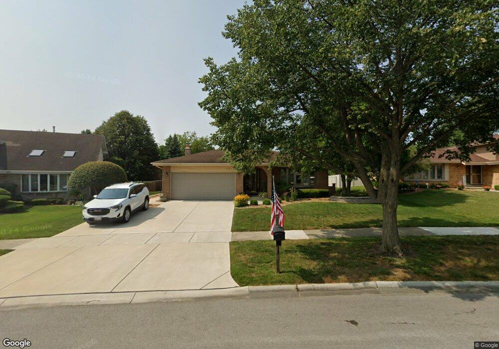
9133 Oakwood Dr Tinley Park, IL 60487
Central Tinley Park NeighborhoodEstimated Value: $412,858 - $443,000
4
Beds
2
Baths
1,864
Sq Ft
$230/Sq Ft
Est. Value
About This Home
This home is located at 9133 Oakwood Dr, Tinley Park, IL 60487 and is currently estimated at $428,965, approximately $230 per square foot. 9133 Oakwood Dr is a home located in Cook County with nearby schools including Christa Mcauliffe School, Prairie View Middle School, and Victor J Andrew High School.
Ownership History
Date
Name
Owned For
Owner Type
Purchase Details
Closed on
Oct 30, 1998
Sold by
Paternostro John J and Paternostro Helene
Bought by
Zielinski Larry M and Zielinski Bonnie L
Current Estimated Value
Home Financials for this Owner
Home Financials are based on the most recent Mortgage that was taken out on this home.
Original Mortgage
$50,000
Interest Rate
6.96%
Create a Home Valuation Report for This Property
The Home Valuation Report is an in-depth analysis detailing your home's value as well as a comparison with similar homes in the area
Home Values in the Area
Average Home Value in this Area
Purchase History
| Date | Buyer | Sale Price | Title Company |
|---|---|---|---|
| Zielinski Larry M | $190,000 | Professional National Title |
Source: Public Records
Mortgage History
| Date | Status | Borrower | Loan Amount |
|---|---|---|---|
| Previous Owner | Zielinski Larry M | $50,000 |
Source: Public Records
Tax History Compared to Growth
Tax History
| Year | Tax Paid | Tax Assessment Tax Assessment Total Assessment is a certain percentage of the fair market value that is determined by local assessors to be the total taxable value of land and additions on the property. | Land | Improvement |
|---|---|---|---|---|
| 2024 | $9,075 | $36,000 | $4,656 | $31,344 |
| 2023 | $8,264 | $36,000 | $4,656 | $31,344 |
| 2022 | $8,264 | $26,599 | $4,049 | $22,550 |
| 2021 | $8,029 | $26,599 | $4,049 | $22,550 |
| 2020 | $7,897 | $26,599 | $4,049 | $22,550 |
| 2019 | $9,000 | $31,181 | $3,644 | $27,537 |
| 2018 | $8,806 | $31,181 | $3,644 | $27,537 |
| 2017 | $8,590 | $31,181 | $3,644 | $27,537 |
| 2016 | $7,595 | $25,366 | $3,239 | $22,127 |
| 2015 | $7,473 | $25,366 | $3,239 | $22,127 |
| 2014 | $7,426 | $25,366 | $3,239 | $22,127 |
| 2013 | $6,793 | $25,122 | $3,239 | $21,883 |
Source: Public Records
Map
Nearby Homes
- 17533 Pecan Ln
- 9280 Windsor Pkwy Unit 92
- 9260 Windsor Pkwy Unit 80
- 9201 175th St
- 17964 Upland Dr
- 17535 S La Grange Rd
- 17535-2 Lagrange Rd
- 18055 Upland Dr
- 17631 Dover Ct
- 17230 Shetland Dr
- 17224 Briar Dr
- Fremont Plan at Radcliffe Place
- Calysta Plan at Radcliffe Place
- Danbury Plan at Radcliffe Place
- Briarcliffe Plan at Radcliffe Place
- Eden Plan at Radcliffe Place
- Amberwood Plan at Radcliffe Place
- 9413 Caledonia Dr
- 17500 Lagrange Rd
- 18248 Murphy Cir Unit 182
- 9127 Oakwood Dr
- 9139 Oakwood Dr
- 14310 Oak Wood Dr
- 9121 Oakwood Dr
- 17624 Oakwood Dr
- 9130 Oakwood Dr
- 9122 Oakwood Dr
- 9115 Oakwood Dr
- 17618 Oakwood Dr
- 17613 Oakwood Dr
- 17645 Ash St
- 17701 Ash St
- 17612 Pecan Ln
- 9109 Oakwood Dr
- 17709 Ash St
- 17639 Ash St
- 17607 Oakwood Dr
- 17713 Ash St
- 17621 Pecan Ln
- 17606 Pecan Ln