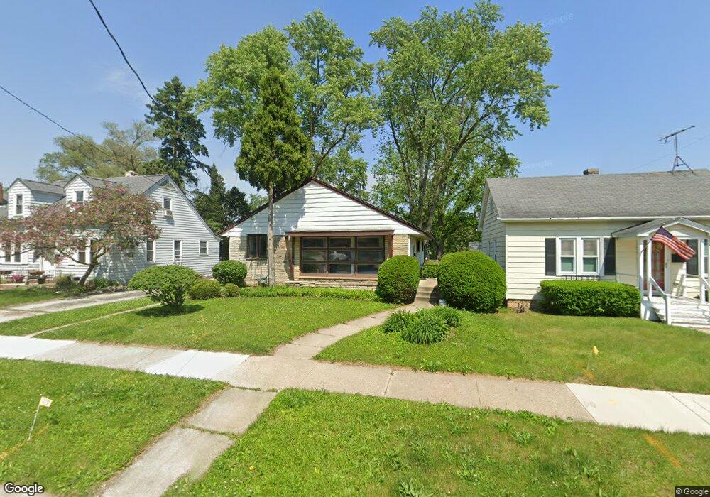
917 Harding Ave Waukesha, WI 53186
Estimated Value: $251,000 - $267,000
3
Beds
1
Bath
972
Sq Ft
$267/Sq Ft
Est. Value
About This Home
This home is located at 917 Harding Ave, Waukesha, WI 53186 and is currently estimated at $259,983, approximately $267 per square foot. 917 Harding Ave is a home located in Waukesha County with nearby schools including Hadfield Elementary School, Horning Middle School, and South High School.
Ownership History
Date
Name
Owned For
Owner Type
Purchase Details
Closed on
Mar 30, 2009
Sold by
Litt Dorothie
Bought by
Dominguez Gerardo
Current Estimated Value
Home Financials for this Owner
Home Financials are based on the most recent Mortgage that was taken out on this home.
Original Mortgage
$127,645
Outstanding Balance
$81,769
Interest Rate
5.19%
Mortgage Type
Purchase Money Mortgage
Estimated Equity
$178,214
Purchase Details
Closed on
Oct 9, 2002
Sold by
Litt Anthony F
Bought by
Litt Dorothie
Create a Home Valuation Report for This Property
The Home Valuation Report is an in-depth analysis detailing your home's value as well as a comparison with similar homes in the area
Home Values in the Area
Average Home Value in this Area
Purchase History
| Date | Buyer | Sale Price | Title Company |
|---|---|---|---|
| Dominguez Gerardo | $130,000 | Capital Title & Closing Svcs | |
| Litt Dorothie | -- | -- |
Source: Public Records
Mortgage History
| Date | Status | Borrower | Loan Amount |
|---|---|---|---|
| Open | Dominguez Gerardo | $127,645 |
Source: Public Records
Tax History Compared to Growth
Tax History
| Year | Tax Paid | Tax Assessment Tax Assessment Total Assessment is a certain percentage of the fair market value that is determined by local assessors to be the total taxable value of land and additions on the property. | Land | Improvement |
|---|---|---|---|---|
| 2024 | $2,756 | $191,600 | $46,800 | $144,800 |
| 2023 | $2,662 | $191,600 | $46,800 | $144,800 |
| 2022 | $2,813 | $151,000 | $45,200 | $105,800 |
| 2021 | $2,867 | $151,000 | $45,200 | $105,800 |
| 2020 | $3,451 | $151,000 | $45,200 | $105,800 |
| 2019 | $2,691 | $151,000 | $45,200 | $105,800 |
| 2018 | $2,524 | $138,500 | $40,900 | $97,600 |
| 2017 | $4,127 | $138,500 | $40,900 | $97,600 |
| 2016 | $4,579 | $129,400 | $38,700 | $90,700 |
| 2015 | $3,615 | $129,400 | $38,700 | $90,700 |
| 2014 | $2,583 | $128,100 | $38,700 | $89,400 |
| 2013 | $2,583 | $128,100 | $38,700 | $89,400 |
Source: Public Records
Map
Nearby Homes
- 930 Harding Ave
- 1219 National Ave
- 953 Genesee St
- 1103 Arcadian Ave
- 1021 Arcadian Ave
- 1021 Aurora St
- 1349 Rose Ct Unit 62
- 918 Niagara St
- 1333 Niagara St
- 1462 Cleveland Ave
- 1308 Danny St
- 1471 Cleveland Ave
- 512 E Main St
- 937 E Moreland Blvd
- 1139 White Rock Ave
- S21W23079 Hillside Dr
- 1343 Hillside Dr
- S17W22650 Lincoln Ave
- 1609 Murray Ave
- 100 E Main St Unit 403
- 913 Harding Ave
- 921 Harding Ave
- 925 Harding Ave
- 929 Harding Ave
- 914 Harding Ave
- 920 Blackstone Ave
- 933 Harding Ave
- 918 Harding Ave
- 904 Blackstone Ave
- 926 Blackstone Ave Unit 3
- 926 Harding Ave
- 912 Blackstone Ave
- 941 Harding Ave
- 916 Blackstone Ave
- 937 Harding Ave
- 906 Harding Ave
- 934 Harding Ave
- 902 Harding Ave
- 945 Harding Ave
- 923 Perkins Ave