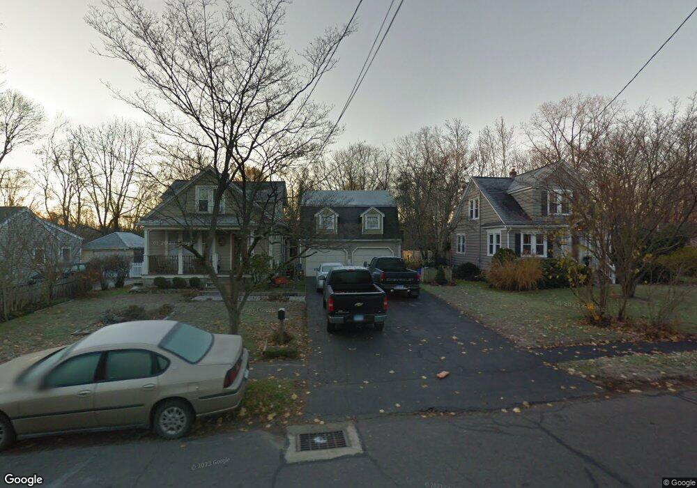
919 Holland Hill Rd Fairfield, CT 06824
University NeighborhoodEstimated Value: $715,000 - $782,918
2
Beds
3
Baths
1,219
Sq Ft
$621/Sq Ft
Est. Value
About This Home
This home is located at 919 Holland Hill Rd, Fairfield, CT 06824 and is currently estimated at $757,480, approximately $621 per square foot. 919 Holland Hill Rd is a home located in Fairfield County with nearby schools including Osborn Hill Elementary School, Fairfield Woods Middle School, and Fairfield Ludlowe High School.
Ownership History
Date
Name
Owned For
Owner Type
Purchase Details
Closed on
Sep 5, 2024
Sold by
Souza Joyce M and Wolfram Deborah S
Bought by
Souza James D
Current Estimated Value
Purchase Details
Closed on
Dec 22, 2020
Sold by
Souza David F Est and Souza
Bought by
Souza Joyce M
Purchase Details
Closed on
Jan 12, 1970
Bought by
Souza David and Souza Joyce M
Create a Home Valuation Report for This Property
The Home Valuation Report is an in-depth analysis detailing your home's value as well as a comparison with similar homes in the area
Home Values in the Area
Average Home Value in this Area
Purchase History
| Date | Buyer | Sale Price | Title Company |
|---|---|---|---|
| Souza James D | -- | None Available | |
| Souza James D | -- | None Available | |
| Souza James D | -- | None Available | |
| Souza Joyce M | -- | None Available | |
| Souza Joyce M | -- | None Available | |
| Souza Joyce M | -- | None Available | |
| Souza David | -- | -- |
Source: Public Records
Tax History Compared to Growth
Tax History
| Year | Tax Paid | Tax Assessment Tax Assessment Total Assessment is a certain percentage of the fair market value that is determined by local assessors to be the total taxable value of land and additions on the property. | Land | Improvement |
|---|---|---|---|---|
| 2025 | $9,499 | $334,600 | $230,720 | $103,880 |
| 2024 | $9,335 | $334,600 | $230,720 | $103,880 |
| 2023 | $9,205 | $334,600 | $230,720 | $103,880 |
| 2022 | $9,115 | $334,600 | $230,720 | $103,880 |
| 2021 | $9,028 | $334,600 | $230,720 | $103,880 |
| 2020 | $8,259 | $308,280 | $189,490 | $118,790 |
| 2019 | $8,259 | $308,280 | $189,490 | $118,790 |
| 2018 | $8,126 | $308,280 | $189,490 | $118,790 |
| 2017 | $7,960 | $308,280 | $189,490 | $118,790 |
| 2016 | $7,846 | $308,280 | $189,490 | $118,790 |
| 2015 | $6,809 | $274,680 | $205,800 | $68,880 |
| 2014 | $6,702 | $274,680 | $205,800 | $68,880 |
Source: Public Records
Map
Nearby Homes
- 15 Barton Rd
- 133 Green Acre Ln
- 168 Wormwood Rd
- 122 Colony St
- 38 Edge Hill Rd
- 2180 Kings Hwy Unit 1
- 478 Crestwood Rd
- 274 High St
- 20 Ermine St
- 68 Figlar Ave
- 109 Jeniford Rd
- 450 Davidson St
- 361 Riverside Dr
- 44 Deer Run Rd
- 45 Robin Cir
- 42 Robin Cir
- 105 Fox St Unit 107
- 165 Bennett St
- 105 Charter Oak Rd
- 855 Brewster St Unit 857
- 915 Holland Hill Rd
- 933 Holland Hill Rd
- 963 Holland Hill Rd
- 898 Holland Hill Rd
- 887 Holland Hill Rd
- 10 Barton Rd
- 888 Holland Hill Rd
- 946 Holland Hill Rd
- 866 Holland Hill Rd
- 965 Holland Hill Rd
- 884 Holland Hill Rd
- 863 Holland Hill Rd
- 23 Barton Rd
- 864 Holland Hill Rd
- 864 Holland Hill Rd Unit 2
- 972 Holland Hill Rd
- 975 Holland Hill Rd
- 850 Holland Hill Rd
- 32 Woodside Ave
- 141 Quaker Ln