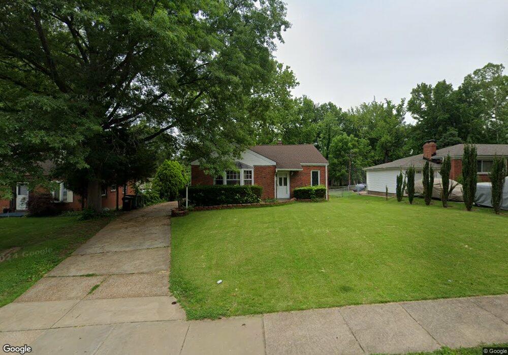
919 January Ave Saint Louis, MO 63135
Estimated Value: $88,000 - $114,000
2
Beds
1
Bath
1,113
Sq Ft
$87/Sq Ft
Est. Value
About This Home
This home is located at 919 January Ave, Saint Louis, MO 63135 and is currently estimated at $96,317, approximately $86 per square foot. 919 January Ave is a home located in St. Louis County with nearby schools including Ferguson Middle School, Johnson Wabash Elementary School, and McCluer High School.
Ownership History
Date
Name
Owned For
Owner Type
Purchase Details
Closed on
Mar 9, 2000
Sold by
Carrollton Board Of Governors Inc
Bought by
The City Of Bridgeton
Current Estimated Value
Home Financials for this Owner
Home Financials are based on the most recent Mortgage that was taken out on this home.
Original Mortgage
$57,000
Outstanding Balance
$19,318
Interest Rate
8.29%
Estimated Equity
$76,999
Purchase Details
Closed on
Mar 6, 2000
Sold by
M & S Properties Inc
Bought by
Coleman Eddie and Coleman Lela
Home Financials for this Owner
Home Financials are based on the most recent Mortgage that was taken out on this home.
Original Mortgage
$57,000
Outstanding Balance
$19,318
Interest Rate
8.29%
Estimated Equity
$76,999
Purchase Details
Closed on
Dec 28, 1999
Sold by
Schenck Donna L and Schenck Christopher P
Bought by
M & S Properties Inc
Home Financials for this Owner
Home Financials are based on the most recent Mortgage that was taken out on this home.
Original Mortgage
$39,000
Interest Rate
7.76%
Create a Home Valuation Report for This Property
The Home Valuation Report is an in-depth analysis detailing your home's value as well as a comparison with similar homes in the area
Home Values in the Area
Average Home Value in this Area
Purchase History
| Date | Buyer | Sale Price | Title Company |
|---|---|---|---|
| The City Of Bridgeton | -- | -- | |
| Coleman Eddie | $60,000 | Land Title Company | |
| M & S Properties Inc | $40,000 | Land Title Company |
Source: Public Records
Mortgage History
| Date | Status | Borrower | Loan Amount |
|---|---|---|---|
| Open | Coleman Eddie | $57,000 | |
| Previous Owner | M & S Properties Inc | $39,000 |
Source: Public Records
Tax History Compared to Growth
Tax History
| Year | Tax Paid | Tax Assessment Tax Assessment Total Assessment is a certain percentage of the fair market value that is determined by local assessors to be the total taxable value of land and additions on the property. | Land | Improvement |
|---|---|---|---|---|
| 2025 | $1,038 | $15,750 | $2,090 | $13,660 |
| 2024 | $1,038 | $14,170 | $1,670 | $12,500 |
| 2023 | $1,032 | $14,170 | $1,670 | $12,500 |
| 2022 | $862 | $10,260 | $1,250 | $9,010 |
| 2021 | $835 | $10,260 | $1,250 | $9,010 |
| 2020 | $884 | $9,790 | $1,730 | $8,060 |
| 2019 | $868 | $9,790 | $1,730 | $8,060 |
| 2018 | $895 | $9,020 | $1,440 | $7,580 |
| 2017 | $878 | $9,020 | $1,440 | $7,580 |
| 2016 | $997 | $10,120 | $1,820 | $8,300 |
| 2015 | $1,004 | $10,120 | $1,820 | $8,300 |
| 2014 | $1,147 | $11,480 | $2,340 | $9,140 |
Source: Public Records
Map
Nearby Homes
- 324 Newell Dr
- 8027 Aline Ave
- 614 January Ave
- 222 Wooster Dr
- 6612 Torlina Dr
- 213 Henquin Dr
- 439 Warford Ave
- 8042 Patterson Dr
- 806 Rolwes Ave
- 8219 Davenport Dr
- 415 Warford Ave
- 6717 Thurston Ave
- 218 N Marguerite Ave
- 8140 Packard Ave
- 117 Henquin Dr
- 116 Henquin Dr
- 6130 Wulff Dr
- 8 Buckeye Dr
- 6605 Carol Lee Dr
- 138 N Marguerite Ave
- 913 January Ave
- 923 January Ave
- 907 January Ave
- 524 Ford Dr
- 501 Ford Dr
- 916 January Ave
- 521 Hentschel Place
- 901 January Ave
- 920 January Ave
- 910 January Ave
- 1007 January Ave
- 928 January Ave
- 525 Hentschel Place
- 525 Ford Dr
- 1 Caldwell Ct
- 528 Ford Dr
- 1006 January Ave
- 1011 January Ave
- 17 Caldwell Ct
- 829 January Ave