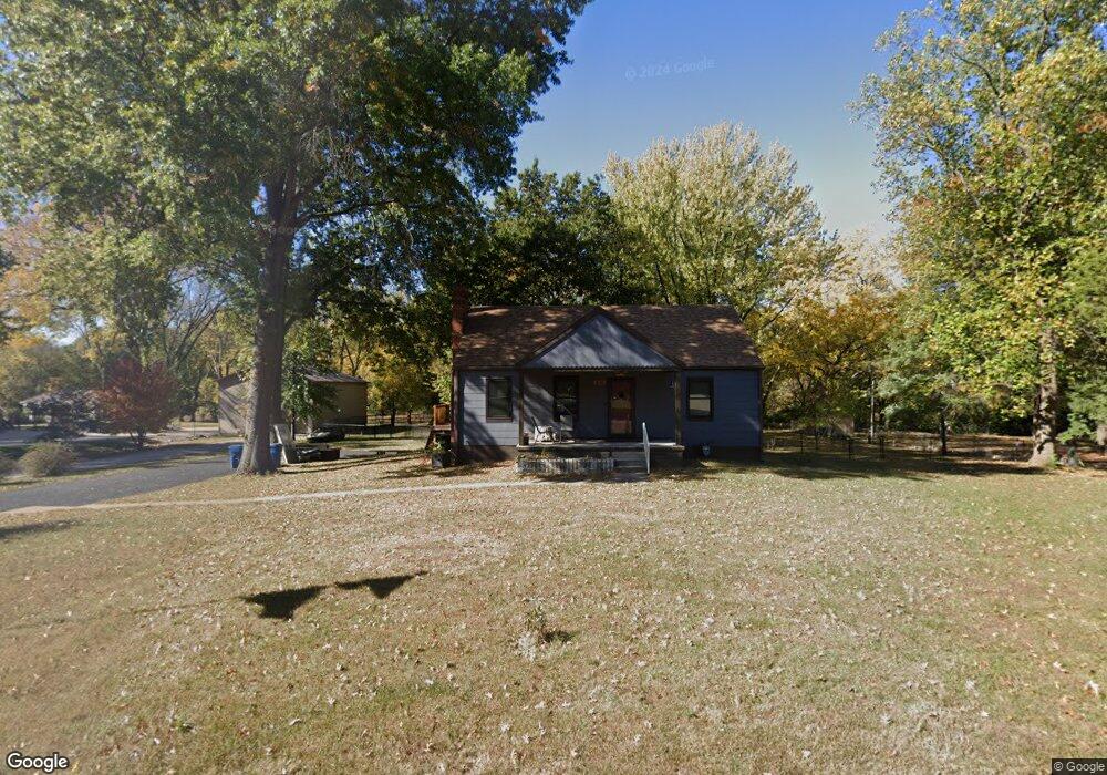
920 Manchester Rd Liberty, MO 64068
Estimated Value: $238,699 - $279,000
2
Beds
1
Bath
1,048
Sq Ft
$242/Sq Ft
Est. Value
About This Home
This home is located at 920 Manchester Rd, Liberty, MO 64068 and is currently estimated at $253,675, approximately $242 per square foot. 920 Manchester Rd is a home located in Clay County with nearby schools including Alexander Doniphan Elementary School, Discovery Middle School, and Liberty High School.
Ownership History
Date
Name
Owned For
Owner Type
Purchase Details
Closed on
Mar 18, 2022
Sold by
Young Viva N
Bought by
Young William
Current Estimated Value
Home Financials for this Owner
Home Financials are based on the most recent Mortgage that was taken out on this home.
Original Mortgage
$75,000
Interest Rate
4.16%
Mortgage Type
New Conventional
Purchase Details
Closed on
Feb 24, 2021
Sold by
Edwards Erma Kay
Bought by
Young Viva N
Purchase Details
Closed on
Apr 24, 2019
Sold by
Edwards James Freel and Edwards Erma Kay
Bought by
Edwards James Freel and Edwards Erma Kay
Purchase Details
Closed on
Dec 25, 2007
Sold by
Ferguson Hershel R
Bought by
Edwards Erma K and Edwards James Freel
Create a Home Valuation Report for This Property
The Home Valuation Report is an in-depth analysis detailing your home's value as well as a comparison with similar homes in the area
Home Values in the Area
Average Home Value in this Area
Purchase History
| Date | Buyer | Sale Price | Title Company |
|---|---|---|---|
| Young William | -- | None Listed On Document | |
| Young Viva N | -- | None Available | |
| Edwards James Freel | -- | None Listed On Document | |
| Edwards James Freel | -- | None Listed On Document | |
| Edwards Erma K | -- | None Available |
Source: Public Records
Mortgage History
| Date | Status | Borrower | Loan Amount |
|---|---|---|---|
| Previous Owner | Young William | $75,000 |
Source: Public Records
Tax History Compared to Growth
Tax History
| Year | Tax Paid | Tax Assessment Tax Assessment Total Assessment is a certain percentage of the fair market value that is determined by local assessors to be the total taxable value of land and additions on the property. | Land | Improvement |
|---|---|---|---|---|
| 2025 | $1,804 | $26,510 | -- | -- |
| 2024 | $1,804 | $23,450 | -- | -- |
| 2023 | $1,834 | $23,450 | $0 | $0 |
| 2022 | $1,749 | $22,080 | $0 | $0 |
| 2021 | $1,735 | $22,078 | $11,400 | $10,678 |
| 2020 | $1,317 | $15,730 | $0 | $0 |
| 2019 | $1,316 | $15,732 | $5,700 | $10,032 |
| 2018 | $1,186 | $13,910 | $0 | $0 |
| 2017 | $1,175 | $13,910 | $5,320 | $8,590 |
| 2016 | $1,175 | $13,910 | $5,320 | $8,590 |
| 2015 | $1,175 | $13,910 | $5,320 | $8,590 |
| 2014 | $1,130 | $13,280 | $5,320 | $7,960 |
Source: Public Records
Map
Nearby Homes
- 918 Amesbury Ave
- 862 Amesbury Ave
- 1124 Amesbury Ave
- 415 Monterey Ave
- 716 Bristol Ct
- 509 Belmont St
- 420 Belmont St
- 1218 Canterbury Ln
- 1323 Amesbury Ave
- 1507 Amesbury Ave
- 253 S Stewart Rd
- 1331 Park Ln
- 1317 Park Ln
- 1733 Welleslay Ln
- 1209 Liberty Drive Terrace
- 1537 Canterbury Ln
- 1304 Wellington Way
- 1327 Easton Ct
- 7908 N Ditzler Ave
- 9102 NE 79th Terrace
- 906 Manchester Rd
- 936 Manchester Rd
- 927 Manchester Rd
- 905 Manchester Rd
- 937 Manchester Rd
- 1006 Manchester Rd
- 1955 Kings Hwy
- 1007 Manchester Rd
- 1970 Kings Hwy
- 1950 Kings Hwy
- 1969 Kings Hwy
- 1935 Kings Hwy
- 1960 Kings Hwy
- 1020 Manchester Rd
- 1021 Manchester Rd
- 1925 Kings Hwy
- 1987 Kings Hwy
- 1930 Kings Hwy
- 833 Kings Hwy
- 1036 Manchester Rd