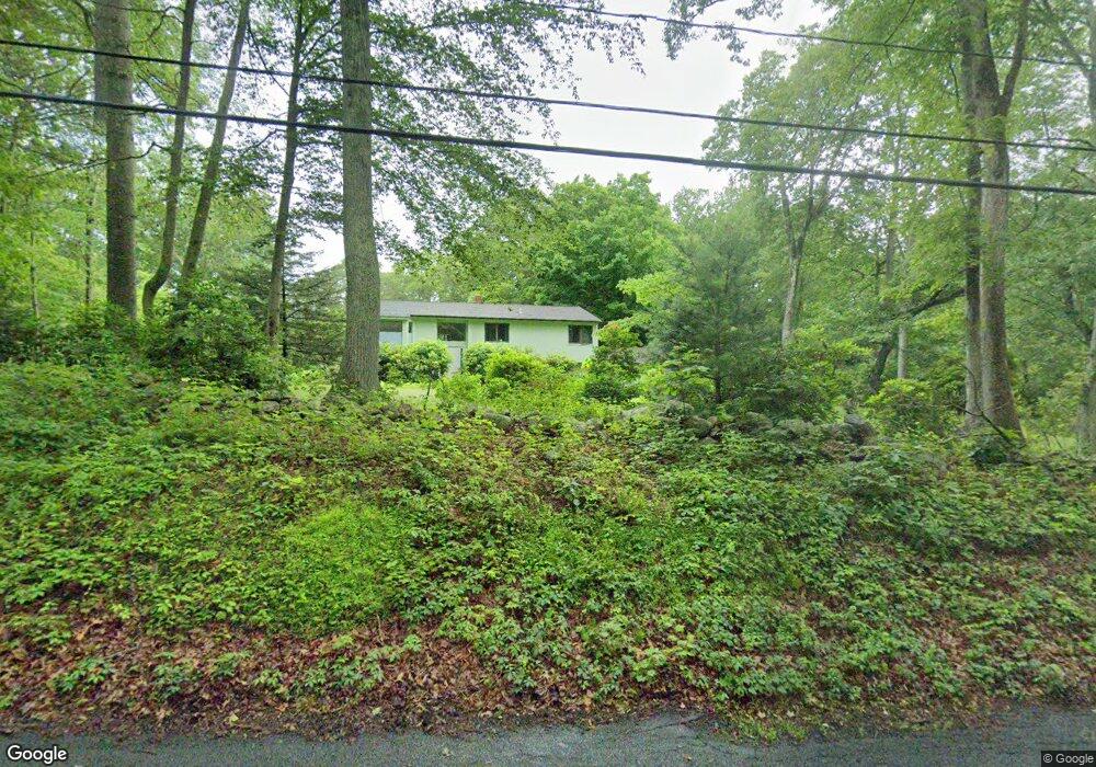
920 Moose Hill Rd Guilford, CT 06437
Estimated Value: $482,000 - $646,000
3
Beds
2
Baths
1,306
Sq Ft
$430/Sq Ft
Est. Value
About This Home
This home is located at 920 Moose Hill Rd, Guilford, CT 06437 and is currently estimated at $561,471, approximately $429 per square foot. 920 Moose Hill Rd is a home located in New Haven County with nearby schools including E.C. Adams Middle School, A. Baldwin Middle School, and Guilford High School.
Ownership History
Date
Name
Owned For
Owner Type
Purchase Details
Closed on
May 23, 1988
Sold by
Lavazza Paul M
Bought by
Barton Eugenia
Current Estimated Value
Home Financials for this Owner
Home Financials are based on the most recent Mortgage that was taken out on this home.
Original Mortgage
$220,500
Interest Rate
10.13%
Create a Home Valuation Report for This Property
The Home Valuation Report is an in-depth analysis detailing your home's value as well as a comparison with similar homes in the area
Home Values in the Area
Average Home Value in this Area
Purchase History
| Date | Buyer | Sale Price | Title Company |
|---|---|---|---|
| Barton Eugenia | $245,000 | -- |
Source: Public Records
Mortgage History
| Date | Status | Borrower | Loan Amount |
|---|---|---|---|
| Closed | Barton Eugenia | $250,000 | |
| Closed | Barton Eugenia | $32,000 | |
| Closed | Barton Eugenia | $220,500 |
Source: Public Records
Tax History Compared to Growth
Tax History
| Year | Tax Paid | Tax Assessment Tax Assessment Total Assessment is a certain percentage of the fair market value that is determined by local assessors to be the total taxable value of land and additions on the property. | Land | Improvement |
|---|---|---|---|---|
| 2025 | $7,750 | $280,280 | $161,000 | $119,280 |
| 2024 | $7,450 | $280,280 | $161,000 | $119,280 |
| 2023 | $7,187 | $277,690 | $161,000 | $116,690 |
| 2022 | $6,354 | $191,110 | $127,400 | $63,710 |
| 2021 | $6,234 | $191,110 | $127,400 | $63,710 |
| 2020 | $6,175 | $191,110 | $127,400 | $63,710 |
| 2019 | $6,121 | $191,110 | $127,400 | $63,710 |
| 2018 | $5,978 | $191,110 | $127,400 | $63,710 |
| 2017 | $5,857 | $199,500 | $132,300 | $67,200 |
| 2016 | $5,720 | $199,500 | $132,300 | $67,200 |
| 2015 | $5,634 | $199,500 | $132,300 | $67,200 |
| 2014 | $5,470 | $199,500 | $132,300 | $67,200 |
Source: Public Records
Map
Nearby Homes
- 59 Hoadley Creek Cir
- 1028 Moose Hill Rd
- 522 Peddlers Rd
- 181 Denison Dr
- 55-69 Sawmill Rd
- 40 Kenneth Cir
- LOT #22 Kenneth Cir Unit MAP 77
- 42 Copper Hill Dr
- 20 Copper Hill Dr Unit 20
- LOT 28B Bruce Ln Unit MAP 83
- 2805 Boston Post Rd
- 312 Leetes Island Rd
- 575 Leetes Island Rd
- 360 Jefferson Dr
- 427 Three Mile Course
- 37 Long Hill Farm
- 12 Bowhay Hill Rd
- 48 Andrews Rd
- 288 Jefferson Dr
- 55 Harbor View Rd
- 900 Moose Hill Rd
- 34 Hoadley Creek Cir
- 948 Moose Hill Rd
- 882 Moose Hill Rd
- 50 Hoadley Creek Cir
- 45 Hoadley Creek Cir
- 62 Hoadley Creek Cir
- 870 Moose Hill Rd
- 68 Hoadley Creek Cir
- 15 Barker Hill Dr
- 53 Barker Hill Dr
- 972 Moose Hill Rd
- 67 Hoadley Creek Cir
- 71 Barker Hill Dr
- 85 Barker Hill Dr
- 76 Hoadley Creek Cir
- 990 Moose Hill Rd
- 70 Hoadley Creek Cir
- 71 Hoadley Creek Cir
- 101 Barker Hill Dr