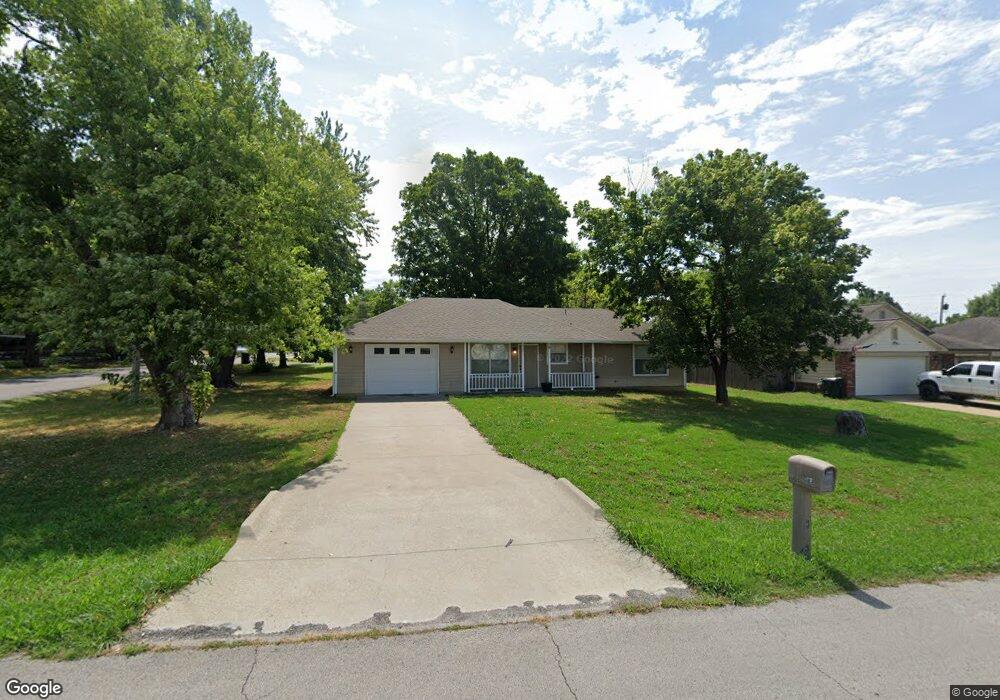
920 N Missouri Ave Claremore, OK 74017
Estimated Value: $134,000 - $147,000
1
Bed
1
Bath
760
Sq Ft
$186/Sq Ft
Est. Value
About This Home
This home is located at 920 N Missouri Ave, Claremore, OK 74017 and is currently estimated at $141,625, approximately $186 per square foot. 920 N Missouri Ave is a home located in Rogers County with nearby schools including Claremont Elementary School, Will Rogers Junior High School, and Claremore High School.
Ownership History
Date
Name
Owned For
Owner Type
Purchase Details
Closed on
Dec 7, 2020
Sold by
Rock Rhonda K
Bought by
Rock Rhonda K and The Rhonda K Rock Revocable Li
Current Estimated Value
Purchase Details
Closed on
Feb 1, 2013
Sold by
Warman Bob J and Warman Bob James
Bought by
Rock Larry W and Rock Rhonda K
Purchase Details
Closed on
Apr 17, 2003
Sold by
Bouchard Joseph A
Purchase Details
Closed on
Jan 31, 2003
Sold by
Newlon Marilyn N Trustee
Create a Home Valuation Report for This Property
The Home Valuation Report is an in-depth analysis detailing your home's value as well as a comparison with similar homes in the area
Home Values in the Area
Average Home Value in this Area
Purchase History
| Date | Buyer | Sale Price | Title Company |
|---|---|---|---|
| Rock Rhonda K | -- | None Available | |
| Rock Rhonda K | -- | None Available | |
| Rock Larry W | $30,000 | None Available | |
| -- | -- | -- | |
| -- | $37,000 | -- |
Source: Public Records
Tax History Compared to Growth
Tax History
| Year | Tax Paid | Tax Assessment Tax Assessment Total Assessment is a certain percentage of the fair market value that is determined by local assessors to be the total taxable value of land and additions on the property. | Land | Improvement |
|---|---|---|---|---|
| 2025 | $1,160 | $12,554 | $2,615 | $9,939 |
| 2024 | $1,105 | $11,956 | $2,490 | $9,466 |
| 2023 | $1,105 | $11,386 | $2,417 | $8,969 |
| 2022 | $1,004 | $10,844 | $2,140 | $8,704 |
| 2021 | $912 | $10,426 | $2,190 | $8,236 |
| 2020 | $901 | $9,836 | $1,755 | $8,081 |
| 2019 | $871 | $9,402 | $1,755 | $7,647 |
| 2018 | $860 | $9,634 | $1,755 | $7,879 |
| 2017 | $814 | $8,867 | $1,652 | $7,215 |
| 2016 | -- | $8,446 | $1,590 | $6,856 |
| 2015 | -- | $8,445 | $1,617 | $6,828 |
| 2014 | $773 | $8,445 | $1,605 | $6,840 |
Source: Public Records
Map
Nearby Homes
- 401 W Blue Starr Dr
- 119 N Missouri Ave
- 0 N J M Davis Blvd
- 103 E 12th Place
- 509 N Weenonah Ave
- 104 W 7th St
- 305 E Falletti Ave
- 1335 N Mcfarland Place
- 1411 N Choctaw Place
- 1403 N Louisville Ave
- 902 W 8th St
- 923 N Seminole Ave
- 1402 N Dorothy Ave
- 202 W 4th St
- 326 E 15th St
- 1216 N Sioux Ave
- 317 E 4th St
- 520 E 6th St
- 522 E 6th St
- 1137 N Oklahoma Ave
- 415 W 12th St
- 916 N Missouri Ave
- 405 W 12th St
- 910 N Missouri Ave
- 418 W 12th St
- 401 W 12th St
- 416 W 11th St
- 917 N Cherokee Ave
- 1001 N Cherokee Ave
- 1002 N Missouri Ave
- 1007 N Cherokee Ave
- 915 N Cherokee Ave
- 920 N Cherokee Ave
- 916 N Cherokee Ave
- 912 N Cherokee Ave
- 920 N Lynn Riggs Blvd
- 1002 N Cherokee Ave
- 413 W 13th St
- 411 W 13th St
- null W 11th St