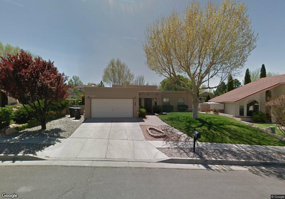
9204 Thornton Ave NE Albuquerque, NM 87109
Heritage East NeighborhoodEstimated Value: $478,000 - $522,000
3
Beds
2
Baths
2,155
Sq Ft
$232/Sq Ft
Est. Value
About This Home
This home is located at 9204 Thornton Ave NE, Albuquerque, NM 87109 and is currently estimated at $500,022, approximately $232 per square foot. 9204 Thornton Ave NE is a home located in Bernalillo County with nearby schools including Hubert H. Humphrey Elementary School, Eisenhower Middle School, and La Cueva High School.
Ownership History
Date
Name
Owned For
Owner Type
Purchase Details
Closed on
Mar 21, 2022
Sold by
Porter Alfred E and Porter Cherriel L
Bought by
Alfred E Porter Jr And Cherriel Leigh Porter
Current Estimated Value
Purchase Details
Closed on
Jul 22, 2004
Sold by
Lee Thomas O and Lee Gloria M
Bought by
Porter Alfred E and Porter Cherriel L
Home Financials for this Owner
Home Financials are based on the most recent Mortgage that was taken out on this home.
Original Mortgage
$160,000
Interest Rate
6.32%
Mortgage Type
Purchase Money Mortgage
Create a Home Valuation Report for This Property
The Home Valuation Report is an in-depth analysis detailing your home's value as well as a comparison with similar homes in the area
Home Values in the Area
Average Home Value in this Area
Purchase History
| Date | Buyer | Sale Price | Title Company |
|---|---|---|---|
| Alfred E Porter Jr And Cherriel Leigh Porter | -- | None Listed On Document | |
| Porter Alfred E | -- | First American Title Ins Co |
Source: Public Records
Mortgage History
| Date | Status | Borrower | Loan Amount |
|---|---|---|---|
| Previous Owner | Porter Alfred E | $160,000 |
Source: Public Records
Tax History Compared to Growth
Tax History
| Year | Tax Paid | Tax Assessment Tax Assessment Total Assessment is a certain percentage of the fair market value that is determined by local assessors to be the total taxable value of land and additions on the property. | Land | Improvement |
|---|---|---|---|---|
| 2025 | $4,372 | $108,801 | $31,839 | $76,962 |
| 2024 | $4,372 | $105,633 | $30,912 | $74,721 |
| 2023 | $4,257 | $102,557 | $30,012 | $72,545 |
| 2022 | $4,150 | $99,570 | $29,138 | $70,432 |
| 2021 | $4,008 | $96,671 | $28,290 | $68,381 |
| 2020 | $3,940 | $93,855 | $27,466 | $66,389 |
| 2019 | $3,822 | $91,122 | $26,666 | $64,456 |
| 2018 | $3,683 | $91,122 | $26,666 | $64,456 |
| 2017 | $3,568 | $88,468 | $25,889 | $62,579 |
| 2016 | $3,463 | $83,390 | $24,403 | $58,987 |
| 2015 | $80,962 | $80,962 | $23,693 | $57,269 |
| 2014 | $3,338 | $78,604 | $23,003 | $55,601 |
| 2013 | -- | $76,315 | $22,333 | $53,982 |
Source: Public Records
Map
Nearby Homes
- 9505 Giddings Ave NE
- 7605 Don Gaspar Dr NE
- 7728 Jacobo Dr NE
- 7732 Jacobo Dr NE
- 7416 Don Tomas Ln NE
- 9129 Dempsey Dr NE
- 9604 Peralta Rd NE
- 7920 Ridgefield Ct NE
- 9616 Peralta Rd NE
- 9516 San Rafael Ave NE
- 0 Palomas Ave NE Unit 1090778
- 0 Palomas Ave NE Unit 1090779
- 7401 Volunteer St NE
- 9612 Rosas Ave NE
- 9621 San Francisco Rd NE
- 9704 Talea Ct NE
- 8718 Liberty Dr NE
- 9705 Blue Dove Place NE
- 9719 Blue Dove Place NE
- 9244 Bluewood Ln NE
- 9208 Thornton Ave NE
- 9200 Thornton Ave NE
- 7527 Jacobo Dr NE
- 7523 Jacobo Dr NE
- 9214 Thornton Ave NE
- 9122 Thornton Ave NE
- 7601 Jacobo Dr NE
- 9205 Thornton Ave NE
- 9127 Mabry Ave NE
- 9201 Thornton Ave NE
- 9131 Mabry Ave NE
- 9209 Thornton Ave NE
- 9123 Mabry Ave NE
- 7605 Jacobo Dr NE
- 9218 Thornton Ave NE
- 9123 Thornton Ave NE
- 9119 Mabry Ave NE
- 9208 Meriwether Ave NE
- 9119 Thornton Ave NE
- 9114 Thornton Ave NE