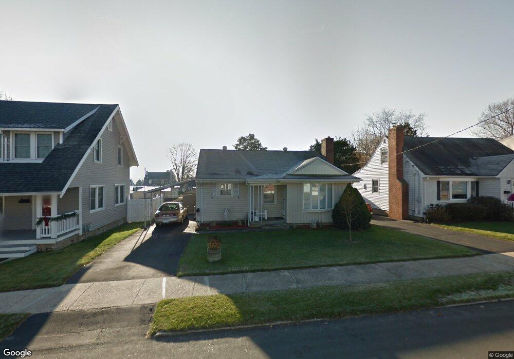
921 Birmingham St Bridgeport, CT 06606
North End NeighborhoodEstimated Value: $333,000 - $373,331
2
Beds
1
Bath
929
Sq Ft
$389/Sq Ft
Est. Value
About This Home
This home is located at 921 Birmingham St, Bridgeport, CT 06606 and is currently estimated at $361,333, approximately $388 per square foot. 921 Birmingham St is a home located in Fairfield County with nearby schools including Blackham School, Central High School, and Assumption Catholic School.
Ownership History
Date
Name
Owned For
Owner Type
Purchase Details
Closed on
Aug 17, 2004
Sold by
Faison Clarence and Faison Earl
Bought by
Flowsciante Nino
Current Estimated Value
Purchase Details
Closed on
Aug 30, 1991
Sold by
Szczerba Zigmund and Szczerba Florence
Bought by
Faison Clarence
Home Financials for this Owner
Home Financials are based on the most recent Mortgage that was taken out on this home.
Original Mortgage
$88,000
Interest Rate
9.44%
Mortgage Type
Purchase Money Mortgage
Create a Home Valuation Report for This Property
The Home Valuation Report is an in-depth analysis detailing your home's value as well as a comparison with similar homes in the area
Home Values in the Area
Average Home Value in this Area
Purchase History
| Date | Buyer | Sale Price | Title Company |
|---|---|---|---|
| Flowsciante Nino | $179,500 | -- | |
| Flowsciante Nino | $179,500 | -- | |
| Faison Clarence | $110,000 | -- |
Source: Public Records
Mortgage History
| Date | Status | Borrower | Loan Amount |
|---|---|---|---|
| Previous Owner | Faison Clarence | $97,500 | |
| Previous Owner | Faison Clarence | $91,000 | |
| Previous Owner | Faison Clarence | $88,000 |
Source: Public Records
Tax History Compared to Growth
Tax History
| Year | Tax Paid | Tax Assessment Tax Assessment Total Assessment is a certain percentage of the fair market value that is determined by local assessors to be the total taxable value of land and additions on the property. | Land | Improvement |
|---|---|---|---|---|
| 2025 | $5,811 | $133,730 | $75,310 | $58,420 |
| 2024 | $5,811 | $133,730 | $75,310 | $58,420 |
| 2023 | $5,811 | $133,730 | $75,310 | $58,420 |
| 2022 | $5,811 | $133,730 | $75,310 | $58,420 |
| 2021 | $5,811 | $133,730 | $75,310 | $58,420 |
| 2020 | $4,832 | $89,500 | $39,340 | $50,160 |
| 2019 | $4,832 | $89,500 | $39,340 | $50,160 |
| 2018 | $4,866 | $89,500 | $39,340 | $50,160 |
| 2017 | $4,866 | $89,500 | $39,340 | $50,160 |
| 2016 | $4,866 | $89,500 | $39,340 | $50,160 |
| 2015 | $5,236 | $124,070 | $47,600 | $76,470 |
| 2014 | $5,236 | $124,070 | $47,600 | $76,470 |
Source: Public Records
Map
Nearby Homes
- 932 Thorme St
- 783 Clark St
- 3450 Park Ave
- 3430 Park Ave
- 3200 Park Ave Unit 11C2
- 3200 Park Ave Unit 11E2
- 720 Queen St
- 226 Alberta St
- 605 Merritt St
- 604 Birmingham St
- 129 Ashton St
- 681 Westfield Ave
- 161 Brion Dr
- 520 Savoy St
- 90 Lu Manor Dr
- 375 Ruth St
- 485 Westfield Ave
- 38 Enid St Unit B
- 533 Glendale Ave
- 81 Ameridge Dr
- 919 Birmingham St
- 927 Birmingham St
- 911 Birmingham St
- 935 Birmingham St
- 830 Clark St
- 838 Clark St
- 810 Clark St
- 848 Clark St
- 924 Birmingham St
- 909 Birmingham St
- 945 Birmingham St
- 914 Birmingham St
- 934 Birmingham St
- 800 Clark St
- 858 Clark St
- 944 Birmingham St
- 907 Birmingham St
- 955 Birmingham St
- 912 Birmingham St
- 790 Clark St