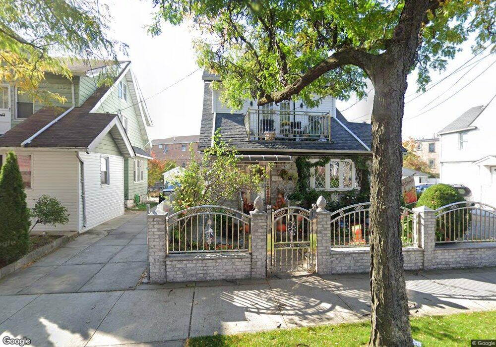
9236 190th St Hollis, NY 11423
Hollis NeighborhoodEstimated Value: $881,582 - $1,054,000
--
Bed
--
Bath
2,230
Sq Ft
$437/Sq Ft
Est. Value
About This Home
This home is located at 9236 190th St, Hollis, NY 11423 and is currently estimated at $974,896, approximately $437 per square foot. 9236 190th St is a home located in Queens County with nearby schools including P.S. 35 Nathaniel Woodhull, I.S. 238 Susan B Anthony Academy, and Wellspring Elementary & Middle.
Ownership History
Date
Name
Owned For
Owner Type
Purchase Details
Closed on
May 17, 2011
Sold by
Naipaul Nanranie
Bought by
Devanand Tilak and Tilak Meena
Current Estimated Value
Purchase Details
Closed on
Sep 19, 2000
Sold by
Deochand Dharmacharge and Deochand Serojinie
Bought by
Naipaul Nanranie
Home Financials for this Owner
Home Financials are based on the most recent Mortgage that was taken out on this home.
Original Mortgage
$204,000
Interest Rate
7.83%
Create a Home Valuation Report for This Property
The Home Valuation Report is an in-depth analysis detailing your home's value as well as a comparison with similar homes in the area
Home Values in the Area
Average Home Value in this Area
Purchase History
| Date | Buyer | Sale Price | Title Company |
|---|---|---|---|
| Devanand Tilak | -- | -- | |
| Naipaul Nanranie | $255,000 | Commonwealth Land Title Ins |
Source: Public Records
Mortgage History
| Date | Status | Borrower | Loan Amount |
|---|---|---|---|
| Previous Owner | Naipaul Nanranie | $204,000 |
Source: Public Records
Tax History Compared to Growth
Tax History
| Year | Tax Paid | Tax Assessment Tax Assessment Total Assessment is a certain percentage of the fair market value that is determined by local assessors to be the total taxable value of land and additions on the property. | Land | Improvement |
|---|---|---|---|---|
| 2025 | $6,227 | $32,861 | $12,788 | $20,073 |
| 2024 | $6,227 | $31,001 | $11,468 | $19,533 |
| 2023 | $5,896 | $29,354 | $10,931 | $18,423 |
| 2022 | $5,860 | $48,780 | $20,220 | $28,560 |
| 2021 | $5,853 | $40,620 | $20,220 | $20,400 |
| 2020 | $5,796 | $41,880 | $20,220 | $21,660 |
| 2019 | $5,404 | $44,580 | $20,220 | $24,360 |
| 2018 | $4,987 | $24,462 | $15,762 | $8,700 |
| 2017 | $4,987 | $24,462 | $13,925 | $10,537 |
| 2016 | $4,633 | $24,462 | $13,925 | $10,537 |
| 2015 | $2,564 | $22,820 | $12,019 | $10,801 |
| 2014 | $2,564 | $21,529 | $13,617 | $7,912 |
Source: Public Records
Map
Nearby Homes
- 188-14 Woodhull Ave
- 188-09 Jamaica Ave
- 191-13 Jamaica Ave
- 10220 189th St
- 10211 187th St
- 90-45 186th St
- 9141 195th St
- 19511 Woodhull Ave
- 19515 Woodhull Ave
- 102-35 187th St
- 190-30 103rd Ave
- 90-31 185th St
- 92-22 195th Place
- 184-15 Henderson Ave
- 90-19 185th St
- 90-21 185th St
- 187-11 104th Ave
- 8817 190th St
- 104-11 188th St
- 184-09 Jamaica Ave
- 9240 190th St
- 9240 190th St
- 18827 Woodhull Ave Unit 2
- 18827 Woodhull Ave Unit 2 Fl
- 18827 Woodhull Ave Unit 3 Fl
- 18827 Woodhull Ave Unit 1 Fl
- 9228 190th St
- 9228 190th St Unit 2/3 Fl
- 92-28 190th St Unit 2/3 Fl
- 188-27 Woodhull Ave Unit 3
- 188-27 Woodhull Ave
- 92-42 190th St
- 9242 190th St
- 18825 Woodhull Ave Unit 1+bsm
- 18825 Woodhull Ave Unit 3
- 18825 Woodhull Ave Unit 2
- 18825 Woodhull Ave
- 18825 Woodhull Ave Unit 2 Fl
- 18825 Woodhull Ave Unit 1Fl/Ba
- 18823 Woodhull Ave