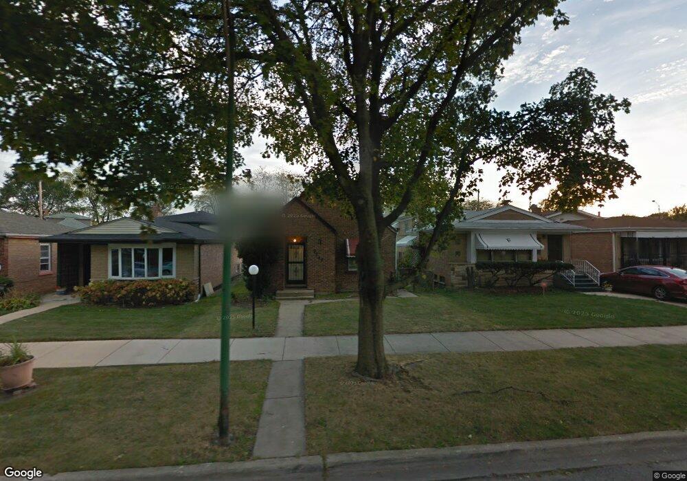
9242 S Burnside Ave Chicago, IL 60619
Roseland NeighborhoodEstimated Value: $145,000 - $186,000
2
Beds
1
Bath
849
Sq Ft
$196/Sq Ft
Est. Value
About This Home
This home is located at 9242 S Burnside Ave, Chicago, IL 60619 and is currently estimated at $166,244, approximately $195 per square foot. 9242 S Burnside Ave is a home located in Cook County with nearby schools including Gillespie Elementary School, Harlan Community Academy High School, and Christian S T E M Scholars.
Ownership History
Date
Name
Owned For
Owner Type
Purchase Details
Closed on
May 31, 2000
Sold by
Irions David
Bought by
Loftin Johnson Rose M
Current Estimated Value
Home Financials for this Owner
Home Financials are based on the most recent Mortgage that was taken out on this home.
Original Mortgage
$56,000
Outstanding Balance
$21,353
Interest Rate
9.37%
Estimated Equity
$144,891
Purchase Details
Closed on
Jul 25, 1997
Sold by
Lathan David T and Lathan Zelma J Martin
Bought by
Irions David T
Home Financials for this Owner
Home Financials are based on the most recent Mortgage that was taken out on this home.
Original Mortgage
$63,446
Interest Rate
7.71%
Mortgage Type
FHA
Purchase Details
Closed on
Apr 13, 1995
Sold by
Robinson Oliver
Bought by
Lathan David T and Martin Lathan Zelma J
Home Financials for this Owner
Home Financials are based on the most recent Mortgage that was taken out on this home.
Original Mortgage
$56,700
Interest Rate
8.55%
Create a Home Valuation Report for This Property
The Home Valuation Report is an in-depth analysis detailing your home's value as well as a comparison with similar homes in the area
Home Values in the Area
Average Home Value in this Area
Purchase History
| Date | Buyer | Sale Price | Title Company |
|---|---|---|---|
| Loftin Johnson Rose M | $70,000 | -- | |
| Irions David T | $63,500 | -- | |
| Lathan David T | $87,750 | First American Title |
Source: Public Records
Mortgage History
| Date | Status | Borrower | Loan Amount |
|---|---|---|---|
| Open | Loftin Johnson Rose M | $56,000 | |
| Previous Owner | Irions David T | $63,446 | |
| Previous Owner | Lathan David T | $56,700 | |
| Closed | Loftin Johnson Rose M | $14,000 |
Source: Public Records
Tax History Compared to Growth
Tax History
| Year | Tax Paid | Tax Assessment Tax Assessment Total Assessment is a certain percentage of the fair market value that is determined by local assessors to be the total taxable value of land and additions on the property. | Land | Improvement |
|---|---|---|---|---|
| 2024 | $1,688 | $11,000 | $5,498 | $5,502 |
| 2023 | $1,645 | $8,000 | $4,687 | $3,313 |
| 2022 | $1,645 | $8,000 | $4,687 | $3,313 |
| 2021 | $1,609 | $8,000 | $4,687 | $3,313 |
| 2020 | $2,018 | $9,059 | $3,749 | $5,310 |
| 2019 | $2,000 | $9,955 | $3,749 | $6,206 |
| 2018 | $1,966 | $9,955 | $3,749 | $6,206 |
| 2017 | $2,421 | $11,245 | $3,280 | $7,965 |
| 2016 | $2,252 | $11,245 | $3,280 | $7,965 |
| 2015 | $2,061 | $11,245 | $3,280 | $7,965 |
| 2014 | $1,716 | $9,247 | $2,812 | $6,435 |
| 2013 | $1,682 | $9,247 | $2,812 | $6,435 |
Source: Public Records
Map
Nearby Homes
- 9300 S Vernon Ave
- 9220 S King Dr
- 9326 S King Dr
- 9302 S Eberhart Ave
- 9400 S Calumet Ave
- 254 E 92nd St Unit 1
- 9425 S Vernon Ave
- 9422 S Calumet Ave
- 9150 S Burnside Ave
- 237 E 92nd St
- 9413 S Prairie Ave
- 605 E 92nd Place
- 9456 S Calumet Ave
- 543 E 91st Place
- 521 E 91st St
- 9311 S Burnside Ave
- 627 E 92nd Place
- 549 E 91st St
- 9418 S Champlain Ave
- 9437 S Indiana Ave
- 9244 S Burnside Ave
- 9238 S Burnside Ave
- 9248 S Burnside Ave
- 9234 S Burnside Ave
- 9252 S Burnside Ave
- 9251 S King Dr
- 9259 S Burnside Ave
- 9225 S King Dr
- 9253 S King Dr
- 9258 S Burnside Ave
- 9254 S Burnside Ave
- 9257 S King Dr
- 416 E 93rd St
- 9260 S Burnside Ave
- 418 E 93rd St
- 418 E 93rd St
- 9241 S Burnside Ave
- 9245 S Burnside Ave
- 9237 S Burnside Ave
- 9249 S Burnside Ave