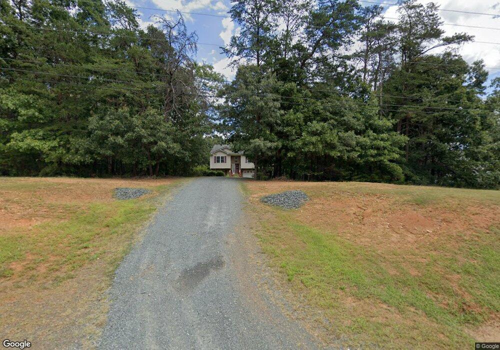
925 Dixie Airport Rd Madison Heights, VA 24572
Estimated Value: $248,000 - $286,000
3
Beds
2
Baths
1,148
Sq Ft
$229/Sq Ft
Est. Value
About This Home
This home is located at 925 Dixie Airport Rd, Madison Heights, VA 24572 and is currently estimated at $263,160, approximately $229 per square foot. 925 Dixie Airport Rd is a home located in Amherst County with nearby schools including Amelon Elementary School, Monelison Middle School, and Amherst County High School.
Ownership History
Date
Name
Owned For
Owner Type
Purchase Details
Closed on
Jun 25, 2008
Sold by
Anderson Brothers Realty Llc
Bought by
Meesala Venkata R
Current Estimated Value
Home Financials for this Owner
Home Financials are based on the most recent Mortgage that was taken out on this home.
Original Mortgage
$167,800
Outstanding Balance
$108,582
Interest Rate
6.13%
Mortgage Type
FHA
Estimated Equity
$154,578
Purchase Details
Closed on
Mar 17, 2008
Sold by
Conway Development Corp
Bought by
Anderson Brothers Realty Llc
Purchase Details
Closed on
Nov 29, 2007
Sold by
Nash Dewey C
Bought by
Cash James L
Create a Home Valuation Report for This Property
The Home Valuation Report is an in-depth analysis detailing your home's value as well as a comparison with similar homes in the area
Home Values in the Area
Average Home Value in this Area
Purchase History
| Date | Buyer | Sale Price | Title Company |
|---|---|---|---|
| Meesala Venkata R | $170,450 | Southern Title Realty Agency | |
| Anderson Brothers Realty Llc | $36,000 | None Available | |
| Conway Development Corporation | -- | None Available | |
| Cash James L | $13,000 | None Available |
Source: Public Records
Mortgage History
| Date | Status | Borrower | Loan Amount |
|---|---|---|---|
| Open | Meesala Venkata R | $167,800 |
Source: Public Records
Tax History Compared to Growth
Tax History
| Year | Tax Paid | Tax Assessment Tax Assessment Total Assessment is a certain percentage of the fair market value that is determined by local assessors to be the total taxable value of land and additions on the property. | Land | Improvement |
|---|---|---|---|---|
| 2025 | $865 | $141,800 | $32,700 | $109,100 |
| 2024 | $865 | $141,800 | $32,700 | $109,100 |
| 2023 | $865 | $141,800 | $32,700 | $109,100 |
| 2022 | $865 | $141,800 | $32,700 | $109,100 |
| 2021 | $865 | $141,800 | $32,700 | $109,100 |
| 2020 | $865 | $141,800 | $32,700 | $109,100 |
| 2019 | $855 | $140,100 | $38,700 | $101,400 |
| 2018 | $855 | $140,100 | $38,700 | $101,400 |
| 2017 | $855 | $140,100 | $38,700 | $101,400 |
| 2016 | $855 | $140,100 | $38,700 | $101,400 |
| 2015 | $785 | $140,100 | $38,700 | $101,400 |
| 2014 | $785 | $140,100 | $38,700 | $101,400 |
Source: Public Records
Map
Nearby Homes
- 121 Crestwood Dr
- 250 S Wood Duck Dr
- 0 Commonwealth Dr Unit 361760
- 571 Dixie Airport Rd
- 0 Lot 10 & 11 Stoney Creek Dr Unit 345183
- 164 Glade Rd
- 0 Monticello Ln
- 151 Stratford Place
- 255 Glade Rd
- TBD Stratford Place Unit 39
- 1769 Izaak Walton Rd
- 149 Peaceful Ln
- 289 Todd Ln
- 327 Dixie Airport Rd
- 150 Glenwood Dr
- 272 Dixie Airport Rd
- 172 Stoney Creek Dr
- 0 Izaak Walton Rd
- 11 Stoney Creek Dr
- 10 Stoney Creek Dr
- 933 Dixie Airport Rd
- 910 Dixie Airport Rd
- 948 Dixie Airport Rd
- 889 Dixie Airport Rd
- 952 Dixie Airport Rd
- 896 Dixie Airport Rd
- 962 Dixie Airport Rd
- 876 Dixie Airport Rd
- 867 Dixie Airport Rd
- 870 Dixie Airport Rd
- 858 Dixie Airport Rd
- 1007 Dixie Airport Rd
- 857 Dixie Airport Rd
- 853 Dixie Airport Rd
- 848 Dixie Airport Rd
- 901 Possum Island Rd
- 211 Beasley Farm Rd
- 914 Possum Island Rd
- 173 Beasley Farm Rd