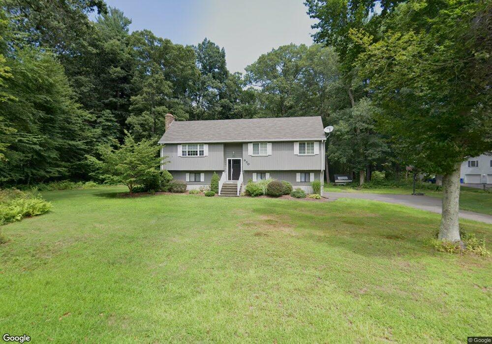
930 Strong Rd South Windsor, CT 06074
Estimated Value: $400,000 - $546,000
3
Beds
3
Baths
1,388
Sq Ft
$338/Sq Ft
Est. Value
About This Home
This home is located at 930 Strong Rd, South Windsor, CT 06074 and is currently estimated at $469,650, approximately $338 per square foot. 930 Strong Rd is a home located in Hartford County with nearby schools including Timothy Edwards School, South Windsor High School, and Odyssey Community School.
Ownership History
Date
Name
Owned For
Owner Type
Purchase Details
Closed on
Oct 1, 2003
Sold by
Goss Robert
Bought by
Suffish Joel and Suffish Lauren
Current Estimated Value
Home Financials for this Owner
Home Financials are based on the most recent Mortgage that was taken out on this home.
Original Mortgage
$185,600
Interest Rate
6.25%
Purchase Details
Closed on
Jan 16, 1991
Sold by
Deptula Walter and Deptula Kathy
Bought by
Land Kenneth and Land Catherine
Purchase Details
Closed on
Dec 29, 1987
Sold by
Deptula Walter
Bought by
Lance Kenneth
Create a Home Valuation Report for This Property
The Home Valuation Report is an in-depth analysis detailing your home's value as well as a comparison with similar homes in the area
Home Values in the Area
Average Home Value in this Area
Purchase History
| Date | Buyer | Sale Price | Title Company |
|---|---|---|---|
| Suffish Joel | $232,000 | -- | |
| Land Kenneth | $10,000 | -- | |
| Lance Kenneth | $10,000 | -- |
Source: Public Records
Mortgage History
| Date | Status | Borrower | Loan Amount |
|---|---|---|---|
| Open | Lance Kenneth | $172,000 | |
| Closed | Lance Kenneth | $185,600 | |
| Previous Owner | Lance Kenneth | $112,500 |
Source: Public Records
Tax History Compared to Growth
Tax History
| Year | Tax Paid | Tax Assessment Tax Assessment Total Assessment is a certain percentage of the fair market value that is determined by local assessors to be the total taxable value of land and additions on the property. | Land | Improvement |
|---|---|---|---|---|
| 2025 | $8,846 | $248,400 | $109,000 | $139,400 |
| 2024 | $8,560 | $248,400 | $109,000 | $139,400 |
| 2023 | $8,232 | $248,400 | $109,000 | $139,400 |
| 2022 | $7,560 | $195,000 | $109,000 | $86,000 |
| 2021 | $7,383 | $195,000 | $109,000 | $86,000 |
| 2020 | $7,387 | $195,000 | $109,000 | $86,000 |
| 2019 | $7,234 | $187,900 | $109,000 | $78,900 |
| 2018 | $7,078 | $187,900 | $109,000 | $78,900 |
| 2017 | $6,946 | $182,400 | $109,000 | $73,400 |
| 2016 | $6,811 | $182,400 | $109,000 | $73,400 |
| 2015 | $6,665 | $182,400 | $109,000 | $73,400 |
| 2014 | $6,477 | $182,400 | $109,000 | $73,400 |
Source: Public Records
Map
Nearby Homes
- 668 Sullivan Ave
- 10 Victorian Woods Ln Unit 10
- 22 Candlewood Dr Unit 22
- 50 High St
- 62 Candlewood Dr Unit 62
- 81 Candlewood Dr Unit 81
- 130 Candlewood Dr Unit 130
- 816 Sand Stone Dr Unit 816
- 509 Mill Pond Dr
- 24 Podunk Cir Unit 24
- 1202 Twin Circle Dr
- 11 Kupchunos Rd
- 908 Mill Pond Dr
- 2201 Mill Pond Dr Unit 2201
- 88 Andreis Trail
- 610 Clark St
- 178 Scott Dr
- 51 Carriage Dr
- 66 Farmbrook Ln
- 31 Wendy Dr
- 946 Strong Rd
- L24-3 Griffin Rd
- 6 St Marc Cir Unit J6
- 2 St Marc Cir Unit Q
- 1209 Twin CI Unit 1209
- 505 Foster Rd
- 890 Strong Rd
- 915 Strong Rd
- 901 Strong Rd
- 485 Foster Rd
- 955 Strong Rd
- 885 Strong Rd
- 864 Strong Rd
- 455 Foster Rd
- 871 Strong Rd
- 878 Strong Rd
- 848 Strong Rd
- 990 Strong Rd
- 987 Strong Rd
- 450 Foster Rd