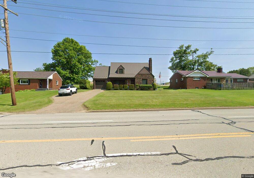
932 Freeport Rd Brackenridge, PA 15014
Estimated Value: $210,000 - $228,000
2
Beds
2
Baths
1,787
Sq Ft
$122/Sq Ft
Est. Value
About This Home
This home is located at 932 Freeport Rd, Brackenridge, PA 15014 and is currently estimated at $218,066, approximately $122 per square foot. 932 Freeport Rd is a home located in Allegheny County with nearby schools including Highlands Senior High School, Mary Queen of Apostles School, and St. Joseph High School.
Ownership History
Date
Name
Owned For
Owner Type
Purchase Details
Closed on
Oct 21, 2008
Sold by
Perkins Margaret B
Bought by
Williams David H
Current Estimated Value
Home Financials for this Owner
Home Financials are based on the most recent Mortgage that was taken out on this home.
Original Mortgage
$105,350
Outstanding Balance
$68,006
Interest Rate
5.83%
Mortgage Type
New Conventional
Estimated Equity
$150,060
Create a Home Valuation Report for This Property
The Home Valuation Report is an in-depth analysis detailing your home's value as well as a comparison with similar homes in the area
Home Values in the Area
Average Home Value in this Area
Purchase History
| Date | Buyer | Sale Price | Title Company |
|---|---|---|---|
| Williams David H | $113,000 | -- |
Source: Public Records
Mortgage History
| Date | Status | Borrower | Loan Amount |
|---|---|---|---|
| Open | Williams David H | $105,350 |
Source: Public Records
Tax History Compared to Growth
Tax History
| Year | Tax Paid | Tax Assessment Tax Assessment Total Assessment is a certain percentage of the fair market value that is determined by local assessors to be the total taxable value of land and additions on the property. | Land | Improvement |
|---|---|---|---|---|
| 2025 | $3,947 | $109,300 | $18,700 | $90,600 |
| 2024 | $3,947 | $109,300 | $18,700 | $90,600 |
| 2023 | $3,947 | $109,300 | $18,700 | $90,600 |
| 2022 | $3,920 | $109,300 | $18,700 | $90,600 |
| 2021 | $517 | $109,300 | $18,700 | $90,600 |
| 2020 | $3,920 | $109,300 | $18,700 | $90,600 |
| 2019 | $3,892 | $109,300 | $18,700 | $90,600 |
| 2018 | $517 | $109,300 | $18,700 | $90,600 |
| 2017 | $3,749 | $109,300 | $18,700 | $90,600 |
| 2016 | $517 | $109,300 | $18,700 | $90,600 |
| 2015 | $517 | $109,300 | $18,700 | $90,600 |
| 2014 | $3,749 | $109,300 | $18,700 | $90,600 |
Source: Public Records
Map
Nearby Homes
- 965 Morgan St
- 952 Roup Ave
- 721 Morgan St
- 1026 Cambridge St
- 1010 8th Ave
- 807 Hazlett Ave
- 1105 Parkside Dr
- 835 6th Ave
- 726 7th Ave
- 1126 Highland St
- 1117 8th Ave
- 613 E 7th Ave
- 805 Kentucky St
- 1202 Cambridge St
- 1203 Cambridge St
- 473 E 7th Ave
- 519 Roup St
- 623 E 3rd Ave
- 841 Brackenridge Ave
- 1219 Minnesota Ave
- 938 Freeport Rd
- 924 Freeport Rd
- 944 Freeport Rd
- 916 Freeport Rd
- 939 Freeport Rd
- 941 Freeport Rd
- 943 Freeport Rd
- 912 Freeport Rd
- 945 Freeport Rd
- 950 Freeport Rd
- 953 Union Ave
- 935 Freeport Rd
- 906 Freeport Rd
- 955 Union Ave
- 956 Freeport Rd
- 907 Freeport Rd
- 900 Freeport Rd
- 952 Union Ave
- 905 Freeport Rd
- 962 Freeport Rd