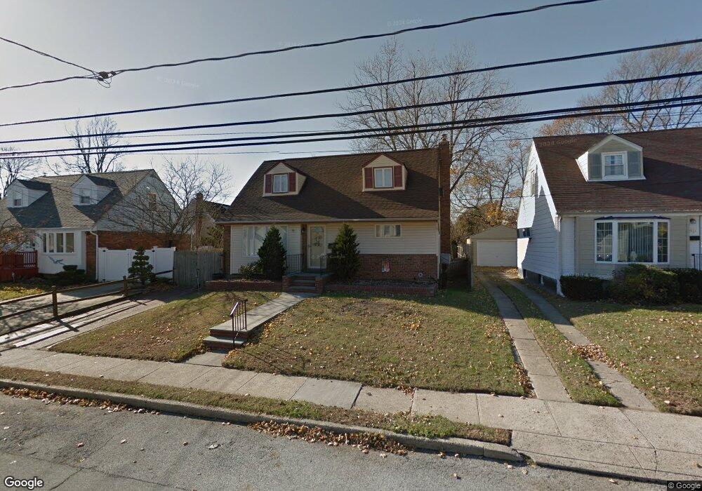
94 Branch Ave Freeport, NY 11520
Estimated Value: $630,253 - $641,000
3
Beds
2
Baths
1,190
Sq Ft
$534/Sq Ft
Est. Value
About This Home
This home is located at 94 Branch Ave, Freeport, NY 11520 and is currently estimated at $635,627, approximately $534 per square foot. 94 Branch Ave is a home located in Nassau County with nearby schools including Columbus Avenue School, Caroline G. Atkinson Intermediate School, and John W Dodd Middle School.
Ownership History
Date
Name
Owned For
Owner Type
Purchase Details
Closed on
Aug 23, 2018
Sold by
Glemboski Jeffrey M
Bought by
Pram Trinita and Mothersil Thatyana
Current Estimated Value
Home Financials for this Owner
Home Financials are based on the most recent Mortgage that was taken out on this home.
Original Mortgage
$362,484
Interest Rate
4.62%
Mortgage Type
FHA
Purchase Details
Closed on
Jul 25, 2010
Sold by
Ortiz Lucas and Osegueda Rosa
Bought by
Glemboski Jeffrey M
Home Financials for this Owner
Home Financials are based on the most recent Mortgage that was taken out on this home.
Original Mortgage
$249,000
Interest Rate
4.63%
Mortgage Type
Purchase Money Mortgage
Purchase Details
Closed on
Oct 30, 1998
Sold by
Ragonesi Thomas
Bought by
Ortiz Lucas and Osequeda Rosa
Create a Home Valuation Report for This Property
The Home Valuation Report is an in-depth analysis detailing your home's value as well as a comparison with similar homes in the area
Home Values in the Area
Average Home Value in this Area
Purchase History
| Date | Buyer | Sale Price | Title Company |
|---|---|---|---|
| Pram Trinita | $375,000 | None Available | |
| Glemboski Jeffrey M | $289,000 | -- | |
| Ortiz Lucas | $166,420 | -- |
Source: Public Records
Mortgage History
| Date | Status | Borrower | Loan Amount |
|---|---|---|---|
| Previous Owner | Pram Trinita | $362,484 | |
| Previous Owner | Glemboski Jeffrey M | $249,000 |
Source: Public Records
Tax History Compared to Growth
Tax History
| Year | Tax Paid | Tax Assessment Tax Assessment Total Assessment is a certain percentage of the fair market value that is determined by local assessors to be the total taxable value of land and additions on the property. | Land | Improvement |
|---|---|---|---|---|
| 2025 | $8,517 | $395 | $150 | $245 |
| 2024 | $906 | $395 | $150 | $245 |
| 2023 | $9,141 | $395 | $150 | $245 |
| 2022 | $9,141 | $395 | $150 | $245 |
| 2021 | $14,091 | $379 | $144 | $235 |
| 2020 | $10,419 | $708 | $441 | $267 |
| 2019 | $1,174 | $708 | $441 | $267 |
| 2018 | $3,574 | $646 | $0 | $0 |
| 2017 | $6,374 | $646 | $441 | $205 |
| 2016 | $7,344 | $693 | $441 | $252 |
| 2015 | $1,001 | $693 | $441 | $252 |
| 2014 | $1,001 | $693 | $441 | $252 |
| 2013 | $898 | $658 | $419 | $239 |
Source: Public Records
Map
Nearby Homes
- 173 Cedar St
- 171 Westside Ave
- 159 Branch Ave
- 31 Casino St Unit PH
- 16 Johnson Place
- 119 S Bay Ave
- 153 Westend Ave
- 437 Ray St
- 587 S Bayview Ave
- 214 Westend Ave Unit 6c
- 210 Westend Ave Unit 8B
- 226 Westside Ave Unit B
- 8 Florence Ave Unit 16C
- 28 Florence Ave
- 77 Hampton Place
- 451 Atlantic Ave
- 310 Miller Ave
- 116 Westend Ave Unit 21
- 116 Westend Ave Unit 8
- 322 Miller Ave