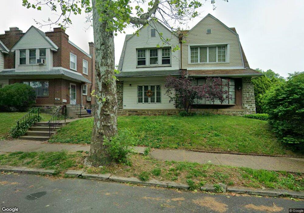
943 Dyre St Philadelphia, PA 19124
Lawncrest NeighborhoodEstimated Value: $258,000 - $292,000
4
Beds
1
Bath
1,634
Sq Ft
$169/Sq Ft
Est. Value
About This Home
This home is located at 943 Dyre St, Philadelphia, PA 19124 and is currently estimated at $276,657, approximately $169 per square foot. 943 Dyre St is a home with nearby schools including Frankford High School, The Philadelphia Charter School for the Arts & Sciences, and Northwood Academy Charter School.
Ownership History
Date
Name
Owned For
Owner Type
Purchase Details
Closed on
Oct 17, 2000
Sold by
Alvarez Daniel
Bought by
Groover Charlotte M and Mason Kenneth
Current Estimated Value
Home Financials for this Owner
Home Financials are based on the most recent Mortgage that was taken out on this home.
Original Mortgage
$76,370
Interest Rate
7.81%
Mortgage Type
FHA
Purchase Details
Closed on
Nov 29, 1999
Sold by
La Salle Bank Fsb
Bought by
Alvarez Daniel
Home Financials for this Owner
Home Financials are based on the most recent Mortgage that was taken out on this home.
Original Mortgage
$53,250
Interest Rate
7.61%
Purchase Details
Closed on
Sep 13, 1999
Sold by
Petrillo Paul D and Brooks Kelly A
Bought by
Lasalle Bank Fsb
Create a Home Valuation Report for This Property
The Home Valuation Report is an in-depth analysis detailing your home's value as well as a comparison with similar homes in the area
Home Values in the Area
Average Home Value in this Area
Purchase History
| Date | Buyer | Sale Price | Title Company |
|---|---|---|---|
| Groover Charlotte M | $77,000 | First American Title Ins Co | |
| Alvarez Daniel | $54,900 | -- | |
| Lasalle Bank Fsb | $6,300 | -- |
Source: Public Records
Mortgage History
| Date | Status | Borrower | Loan Amount |
|---|---|---|---|
| Previous Owner | Groover Charlotte M | $76,370 | |
| Previous Owner | Alvarez Daniel | $53,250 |
Source: Public Records
Tax History Compared to Growth
Tax History
| Year | Tax Paid | Tax Assessment Tax Assessment Total Assessment is a certain percentage of the fair market value that is determined by local assessors to be the total taxable value of land and additions on the property. | Land | Improvement |
|---|---|---|---|---|
| 2026 | $3,236 | $265,500 | $53,100 | $212,400 |
| 2025 | $3,236 | $265,500 | $53,100 | $212,400 |
| 2024 | $3,236 | $265,500 | $53,100 | $212,400 |
| 2023 | $3,236 | $231,200 | $46,240 | $184,960 |
| 2022 | $2,378 | $231,200 | $46,240 | $184,960 |
| 2021 | $2,378 | $0 | $0 | $0 |
| 2020 | $2,378 | $0 | $0 | $0 |
| 2019 | $2,282 | $0 | $0 | $0 |
| 2018 | $2,181 | $0 | $0 | $0 |
| 2017 | $2,181 | $0 | $0 | $0 |
| 2016 | $2,181 | $0 | $0 | $0 |
| 2015 | $2,088 | $0 | $0 | $0 |
| 2014 | -- | $155,800 | $40,975 | $114,825 |
| 2012 | -- | $19,552 | $2,445 | $17,107 |
Source: Public Records
Map
Nearby Homes
- 4046 E Roosevelt Blvd
- 5505 Loretto Ave
- 1048 Bridge St
- 1859 Harrison St
- 1052 Allengrove St
- 5640 Miriam Rd
- 5659 Miriam Rd
- 5661 Miriam Rd
- 894 Granite St
- 926 Foulkrod St
- 934 Brill St
- 1137 Bridge St
- 1204 Pratt St
- 880 Granite St
- 934 E Sanger St
- 1218 Pratt St
- 991 Carver St
- 1220 Pratt St
- 1208 Haworth St
- 996 Anchor St
- 941 Dyre St
- 945 Dyre St
- 939 Dyre St
- 951 Dyre St
- 953 Dyre St
- 944 Kenwyn St
- 946 Kenwyn St
- 948 Kenwyn St
- 955 Dyre St
- 5109 E Roosevelt Blvd
- 5105 Roosevelt Blvd
- 5105 Roosevelt Blvd Unit 2ND FR
- 950 Kenwyn St
- 5107 Roosevelt Blvd
- 5105 E Roosevelt Blvd Unit 2ND FLOOR REAR
- 5105 E Roosevelt Blvd Unit 2ND FR
- 5105 E Roosevelt Blvd
- 5103 Roosevelt Blvd
- 5109 Roosevelt Blvd
- 5101 E Roosevelt Blvd