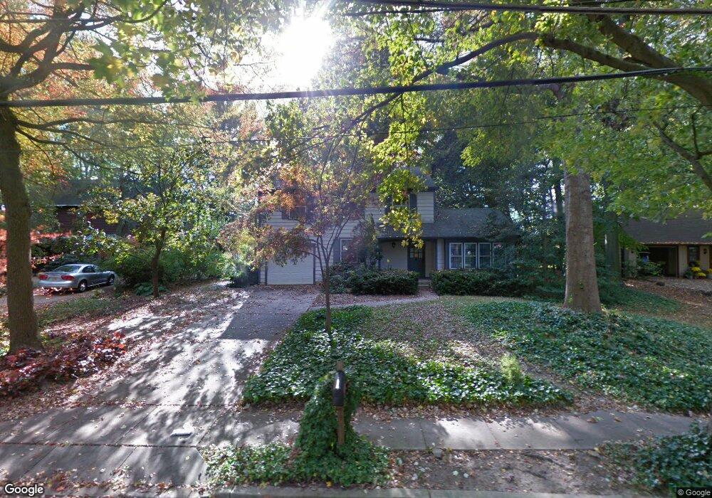
944 Locksley Ln West Deptford, NJ 08096
West Deptford Township NeighborhoodEstimated Value: $369,741 - $492,000
--
Bed
--
Bath
1,884
Sq Ft
$228/Sq Ft
Est. Value
About This Home
This home is located at 944 Locksley Ln, West Deptford, NJ 08096 and is currently estimated at $428,935, approximately $227 per square foot. 944 Locksley Ln is a home located in Gloucester County with nearby schools including Green-Fields Elementary School, Red Bank Elementary School, and Oakview Elementary School.
Ownership History
Date
Name
Owned For
Owner Type
Purchase Details
Closed on
Mar 9, 2018
Sold by
Weiner Thomas H and Weiner Elayne M
Bought by
Mckeeverr William R
Current Estimated Value
Home Financials for this Owner
Home Financials are based on the most recent Mortgage that was taken out on this home.
Original Mortgage
$114,000
Outstanding Balance
$65,785
Interest Rate
4.15%
Mortgage Type
New Conventional
Estimated Equity
$363,150
Purchase Details
Closed on
Apr 27, 1990
Bought by
Weiner Thomas and Weiner Elayne
Create a Home Valuation Report for This Property
The Home Valuation Report is an in-depth analysis detailing your home's value as well as a comparison with similar homes in the area
Home Values in the Area
Average Home Value in this Area
Purchase History
| Date | Buyer | Sale Price | Title Company |
|---|---|---|---|
| Mckeeverr William R | $142,500 | Group 21 Title Agency | |
| Weiner Thomas | $157,000 | -- |
Source: Public Records
Mortgage History
| Date | Status | Borrower | Loan Amount |
|---|---|---|---|
| Open | Mckeeverr William R | $114,000 |
Source: Public Records
Tax History Compared to Growth
Tax History
| Year | Tax Paid | Tax Assessment Tax Assessment Total Assessment is a certain percentage of the fair market value that is determined by local assessors to be the total taxable value of land and additions on the property. | Land | Improvement |
|---|---|---|---|---|
| 2025 | $7,620 | $218,200 | $54,100 | $164,100 |
| 2024 | $7,521 | $218,200 | $54,100 | $164,100 |
| 2023 | $7,521 | $218,200 | $54,100 | $164,100 |
| 2022 | $7,486 | $218,200 | $54,100 | $164,100 |
| 2021 | $7,460 | $218,200 | $54,100 | $164,100 |
| 2020 | $7,443 | $218,200 | $54,100 | $164,100 |
| 2019 | $7,236 | $218,200 | $54,100 | $164,100 |
| 2018 | $7,039 | $218,200 | $54,100 | $164,100 |
| 2017 | $6,875 | $218,200 | $54,100 | $164,100 |
| 2016 | $6,683 | $218,200 | $54,100 | $164,100 |
| 2015 | $6,367 | $218,200 | $54,100 | $164,100 |
| 2014 | $6,051 | $218,200 | $54,100 | $164,100 |
Source: Public Records
Map
Nearby Homes
- 1102 Barnesdale Rd
- 1220 Royal Ln
- 1311 Barnesdale Rd
- 4 Saint Emilion Ct
- 863 Doncaster Dr
- 87 Woodway Dr Unit 87
- 740 Carter Hill Dr
- 1810 Fernwood Dr
- 640 Worcester Dr
- 12 Highbridge Ln Unit I2
- 125 Lionheart Ln Unit C125
- 558 Prince St
- 1012 Moore Rd Unit 6
- 1091 Buckingham Dr Unit 45
- 1066 Buckingham Dr
- 64 Tilden Rd
- 344 S Girard St
- 438 S Columbia St
- 609 Salem Ave
- 608 Salem Ave
- 938 Locksley Ln
- 950 Locksley Ln
- 932 Locksley Ln
- 956 Locksley Ln
- 947 Locksley Ln
- 941 Locksley Ln
- 926 Locksley Ln
- 935 Locksley Ln
- 1092 Barnesdale Rd
- 920 Locksley Ln
- 1068 Barnesdale Rd
- 931 Elfwood Ct
- 921 Locksley Ln
- 1083 Barnesdale Rd
- 914 Locksley Ln
- 1062 Barnesdale Rd
- 1069 Barnesdale Rd
- 915 Locksley Ln
- 929 Elfwood Ct
- 908 Locksley Ln