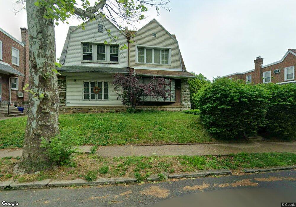
945 Dyre St Philadelphia, PA 19124
Lawncrest NeighborhoodEstimated Value: $282,000 - $331,000
3
Beds
2
Baths
1,634
Sq Ft
$184/Sq Ft
Est. Value
About This Home
This home is located at 945 Dyre St, Philadelphia, PA 19124 and is currently estimated at $300,981, approximately $184 per square foot. 945 Dyre St is a home located in Philadelphia County with nearby schools including Frankford High School, The Philadelphia Charter School for the Arts & Sciences, and Northwood Academy Charter School.
Ownership History
Date
Name
Owned For
Owner Type
Purchase Details
Closed on
Aug 4, 2009
Sold by
Roldan Maria
Bought by
Hartzell Kevin L
Current Estimated Value
Home Financials for this Owner
Home Financials are based on the most recent Mortgage that was taken out on this home.
Original Mortgage
$201,286
Outstanding Balance
$131,901
Interest Rate
5.47%
Mortgage Type
FHA
Estimated Equity
$169,080
Create a Home Valuation Report for This Property
The Home Valuation Report is an in-depth analysis detailing your home's value as well as a comparison with similar homes in the area
Home Values in the Area
Average Home Value in this Area
Purchase History
| Date | Buyer | Sale Price | Title Company |
|---|---|---|---|
| Hartzell Kevin L | $205,000 | Lawyers Title Insurance Corp |
Source: Public Records
Mortgage History
| Date | Status | Borrower | Loan Amount |
|---|---|---|---|
| Open | Hartzell Kevin L | $201,286 |
Source: Public Records
Tax History Compared to Growth
Tax History
| Year | Tax Paid | Tax Assessment Tax Assessment Total Assessment is a certain percentage of the fair market value that is determined by local assessors to be the total taxable value of land and additions on the property. | Land | Improvement |
|---|---|---|---|---|
| 2026 | $3,439 | $281,600 | $56,320 | $225,280 |
| 2025 | $3,439 | $281,600 | $56,320 | $225,280 |
| 2024 | $3,439 | $281,600 | $56,320 | $225,280 |
| 2023 | $3,439 | $245,700 | $49,140 | $196,560 |
| 2022 | $2,480 | $245,700 | $49,140 | $196,560 |
| 2021 | $2,480 | $0 | $0 | $0 |
| 2020 | $2,480 | $0 | $0 | $0 |
| 2019 | $2,380 | $0 | $0 | $0 |
| 2018 | $2,340 | $0 | $0 | $0 |
| 2017 | $2,340 | $0 | $0 | $0 |
| 2016 | $2,340 | $0 | $0 | $0 |
| 2015 | $2,240 | $0 | $0 | $0 |
| 2014 | -- | $167,200 | $65,208 | $101,992 |
| 2012 | -- | $19,552 | $3,602 | $15,950 |
Source: Public Records
Map
Nearby Homes
- 4046 E Roosevelt Blvd
- 5505 Loretto Ave
- 1048 Bridge St
- 1859 Harrison St
- 1052 Allengrove St
- 5640 Miriam Rd
- 5659 Miriam Rd
- 5661 Miriam Rd
- 894 Granite St
- 926 Foulkrod St
- 934 Brill St
- 1137 Bridge St
- 1204 Pratt St
- 880 Granite St
- 934 E Sanger St
- 1218 Pratt St
- 991 Carver St
- 1220 Pratt St
- 1208 Haworth St
- 996 Anchor St
- 943 Dyre St
- 951 Dyre St
- 941 Dyre St
- 953 Dyre St
- 939 Dyre St
- 955 Dyre St
- 957 Dyre St
- 948 Kenwyn St
- 946 Kenwyn St
- 950 Kenwyn St
- 944 Kenwyn St
- 952 Kenwyn St
- 991 E Godfrey Ave
- 954 Kenwyn St
- 956 Kenwyn St
- 5109 E Roosevelt Blvd
- 5107 Roosevelt Blvd
- 5105 Roosevelt Blvd
- 5105 Roosevelt Blvd Unit 2ND FR
- 5109 Roosevelt Blvd