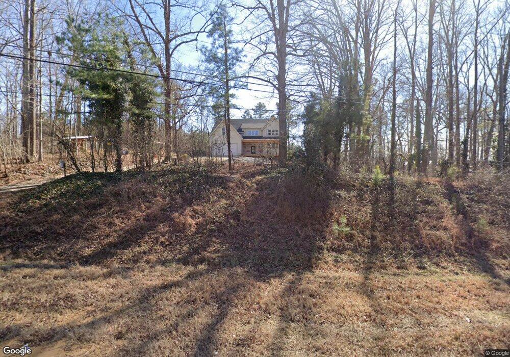
947 Buchanan Hwy Dallas, GA 30157
Estimated Value: $326,000 - $476,056
4
Beds
3
Baths
3,494
Sq Ft
$109/Sq Ft
Est. Value
About This Home
This home is located at 947 Buchanan Hwy, Dallas, GA 30157 and is currently estimated at $382,264, approximately $109 per square foot. 947 Buchanan Hwy is a home located in Paulding County with nearby schools including Lillian C. Poole Elementary School, South Paulding Middle School, and Paulding County High School.
Ownership History
Date
Name
Owned For
Owner Type
Purchase Details
Closed on
Mar 8, 2022
Sold by
Davis Shannon Corrie
Bought by
Kiezebrink Daniel and Kiezebrink Jill
Current Estimated Value
Purchase Details
Closed on
Mar 3, 2022
Sold by
Griffin Ronald David
Bought by
Davis Shannon Corrie
Purchase Details
Closed on
Feb 24, 2022
Sold by
Kendrick Christy Leigh
Bought by
Davis Shannon Corrie
Purchase Details
Closed on
Feb 23, 2022
Sold by
Petty Brenda Diane
Bought by
Davis Shannon Corrie
Purchase Details
Closed on
Jul 20, 2021
Sold by
Fields Shirley Griffin
Bought by
Fields Shannon Corrie
Create a Home Valuation Report for This Property
The Home Valuation Report is an in-depth analysis detailing your home's value as well as a comparison with similar homes in the area
Home Values in the Area
Average Home Value in this Area
Purchase History
| Date | Buyer | Sale Price | Title Company |
|---|---|---|---|
| Kiezebrink Daniel | $50,000 | -- | |
| Davis Shannon Corrie | -- | -- | |
| Davis Shannon Corrie | -- | -- | |
| Davis Shannon Corrie | -- | -- | |
| Davis Shannon Corrie | -- | -- | |
| Fields Shannon Corrie | -- | -- |
Source: Public Records
Tax History Compared to Growth
Tax History
| Year | Tax Paid | Tax Assessment Tax Assessment Total Assessment is a certain percentage of the fair market value that is determined by local assessors to be the total taxable value of land and additions on the property. | Land | Improvement |
|---|---|---|---|---|
| 2024 | $2,225 | $89,440 | $16,840 | $72,600 |
| 2023 | $424 | $16,280 | $16,280 | $0 |
| 2022 | $343 | $13,160 | $13,160 | $0 |
| 2021 | $312 | $10,720 | $10,720 | $0 |
| 2020 | $331 | $11,160 | $11,160 | $0 |
| 2019 | $345 | $11,440 | $11,440 | $0 |
| 2018 | $309 | $10,240 | $10,240 | $0 |
| 2017 | $313 | $10,240 | $10,240 | $0 |
| 2016 | $299 | $9,883 | $9,720 | $163 |
| 2015 | $272 | $8,843 | $8,680 | $163 |
| 2014 | $267 | $8,443 | $8,280 | $163 |
| 2013 | -- | $10,040 | $9,200 | $840 |
Source: Public Records
Map
Nearby Homes
- 216 McMichen Rd
- 196 Pope Place
- 380 Buchanan Hwy
- 451 Lone Bear Path
- 298 Buchanan Hwy
- 60 Westside Cir
- 233 E Skyline View
- 47 Whitley Ct
- 236 E Skyline View
- 1136 Cole Lake Rd
- 203 Overlook Ct
- 0 Cole Lake Rd Unit 10607141
- 0 Cole Lake Rd Unit 7651259
- 1160 W Memorial Dr
- +/-1.0 Cole Lake Rd
- 107 Salem Place
- 209 Overlook Dr
- 204 Overlook Dr
- 103 E Skyline View
- 929 Buchanan Hwy
- 928 Buchanan Hwy
- 1059 Buchanan Hwy
- 869 Buchanan Hwy
- 1137 Buchanan Hwy
- 815 Buchanan Hwy
- 1097 Buchanan Hwy
- 1000 Buchanan Hwy
- 121 Lane Rd
- 75 Lane Rd
- 1141 Buchanan Hwy
- 789 Buchanan Hwy
- 1038 Buchanan Hwy
- 78 Lane Rd
- 139 Lane Rd
- 769 Buchanan Hwy
- 785 Buchanan Hwy
- 127 Pope Place
- 205 Lane Rd
- 219 Lane Rd