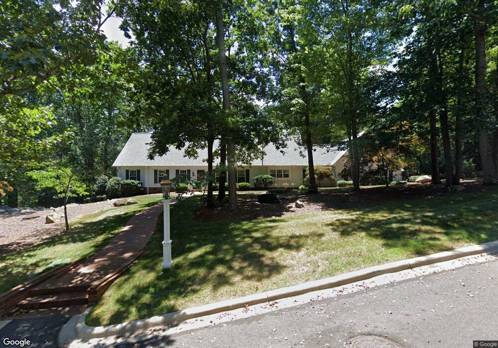
947 Highwood Dr Asheboro, NC 27205
Estimated Value: $517,000 - $706,000
2
Beds
3
Baths
2,909
Sq Ft
$214/Sq Ft
Est. Value
About This Home
This home is located at 947 Highwood Dr, Asheboro, NC 27205 and is currently estimated at $621,255, approximately $213 per square foot. 947 Highwood Dr is a home located in Randolph County with nearby schools including Charles W. McCrary Elementary School, North Asheboro Middle School, and Asheboro High School.
Ownership History
Date
Name
Owned For
Owner Type
Purchase Details
Closed on
Jan 11, 2021
Sold by
Steven Pugh Jason and Grimes Tammy
Bought by
Pugh Jason Steven and Pugh Tammy Grimes
Current Estimated Value
Purchase Details
Closed on
Feb 3, 2014
Sold by
Pugh Richard K and Pugh Betty D
Bought by
Pugh Steven K and Pugh Tammy B
Home Financials for this Owner
Home Financials are based on the most recent Mortgage that was taken out on this home.
Original Mortgage
$325,000
Interest Rate
4.48%
Mortgage Type
Purchase Money Mortgage
Create a Home Valuation Report for This Property
The Home Valuation Report is an in-depth analysis detailing your home's value as well as a comparison with similar homes in the area
Home Values in the Area
Average Home Value in this Area
Purchase History
| Date | Buyer | Sale Price | Title Company |
|---|---|---|---|
| Pugh Jason Steven | -- | None Listed On Document | |
| Pugh Steven K | $325,000 | None Available |
Source: Public Records
Mortgage History
| Date | Status | Borrower | Loan Amount |
|---|---|---|---|
| Previous Owner | Pugh Steven K | $325,000 |
Source: Public Records
Tax History Compared to Growth
Tax History
| Year | Tax Paid | Tax Assessment Tax Assessment Total Assessment is a certain percentage of the fair market value that is determined by local assessors to be the total taxable value of land and additions on the property. | Land | Improvement |
|---|---|---|---|---|
| 2025 | $6,115 | $461,430 | $80,950 | $380,480 |
| 2024 | $6,115 | $461,430 | $80,950 | $380,480 |
| 2023 | $6,115 | $461,430 | $80,950 | $380,480 |
| 2022 | $5,027 | $348,720 | $64,340 | $284,380 |
| 2021 | $5,027 | $348,720 | $64,340 | $284,380 |
| 2020 | $5,027 | $348,720 | $64,340 | $284,380 |
| 2019 | $3,500 | $348,720 | $64,340 | $284,380 |
| 2018 | $4,651 | $316,910 | $47,140 | $269,770 |
| 2016 | $4,651 | $316,909 | $47,140 | $269,769 |
| 2015 | $4,659 | $316,909 | $47,140 | $269,769 |
| 2014 | -- | $316,909 | $47,140 | $269,769 |
Source: Public Records
Map
Nearby Homes
- 0 Highwood Dr
- 1110 Park Dr
- 866 Mountain Rd
- 1025 Neely Dr
- 0000 Little Gate Dr
- 1011 Westmont Dr
- 1142 Westover Terrace
- 627 Oakmont Dr
- 1582 Westmont Dr
- 1407 Oakland Ave
- TBD Oakland Ave
- 516 and 518 Peachtree St
- 435 Peachtree St
- 0 Amity Rd
- 914 Tamworth Rd
- 1821 Back Creek Ct
- 923 Arnold St
- 246 Hampton Rd Unit 8A
- 330 W Presnell St Unit 37
- 330 13 W Presnell St
- 1050 N Rockridge Rd
- 946 Highwood Dr
- 00 N Rockridge Road & Daves Mount Ct
- 1060 N Rockridge Rd
- 1047 N Rockridge Rd
- 1002 Park Dr
- 1122 Park Dr
- 1036 Rockridge Rd
- 1000 N Park Dr
- 1065 N Rockridge Rd
- 1126 Park Dr
- 1074 N Rockridge Rd
- 763 Lincoln Ave
- 1132 Park Dr
- 1121 Park Dr
- 936 N Park Dr
- 1100 Rockridge Rd
- 759 N Mccrary St
- 750 Lincoln Ave
- 1129 Park Dr