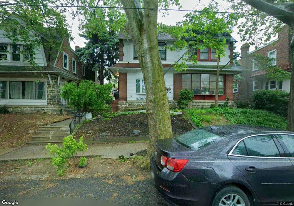
948 Kenwyn St Philadelphia, PA 19124
Lawncrest NeighborhoodEstimated Value: $215,000 - $301,000
3
Beds
2
Baths
1,774
Sq Ft
$149/Sq Ft
Est. Value
About This Home
This home is located at 948 Kenwyn St, Philadelphia, PA 19124 and is currently estimated at $264,950, approximately $149 per square foot. 948 Kenwyn St is a home located in Philadelphia County with nearby schools including Frankford High School, The Philadelphia Charter School for the Arts & Sciences, and Northwood Academy Charter School.
Ownership History
Date
Name
Owned For
Owner Type
Purchase Details
Closed on
Jul 29, 2008
Sold by
Bender Richard W
Bought by
Vasquez Arlene
Current Estimated Value
Home Financials for this Owner
Home Financials are based on the most recent Mortgage that was taken out on this home.
Original Mortgage
$88,000
Outstanding Balance
$57,726
Interest Rate
6.49%
Mortgage Type
Purchase Money Mortgage
Estimated Equity
$207,224
Create a Home Valuation Report for This Property
The Home Valuation Report is an in-depth analysis detailing your home's value as well as a comparison with similar homes in the area
Home Values in the Area
Average Home Value in this Area
Purchase History
| Date | Buyer | Sale Price | Title Company |
|---|---|---|---|
| Vasquez Arlene | $110,000 | None Available |
Source: Public Records
Mortgage History
| Date | Status | Borrower | Loan Amount |
|---|---|---|---|
| Open | Vasquez Arlene | $88,000 |
Source: Public Records
Tax History Compared to Growth
Tax History
| Year | Tax Paid | Tax Assessment Tax Assessment Total Assessment is a certain percentage of the fair market value that is determined by local assessors to be the total taxable value of land and additions on the property. | Land | Improvement |
|---|---|---|---|---|
| 2026 | $3,304 | $273,300 | $54,660 | $218,640 |
| 2025 | $3,304 | $273,300 | $54,660 | $218,640 |
| 2024 | $3,304 | $273,300 | $54,660 | $218,640 |
| 2023 | $3,304 | $236,000 | $47,200 | $188,800 |
| 2022 | $1,775 | $191,000 | $47,200 | $143,800 |
| 2021 | $2,405 | $0 | $0 | $0 |
| 2020 | $2,405 | $0 | $0 | $0 |
| 2019 | $2,307 | $0 | $0 | $0 |
| 2018 | $1,817 | $0 | $0 | $0 |
| 2017 | $2,237 | $0 | $0 | $0 |
| 2016 | $1,817 | $0 | $0 | $0 |
| 2015 | $1,739 | $0 | $0 | $0 |
| 2014 | -- | $159,800 | $38,850 | $120,950 |
| 2012 | -- | $19,552 | $2,761 | $16,791 |
Source: Public Records
Map
Nearby Homes
- 5505 Loretto Ave
- 4046 E Roosevelt Blvd
- 1048 Bridge St
- 5640 Miriam Rd
- 5659 Miriam Rd
- 5661 Miriam Rd
- 934 Brill St
- 894 Granite St
- 1859 Harrison St
- 1052 Allengrove St
- 880 Granite St
- 934 E Sanger St
- 991 Carver St
- 1137 Bridge St
- 996 Anchor St
- 925 E Sanger St
- 926 Foulkrod St
- 1204 Pratt St
- 894 E Sanger St
- 883 Brill St
- 950 Kenwyn St
- 946 Kenwyn St
- 952 Kenwyn St
- 944 Kenwyn St
- 954 Kenwyn St
- 956 Kenwyn St
- 958 Kenwyn St
- 945 Dyre St
- 5115 Roosevelt Blvd
- 5115 E Roosevelt Blvd
- 943 Dyre St
- 951 Dyre St
- 5113 Roosevelt Blvd
- 941 Dyre St
- 953 Dyre St
- 5111 Roosevelt Blvd
- 5111 E Roosevelt Blvd Unit 1ST FLOOR
- 5111 E Roosevelt Blvd Unit 2F
- 5111 E Roosevelt Blvd
- 947 Kenwyn St