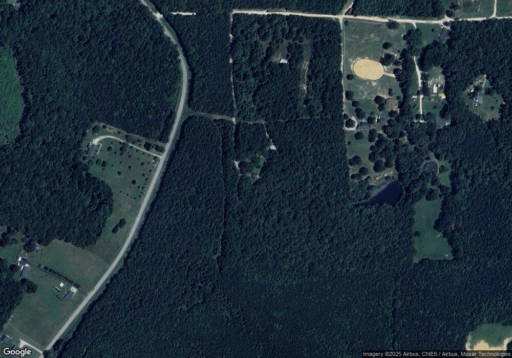
95 Roberson Ln Louisburg, NC 27549
Estimated Value: $404,000 - $502,253
3
Beds
2
Baths
2,261
Sq Ft
$195/Sq Ft
Est. Value
About This Home
This home is located at 95 Roberson Ln, Louisburg, NC 27549 and is currently estimated at $441,813, approximately $195 per square foot. 95 Roberson Ln is a home located in Franklin County with nearby schools including Royal Elementary School, Bunn Middle School, and Bunn High School.
Ownership History
Date
Name
Owned For
Owner Type
Purchase Details
Closed on
Nov 29, 2018
Sold by
Roberson William Robert and Roberson William Oliver
Bought by
Boyer Philip Neal
Current Estimated Value
Home Financials for this Owner
Home Financials are based on the most recent Mortgage that was taken out on this home.
Original Mortgage
$216,000
Outstanding Balance
$189,555
Interest Rate
4.8%
Mortgage Type
New Conventional
Estimated Equity
$252,258
Create a Home Valuation Report for This Property
The Home Valuation Report is an in-depth analysis detailing your home's value as well as a comparison with similar homes in the area
Home Values in the Area
Average Home Value in this Area
Purchase History
| Date | Buyer | Sale Price | Title Company |
|---|---|---|---|
| Boyer Philip Neal | $240,000 | None Available |
Source: Public Records
Mortgage History
| Date | Status | Borrower | Loan Amount |
|---|---|---|---|
| Open | Boyer Philip Neal | $216,000 |
Source: Public Records
Tax History Compared to Growth
Tax History
| Year | Tax Paid | Tax Assessment Tax Assessment Total Assessment is a certain percentage of the fair market value that is determined by local assessors to be the total taxable value of land and additions on the property. | Land | Improvement |
|---|---|---|---|---|
| 2025 | $2,445 | $409,670 | $206,940 | $202,730 |
| 2024 | $2,404 | $409,670 | $206,940 | $202,730 |
| 2023 | $2,055 | $226,160 | $64,410 | $161,750 |
| 2022 | $1,665 | $181,950 | $64,410 | $117,540 |
| 2021 | $1,683 | $181,950 | $64,410 | $117,540 |
| 2020 | $1,693 | $181,950 | $64,410 | $117,540 |
| 2019 | $1,667 | $181,950 | $64,410 | $117,540 |
| 2018 | $1,665 | $181,950 | $64,410 | $117,540 |
| 2017 | $1,795 | $179,080 | $62,320 | $116,760 |
| 2016 | $1,857 | $179,080 | $62,320 | $116,760 |
| 2015 | $1,857 | $179,080 | $62,320 | $116,760 |
| 2014 | $1,738 | $179,080 | $62,320 | $116,760 |
Source: Public Records
Map
Nearby Homes
- 563 Arnold Rd
- 45 Horsecreek Rd
- 0 Cowboys Trail
- 105 Teal Dr
- 115 Parkers Gate Dr
- 116 Thistle Dr
- Lot 3 Rembert Run Ct
- 140 Bramble Ct
- 25 Rembert Run Ct
- Lot 1 Rembert Run Ct
- 150 Babbling Creek Dr
- 50 Babbling Creek Dr
- Lot 5 Rembert Run Ct
- 444 Barnette Rd
- 3555 Nc 98 Hwy W
- 85 Old Garden Ln
- 3986 US 401 Hwy S
- 2333 N Carolina 98
- 40 Muirfield Dr
- 85 Weathered Oak Way
- 25 Roberson Ln
- 120 Mylands Rd E
- 1086 Clifton Pond Rd
- 164 Mylands Rd E
- 10 AC Mylands Rd E
- 0 Mylands Rd E
- 1180 Clifton Pond Rd
- 192 Mylands Rd E
- 65 Mylands Rd E
- 1229 Clifton Pond Rd
- 59 Clifton Way
- 59 Clifton Way
- 207 Clifton Ridge Ct
- 210 Clifton Ridge Ct
- 1238 Clifton Pond Rd
- 77 Clifton Way
- 195 Mylands Rd E
- 208 Clifton Ridge Ct
- 1313 Clifton Pond Rd
- 205 Clifton Ridge Ct
