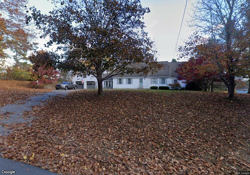
95 Woodman Rd South Hampton, NH 03827
Estimated Value: $740,000 - $980,000
3
Beds
2
Baths
3,459
Sq Ft
$245/Sq Ft
Est. Value
About This Home
This home is located at 95 Woodman Rd, South Hampton, NH 03827 and is currently estimated at $847,913, approximately $245 per square foot. 95 Woodman Rd is a home located in Rockingham County with nearby schools including South Hampton Barnard School, Winnacunnet High School, and Amesbury Seventh-Day Adventist School.
Ownership History
Date
Name
Owned For
Owner Type
Purchase Details
Closed on
Jun 20, 2014
Sold by
Reid James E and Reid Mary
Bought by
Langlois Andrew J and Langois Courtney R
Current Estimated Value
Home Financials for this Owner
Home Financials are based on the most recent Mortgage that was taken out on this home.
Original Mortgage
$298,500
Outstanding Balance
$227,131
Interest Rate
4.21%
Mortgage Type
Purchase Money Mortgage
Estimated Equity
$620,782
Create a Home Valuation Report for This Property
The Home Valuation Report is an in-depth analysis detailing your home's value as well as a comparison with similar homes in the area
Home Values in the Area
Average Home Value in this Area
Purchase History
| Date | Buyer | Sale Price | Title Company |
|---|---|---|---|
| Langlois Andrew J | -- | -- |
Source: Public Records
Mortgage History
| Date | Status | Borrower | Loan Amount |
|---|---|---|---|
| Open | Langlois Andrew J | $298,500 |
Source: Public Records
Tax History Compared to Growth
Tax History
| Year | Tax Paid | Tax Assessment Tax Assessment Total Assessment is a certain percentage of the fair market value that is determined by local assessors to be the total taxable value of land and additions on the property. | Land | Improvement |
|---|---|---|---|---|
| 2024 | $9,892 | $716,800 | $286,200 | $430,600 |
| 2023 | $9,892 | $716,800 | $286,200 | $430,600 |
| 2022 | $9,185 | $462,500 | $164,700 | $297,800 |
| 2021 | $9,218 | $462,500 | $164,700 | $297,800 |
| 2020 | $8,783 | $462,500 | $164,700 | $297,800 |
| 2019 | $8,256 | $462,500 | $164,700 | $297,800 |
| 2018 | $7,710 | $462,500 | $164,700 | $297,800 |
| 2017 | $7,509 | $390,300 | $165,100 | $225,200 |
| 2016 | $7,115 | $390,300 | $165,100 | $225,200 |
| 2015 | $7,779 | $390,300 | $165,100 | $225,200 |
| 2014 | $7,299 | $390,300 | $165,100 | $225,200 |
| 2012 | $7,142 | $484,200 | $234,300 | $249,900 |
Source: Public Records
Map
Nearby Homes
- 25 Whittier Meadows Dr
- 51 Locust St
- 1 Brown Ave Unit 1-37
- 1 Brown Ave Unit 3-78
- 1 Brown Ave Unit 3-80
- 3 Brown Ave Unit 75
- 2 Locke Hill Ln
- 253 Amesbury Rd
- 1 Stacey Ln
- 57 Clinton St
- 28 Powderhouse Ct Unit 28
- 10 Mason Ct Unit 10
- 20 Mason Ct
- 2 Adder Ln
- 16 Glen Devin St
- 84 Blacksnake Rd Unit A
- 4 Woodsom Dr
- 105 Market St Unit B
- 103 Market St Unit A
- 48 Orchard St