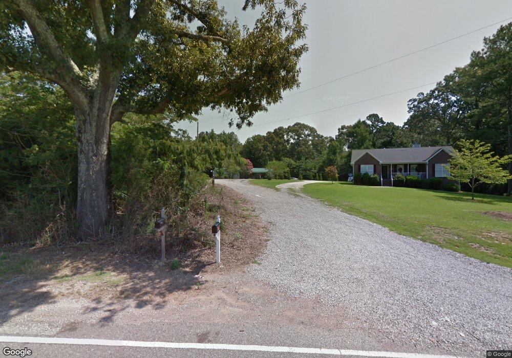
9501 Bill Jones Rd Kimberly, AL 35091
Estimated Value: $196,000 - $286,000
4
Beds
2
Baths
1,792
Sq Ft
$140/Sq Ft
Est. Value
About This Home
This home is located at 9501 Bill Jones Rd, Kimberly, AL 35091 and is currently estimated at $250,910, approximately $140 per square foot. 9501 Bill Jones Rd is a home located in Jefferson County with nearby schools including Bryan Elementary School, North Jefferson Middle School, and Mortimer Jordan High School.
Ownership History
Date
Name
Owned For
Owner Type
Purchase Details
Closed on
Jan 20, 2022
Sold by
Crowe Nicole K
Bought by
Crowe Michael E
Current Estimated Value
Purchase Details
Closed on
Jan 25, 2013
Sold by
Crowe Nicole K
Bought by
Crowe Michael
Home Financials for this Owner
Home Financials are based on the most recent Mortgage that was taken out on this home.
Original Mortgage
$125,087
Interest Rate
3.87%
Mortgage Type
FHA
Purchase Details
Closed on
Sep 2, 2005
Sold by
Pharris Brian and Pharris Sarah
Bought by
Crowe Michael and Kirby Nicole
Home Financials for this Owner
Home Financials are based on the most recent Mortgage that was taken out on this home.
Original Mortgage
$100,000
Interest Rate
6.37%
Mortgage Type
New Conventional
Purchase Details
Closed on
Mar 3, 2004
Sold by
Shannon Lynn Douglas
Bought by
Pharris Brian Edwin
Create a Home Valuation Report for This Property
The Home Valuation Report is an in-depth analysis detailing your home's value as well as a comparison with similar homes in the area
Home Values in the Area
Average Home Value in this Area
Purchase History
| Date | Buyer | Sale Price | Title Company |
|---|---|---|---|
| Crowe Michael E | -- | -- | |
| Crowe Michael | -- | -- | |
| Crowe Michael | $125,000 | None Available | |
| Pharris Brian Edwin | -- | Jefferson Title Corporation |
Source: Public Records
Mortgage History
| Date | Status | Borrower | Loan Amount |
|---|---|---|---|
| Previous Owner | Crowe Michael | $125,087 | |
| Previous Owner | Crowe Michael | $100,000 | |
| Previous Owner | Crowe Michael | $25,000 |
Source: Public Records
Tax History Compared to Growth
Tax History
| Year | Tax Paid | Tax Assessment Tax Assessment Total Assessment is a certain percentage of the fair market value that is determined by local assessors to be the total taxable value of land and additions on the property. | Land | Improvement |
|---|---|---|---|---|
| 2024 | $797 | $16,540 | -- | -- |
| 2022 | $764 | $12,270 | $2,200 | $10,070 |
| 2021 | $717 | $11,450 | $2,200 | $9,250 |
| 2020 | $605 | $9,660 | $2,200 | $7,460 |
| 2019 | $605 | $9,660 | $0 | $0 |
| 2018 | $630 | $10,060 | $0 | $0 |
| 2017 | $630 | $10,060 | $0 | $0 |
| 2016 | $630 | $10,060 | $0 | $0 |
| 2015 | $630 | $10,060 | $0 | $0 |
| 2014 | $621 | $9,700 | $0 | $0 |
| 2013 | $621 | $9,700 | $0 | $0 |
Source: Public Records
Map
Nearby Homes
- The Landen Brunswick Ave
- The Caldwell Brunswick Ave
- The Braselton II Plan at Jersey Park
- The Benson II Plan at Jersey Park
- The McGinnis Plan at Jersey Park
- The Langford Plan at Jersey Park
- The Coleman Plan at Jersey Park
- The Caldwell Plan at Jersey Park
- The Landen Plan at Jersey Park
- The Greenbrier II Plan at Jersey Park
- The Harrington Plan at Jersey Park
- The McGinnis Brunswick Ave
- The Langford Brunswick Ave
- 12345 Brunswick Ave
- 9316 Brunswick Ave
- The Benson II Brunswick Ave
- The Greenbrier Brunswick Ave
- The Braselton Brunswick Ave
- The Coleman Brunswick Ave
- 1234 Brunswick Ave
- 9579 Pharris Ln
- 9575 Pharris Ln
- 9589 Pharris Ln
- 9495 Bill Jones Rd
- 9509 Bill Jones Rd
- 9583 Pharris Ln
- 9441 Bill Jones Rd
- 9571 Pharris Ln
- 9580 Pharris Ln
- 9587 Pharris Ln
- 1008 Derby Pkwy
- 9567 Pharris Ln
- 1012 Derby Pkwy
- 9588 Pharris Ln
- 1016 Derby Pkwy
- 1016 Derby Pkwy Unit 201
- 9513 Bill Jones Rd
- 9435 Bill Jones Rd
- 9566 Pharris Ln
- 1004 Derby Pkwy