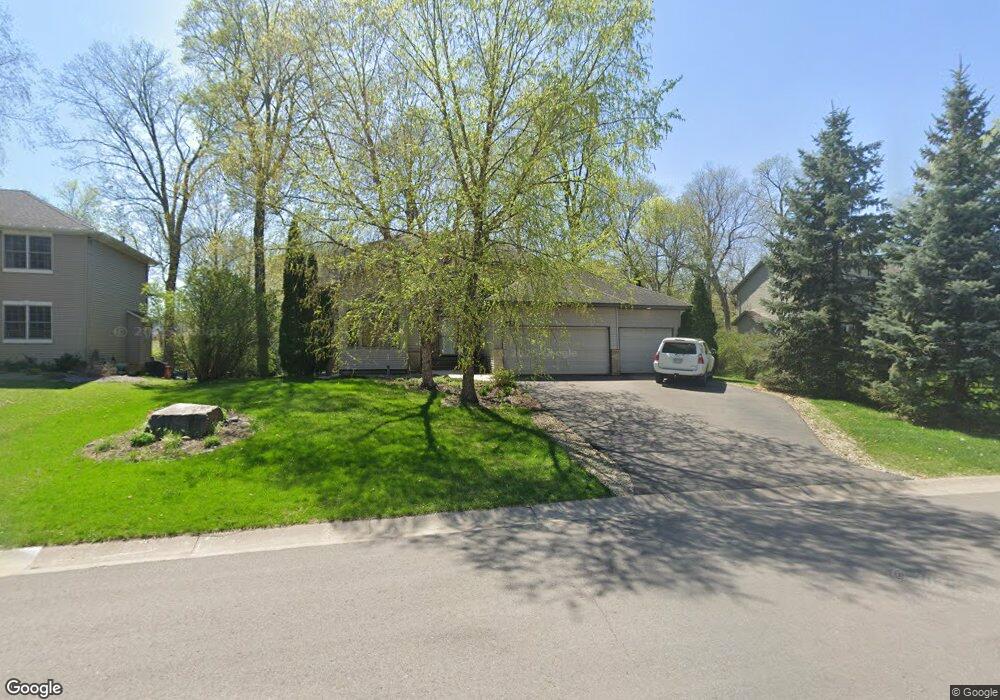
959 10th St S Delano, MN 55328
Estimated Value: $507,000 - $579,000
5
Beds
4
Baths
3,058
Sq Ft
$181/Sq Ft
Est. Value
About This Home
This home is located at 959 10th St S, Delano, MN 55328 and is currently estimated at $553,725, approximately $181 per square foot. 959 10th St S is a home located in Wright County with nearby schools including Delano Elementary School, Delano Middle School, and Delano Senior High School.
Ownership History
Date
Name
Owned For
Owner Type
Purchase Details
Closed on
Jun 21, 2021
Sold by
Tolkkinen Brian P and Tolkkinen Katheryn D
Bought by
Scott Matt and Scott Leah
Current Estimated Value
Home Financials for this Owner
Home Financials are based on the most recent Mortgage that was taken out on this home.
Original Mortgage
$441,750
Outstanding Balance
$399,950
Interest Rate
2.9%
Mortgage Type
New Conventional
Estimated Equity
$153,775
Purchase Details
Closed on
Sep 22, 2000
Sold by
J Phillips Construction Inc
Bought by
Tolkkinen Brian P and Tolkkinen Katherine D
Create a Home Valuation Report for This Property
The Home Valuation Report is an in-depth analysis detailing your home's value as well as a comparison with similar homes in the area
Home Values in the Area
Average Home Value in this Area
Purchase History
| Date | Buyer | Sale Price | Title Company |
|---|---|---|---|
| Scott Matt | $465,000 | Watermark Title Agcy Qualia | |
| Tolkkinen Brian P | $264,028 | -- | |
| Scott Matt Matt | $465,000 | -- |
Source: Public Records
Mortgage History
| Date | Status | Borrower | Loan Amount |
|---|---|---|---|
| Open | Scott Matt | $441,750 | |
| Closed | Scott Matt Matt | $441,750 |
Source: Public Records
Tax History Compared to Growth
Tax History
| Year | Tax Paid | Tax Assessment Tax Assessment Total Assessment is a certain percentage of the fair market value that is determined by local assessors to be the total taxable value of land and additions on the property. | Land | Improvement |
|---|---|---|---|---|
| 2025 | $5,954 | $494,700 | $86,000 | $408,700 |
| 2024 | $6,040 | $493,800 | $79,000 | $414,800 |
| 2023 | $5,956 | $517,200 | $79,000 | $438,200 |
| 2022 | $5,396 | $470,200 | $79,000 | $391,200 |
| 2021 | $5,212 | $375,100 | $66,500 | $308,600 |
| 2020 | $5,312 | $360,000 | $61,500 | $298,500 |
| 2019 | $5,478 | $351,400 | $0 | $0 |
| 2018 | $5,094 | $345,300 | $0 | $0 |
| 2017 | $4,860 | $318,500 | $0 | $0 |
| 2016 | $4,688 | $0 | $0 | $0 |
| 2015 | $3,676 | $0 | $0 | $0 |
| 2014 | -- | $0 | $0 | $0 |
Source: Public Records
Map
Nearby Homes
- 986 Eastwood Cir
- 1157 Woods Creek Dr
- 916 Big Woods Dr
- 1170 Woods Creek Dr S
- 897 Big Woods Dr
- 899 Big Woods Dr
- 978 Big Woods Dr
- 986 Big Woods Dr
- 1192 Woods Creek Dr
- 1198 Woods Creek Dr S
- 1141 Woods Creek Dr S
- 1401 Woods Creek Dr
- 1216 Northwood Dr
- 1165 Woods Creek Dr S
- Jordan Plan at Legacy Woods
- Beckett Plan at Legacy Woods
- Amelia Plan at Legacy Woods
- Leo Plan at Legacy Woods
- Marley Plan at Legacy Woods
- Victoria Plan at Legacy Woods
- 985 Woods Creek Dr
- 947 10th St S
- 997 Woods Creek Dr
- 835 Westwood Cir
- 871 Westwood Cir
- 962 10th St S
- 936 10th St S
- 939 Woods Creek Dr
- 898 Westwood Cir
- 840 Westwood Cir
- 846 Westwood Cir
- 886 Westwood Cir
- 912 10th St S
- 1022 10th St S
- 880 Westwood Cir
- 854 Westwood Cir
- 907 Woods Creek Dr
- 862 Westwood Cir
- 841 Amur Cir
- 837 Amur Cir