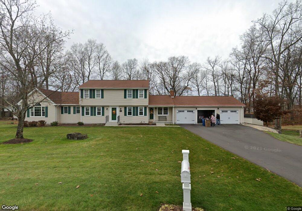
96 School Brook Ln Vernon Rockville, CT 06066
North Vernon NeighborhoodEstimated Value: $512,000 - $621,000
5
Beds
4
Baths
2,712
Sq Ft
$207/Sq Ft
Est. Value
About This Home
This home is located at 96 School Brook Ln, Vernon Rockville, CT 06066 and is currently estimated at $561,979, approximately $207 per square foot. 96 School Brook Ln is a home located in Tolland County with nearby schools including Lake Street School, Vernon Center Middle School, and Rockville High School.
Ownership History
Date
Name
Owned For
Owner Type
Purchase Details
Closed on
Jun 19, 2017
Sold by
Vaillancourt Philippe T and Vaillancourt Suzanne G
Bought by
Vaillancourt Suzanne G
Current Estimated Value
Purchase Details
Closed on
Jul 5, 1984
Bought by
Vaillancourt Philippe T and Vaillancourt Suzanne G
Create a Home Valuation Report for This Property
The Home Valuation Report is an in-depth analysis detailing your home's value as well as a comparison with similar homes in the area
Home Values in the Area
Average Home Value in this Area
Purchase History
| Date | Buyer | Sale Price | Title Company |
|---|---|---|---|
| Vaillancourt Suzanne G | -- | -- | |
| Vaillancourt Philippe T | $110,300 | -- |
Source: Public Records
Mortgage History
| Date | Status | Borrower | Loan Amount |
|---|---|---|---|
| Previous Owner | Vaillancourt Philippe T | $60,000 | |
| Previous Owner | Vaillancourt Philippe T | $113,000 | |
| Previous Owner | Vaillancourt Philippe T | $120,000 |
Source: Public Records
Tax History Compared to Growth
Tax History
| Year | Tax Paid | Tax Assessment Tax Assessment Total Assessment is a certain percentage of the fair market value that is determined by local assessors to be the total taxable value of land and additions on the property. | Land | Improvement |
|---|---|---|---|---|
| 2025 | $10,391 | $287,930 | $46,030 | $241,900 |
| 2024 | $10,103 | $287,930 | $46,030 | $241,900 |
| 2023 | $9,614 | $287,930 | $46,030 | $241,900 |
| 2022 | $9,614 | $287,930 | $46,030 | $241,900 |
| 2021 | $6,330 | $159,740 | $44,980 | $114,760 |
| 2020 | $9,362 | $236,240 | $44,980 | $191,260 |
| 2019 | $9,362 | $236,240 | $44,980 | $191,260 |
| 2018 | $9,362 | $236,240 | $44,980 | $191,260 |
| 2017 | $9,145 | $236,240 | $44,980 | $191,260 |
| 2016 | $8,928 | $234,760 | $48,830 | $185,930 |
| 2015 | $8,928 | $234,760 | $48,830 | $185,930 |
| 2014 | $8,477 | $234,760 | $48,830 | $185,930 |
Source: Public Records
Map
Nearby Homes
- 100 Richard Rd
- 68 Deer Run Trail
- 229 Phoenix St
- 30 Brent Dr
- 25 Partridge Hollow Ln
- 39 W Vernon St
- 600 Lydall St
- 48 Rainbow Trail
- 105 Cidermill Rd
- 25 Briarwood Ln
- 81 Bouldercrest Ln
- 166 Lake St
- 441 Millstream Dr Unit 441
- 413 Lady Bug Ln Unit 413
- 107 Main St
- 39 Alice Dr
- 5 Allison Rd
- 6 Elizabeth Ln Unit 3
- 9 Parsons Ct
- 56 Elizabeth Dr
- 55 Grady Rd
- 98 School Brook Ln
- 48 Grady Rd
- 49 Grady Rd
- 329 Meadowbrook Dr
- 321 Meadowbrook Dr
- 335 Meadowbrook Dr
- 43 Grady Rd
- 42 Grady Rd
- 92 School Brook Ln
- 305 Meadowbrook Dr
- 93 School Brook Ln
- 343 Meadowbrook Dr
- 37 Grady Rd
- 35 Ivy Dr
- 297 Meadowbrook Dr
- 84 School Brook Ln
- 36 Grady Rd
- 36 Duke Rd
- 348 Meadowbrook Dr