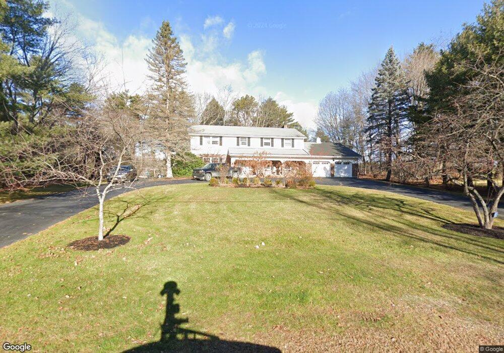
96 Stroudwater Rd Portland, ME 04102
Stroudwater NeighborhoodEstimated Value: $1,020,786 - $1,204,000
5
Beds
4
Baths
5,476
Sq Ft
$201/Sq Ft
Est. Value
About This Home
This home is located at 96 Stroudwater Rd, Portland, ME 04102 and is currently estimated at $1,098,447, approximately $200 per square foot. 96 Stroudwater Rd is a home located in Cumberland County with nearby schools including Amanda C Rowe School, King Middle School, and Levey Day School.
Ownership History
Date
Name
Owned For
Owner Type
Purchase Details
Closed on
Nov 21, 2016
Sold by
Breece Jena A and Breece Jeffrey S
Bought by
Jeffrey S Breece Lt and Breece Jena A
Current Estimated Value
Purchase Details
Closed on
Nov 24, 2008
Sold by
Burns David F and Walder-Burns Hedwig R
Bought by
Breece Jeffrey S and Breece Jena A
Home Financials for this Owner
Home Financials are based on the most recent Mortgage that was taken out on this home.
Original Mortgage
$128,250
Interest Rate
6.03%
Mortgage Type
FHA
Create a Home Valuation Report for This Property
The Home Valuation Report is an in-depth analysis detailing your home's value as well as a comparison with similar homes in the area
Home Values in the Area
Average Home Value in this Area
Purchase History
| Date | Buyer | Sale Price | Title Company |
|---|---|---|---|
| Jeffrey S Breece Lt | -- | -- | |
| Breece Jeffrey S | -- | -- |
Source: Public Records
Mortgage History
| Date | Status | Borrower | Loan Amount |
|---|---|---|---|
| Open | Breece Jeffrey S | $116,500 | |
| Closed | Breece Jeffrey S | $128,250 |
Source: Public Records
Tax History Compared to Growth
Tax History
| Year | Tax Paid | Tax Assessment Tax Assessment Total Assessment is a certain percentage of the fair market value that is determined by local assessors to be the total taxable value of land and additions on the property. | Land | Improvement |
|---|---|---|---|---|
| 2024 | $10,999 | $732,800 | $123,900 | $608,900 |
| 2023 | $10,560 | $732,800 | $123,900 | $608,900 |
| 2022 | $9,973 | $732,800 | $123,900 | $608,900 |
| 2021 | $9,519 | $732,800 | $123,900 | $608,900 |
| 2020 | $10,245 | $439,500 | $120,500 | $319,000 |
| 2019 | $10,245 | $439,500 | $120,500 | $319,000 |
| 2018 | $9,880 | $439,500 | $120,500 | $319,000 |
| 2017 | $9,515 | $439,500 | $120,500 | $319,000 |
| 2016 | $9,278 | $439,500 | $120,500 | $319,000 |
| 2015 | $9,067 | $439,500 | $120,500 | $319,000 |
| 2014 | $8,790 | $439,500 | $120,500 | $319,000 |
Source: Public Records
Map
Nearby Homes
- 1346 Westbrook St
- 1549 Westbrook St
- 63A Capisic St
- 16 Black Sparrow Dr
- 2 Firefly St Unit 303
- 1 Firefly St Unit 402
- 1 Firefly St Unit 201
- 1 Firefly St Unit 303
- 1 Firefly St Unit 302
- 1 Firefly St Unit 403/103
- 1 Firefly St Unit 301
- 1 Firefly St Unit 401
- 1 Firefly St Unit 403
- 1 Firefly St Unit 202
- 159 Bancroft St
- 1542 Congress St
- 0 Hillcrest Ave
- 99 Webb St
- 89 Cobb Ave
- 155 Owls Nest Rd
- 110 Stroudwater Rd
- 80 Stroudwater Rd
- 99 Stroudwater Rd
- 79 Stroudwater Rd
- 126 Stroudwater Rd
- 107 Stroudwater Rd
- 114 Stroudwater Rd
- 125 Stroudwater Rd
- 63 Stroudwater Rd
- 72 Stroudwater Rd
- 124 Stroudwater Rd
- 71 Stroudwater Rd
- 54 Stroudwater Rd
- 55 Stroudwater Rd
- 66 Stroudwater Rd
- 47 Roundabout Ln
- 54 Roundabout Ln
- 42 Stroudwater Rd
- 48 Stroudwater Rd
- 54 Penrith Rd