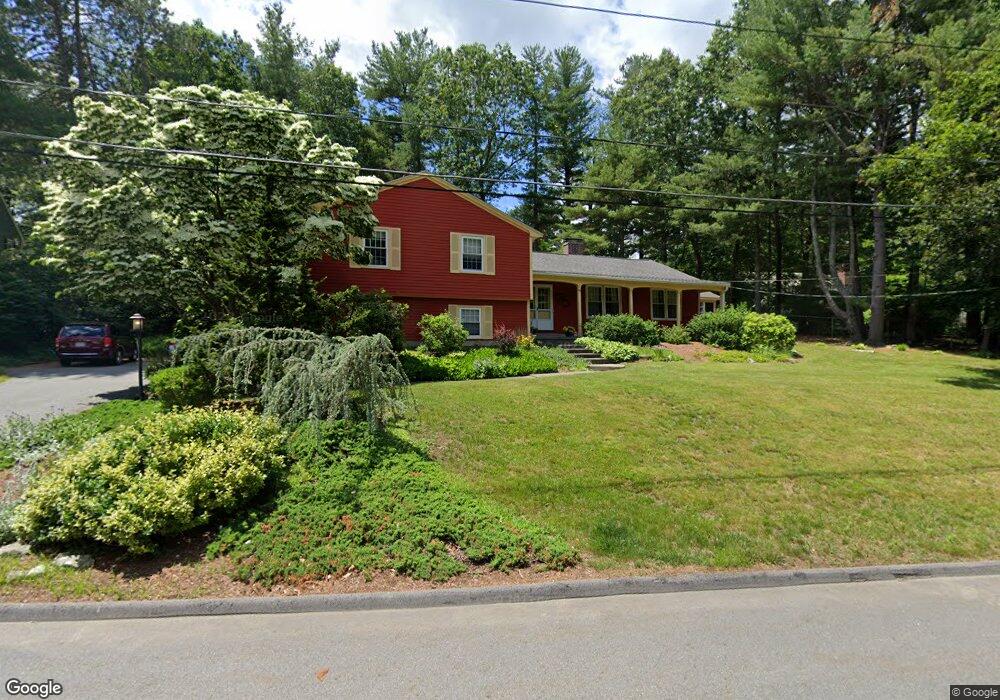
96 Wyndhurst Dr Holden, MA 01520
Estimated Value: $663,080 - $731,000
4
Beds
3
Baths
2,106
Sq Ft
$330/Sq Ft
Est. Value
About This Home
This home is located at 96 Wyndhurst Dr, Holden, MA 01520 and is currently estimated at $694,520, approximately $329 per square foot. 96 Wyndhurst Dr is a home located in Worcester County with nearby schools including Wachusett Regional High School, Holden Christian Academy, and Notre Dame Academy.
Ownership History
Date
Name
Owned For
Owner Type
Purchase Details
Closed on
Apr 30, 2004
Sold by
Moriarty Ann M
Bought by
Vanliew Lisa R and Vanliew Theodore
Current Estimated Value
Home Financials for this Owner
Home Financials are based on the most recent Mortgage that was taken out on this home.
Original Mortgage
$284,900
Outstanding Balance
$132,261
Interest Rate
5.36%
Mortgage Type
Purchase Money Mortgage
Estimated Equity
$562,259
Purchase Details
Closed on
Nov 8, 2002
Sold by
Johnstone John A and Johnsotne Lorraine R
Bought by
Moriarty Ann M
Home Financials for this Owner
Home Financials are based on the most recent Mortgage that was taken out on this home.
Original Mortgage
$248,000
Interest Rate
6.04%
Mortgage Type
Purchase Money Mortgage
Purchase Details
Closed on
Oct 31, 1991
Sold by
Gatres Elizabeth T
Bought by
Johnstone John A and Lorraine Johnstone
Create a Home Valuation Report for This Property
The Home Valuation Report is an in-depth analysis detailing your home's value as well as a comparison with similar homes in the area
Home Values in the Area
Average Home Value in this Area
Purchase History
| Date | Buyer | Sale Price | Title Company |
|---|---|---|---|
| Vanliew Lisa R | $374,900 | -- | |
| Moriarty Ann M | $310,000 | -- | |
| Johnstone John A | $220,000 | -- |
Source: Public Records
Mortgage History
| Date | Status | Borrower | Loan Amount |
|---|---|---|---|
| Open | Vanliew Lisa R | $284,900 | |
| Previous Owner | Johnstone John A | $15,000 | |
| Previous Owner | Johnstone John A | $248,000 | |
| Previous Owner | Johnstone John A | $14,000 |
Source: Public Records
Tax History Compared to Growth
Tax History
| Year | Tax Paid | Tax Assessment Tax Assessment Total Assessment is a certain percentage of the fair market value that is determined by local assessors to be the total taxable value of land and additions on the property. | Land | Improvement |
|---|---|---|---|---|
| 2025 | $8,240 | $594,500 | $206,400 | $388,100 |
| 2024 | $7,815 | $552,300 | $200,300 | $352,000 |
| 2023 | $7,360 | $491,000 | $174,200 | $316,800 |
| 2022 | $7,230 | $436,600 | $140,900 | $295,700 |
| 2021 | $7,358 | $422,900 | $138,900 | $284,000 |
| 2020 | $6,919 | $407,000 | $132,400 | $274,600 |
| 2019 | $6,612 | $378,900 | $132,400 | $246,500 |
| 2018 | $6,384 | $362,500 | $126,000 | $236,500 |
| 2017 | $6,283 | $357,200 | $130,200 | $227,000 |
| 2016 | $5,929 | $343,700 | $123,900 | $219,800 |
| 2015 | $5,882 | $324,600 | $123,900 | $200,700 |
| 2014 | $5,762 | $324,600 | $123,900 | $200,700 |
Source: Public Records
Map
Nearby Homes
- 168 Twinbrooke Dr
- 289 Bailey Rd
- 10 Sumac Cir
- 47 Banbury Ln
- 48 Lexington Cir
- 7 Holmes Dr
- 9 Holmes Dr
- 8 Dawson Cir
- 527 Salisbury St
- 156 Newell Rd
- 124 Bailey Rd
- 0 Chapin Rd
- 33 Thorny Lea Rd
- 35 Chapin Rd
- 8 (Lot 1) Holmes Dr
- 216 Reservoir St Unit 103
- 216 Reservoir St Unit 309
- 23 Gail Dr
- 2 Explorers Way Unit 2
- 27 Mayflower Cir
- 78 Wyndhurst Dr
- 160 Twinbrooke Dr
- 150 Twinbrooke Dr
- 85 Wyndhurst Dr
- 140 Twinbrooke Dr
- 110 Twinbrooke Dr
- 75 Wyndhurst Dr
- 70 Wyndhurst Dr
- 123 Twinbrooke Dr
- 157 Twinbrooke Dr
- 131 Twinbrooke Dr
- 96 Twinbrooke Dr
- 171 Twinbrooke Dr
- 109 Twinbrooke Dr
- 145 Twinbrooke Dr
- 139 Twinbrooke Dr
- 60 Wyndhurst Dr
- 0 Twinbrooke Dr
- 47 Wyndhurst Dr
- 200 Twinbrooke Dr