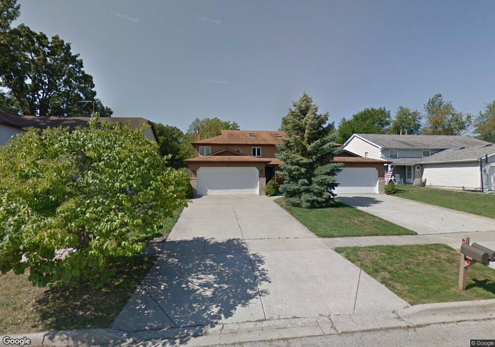
961 Pleasant St Woodstock, IL 60098
Estimated Value: $244,000 - $301,000
3
Beds
2
Baths
2,018
Sq Ft
$131/Sq Ft
Est. Value
About This Home
This home is located at 961 Pleasant St, Woodstock, IL 60098 and is currently estimated at $263,774, approximately $130 per square foot. 961 Pleasant St is a home located in McHenry County with nearby schools including Olson Elementary School, Creekside Middle School, and Woodstock High School.
Ownership History
Date
Name
Owned For
Owner Type
Purchase Details
Closed on
Jun 11, 2019
Sold by
Bowie Nancy J and Brandes Nancy J
Bought by
Bowie Nancy J
Current Estimated Value
Purchase Details
Closed on
Mar 2, 2009
Sold by
Thomas Robert J
Bought by
Brandes Nancy J
Home Financials for this Owner
Home Financials are based on the most recent Mortgage that was taken out on this home.
Original Mortgage
$131,418
Outstanding Balance
$83,608
Interest Rate
5.14%
Mortgage Type
Unknown
Estimated Equity
$180,166
Purchase Details
Closed on
Jul 28, 1995
Sold by
Stoddard Steven E and Stoddard Regina L
Bought by
Thomas Richard A
Home Financials for this Owner
Home Financials are based on the most recent Mortgage that was taken out on this home.
Original Mortgage
$40,000
Interest Rate
7.59%
Create a Home Valuation Report for This Property
The Home Valuation Report is an in-depth analysis detailing your home's value as well as a comparison with similar homes in the area
Home Values in the Area
Average Home Value in this Area
Purchase History
| Date | Buyer | Sale Price | Title Company |
|---|---|---|---|
| Bowie Nancy J | -- | Attorney | |
| Brandes Nancy J | $152,100 | Ticor Title Insurance Co | |
| Thomas Richard A | $127,000 | -- |
Source: Public Records
Mortgage History
| Date | Status | Borrower | Loan Amount |
|---|---|---|---|
| Open | Brandes Nancy J | $131,418 | |
| Previous Owner | Thomas Richard A | $40,000 |
Source: Public Records
Tax History Compared to Growth
Tax History
| Year | Tax Paid | Tax Assessment Tax Assessment Total Assessment is a certain percentage of the fair market value that is determined by local assessors to be the total taxable value of land and additions on the property. | Land | Improvement |
|---|---|---|---|---|
| 2024 | $6,873 | $74,592 | $9,719 | $64,873 |
| 2023 | $6,599 | $67,455 | $8,789 | $58,666 |
| 2022 | $6,172 | $59,864 | $7,800 | $52,064 |
| 2021 | $5,903 | $55,932 | $7,288 | $48,644 |
| 2020 | $5,710 | $53,147 | $6,925 | $46,222 |
| 2019 | $4,907 | $50,732 | $6,610 | $44,122 |
| 2018 | $4,415 | $46,043 | $7,540 | $38,503 |
| 2017 | $4,367 | $43,334 | $7,096 | $36,238 |
| 2016 | $4,307 | $40,124 | $6,570 | $33,554 |
| 2013 | $2,166 | $40,372 | $9,629 | $30,743 |
Source: Public Records
Map
Nearby Homes
- 920 Pleasant St
- 824 Washington St
- 13808 Washington St
- 0 Rt 47 & Lucas Rd Unit MRD12293021
- 4224 Meadowridge Rd
- 4265 Meadowridge Rd
- 4240 Meadowridge Rd
- 4104 Meadowridge Rd
- 1301 Longwood Dr E
- 0 Rt 47 & Hercules Rd Hwy Unit MRD12103853
- 233 Arthur Dr
- 814 Robert Dr
- 740 Victoria Dr
- 514 Washington St
- 320 W Donovan Ave
- 431 Washington St
- 208 W Greenwood Ave
- 389 Lincoln Ave
- 724 Wheeler St
- 1546 Wheeler St
- 961 Pleasant St Unit 1
- 963 Pleasant St
- 951 Pleasant St
- 971 Pleasant St
- 973 Pleasant St
- 1043 Carol Ave
- 1028 Carol Ave
- 960 Pleasant St
- 972 Pleasant St
- 962 Pleasant St
- 950 Pleasant St
- 970 Pleasant St
- 930 Pleasant St Unit 940
- 1015 Carol Ave
- 974 Pleasant St Unit 980
- 1035 Carol Ave
- 914 Pleasant St
- 910 Pleasant St
- 914 Oak St
- 853 Washington St