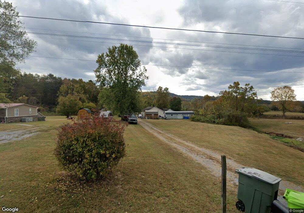
961 Satterfield Rd Maynardville, TN 37807
Paulette NeighborhoodEstimated Value: $242,376 - $354,000
--
Bed
2
Baths
1,512
Sq Ft
$185/Sq Ft
Est. Value
About This Home
This home is located at 961 Satterfield Rd, Maynardville, TN 37807 and is currently estimated at $279,094, approximately $184 per square foot. 961 Satterfield Rd is a home located in Union County with nearby schools including Paulette Elementary School, Union County High School, and H Maynard Middle School.
Ownership History
Date
Name
Owned For
Owner Type
Purchase Details
Closed on
Jun 25, 2003
Sold by
Pratt James R
Bought by
Karen Wright
Current Estimated Value
Purchase Details
Closed on
Jan 18, 2002
Sold by
Paul Marvin
Bought by
James Pratt
Purchase Details
Closed on
Oct 31, 2001
Bought by
Pratt James R
Purchase Details
Closed on
May 5, 2000
Bought by
Marvin Paul
Purchase Details
Closed on
Dec 30, 1998
Bought by
Fair Nancy
Purchase Details
Closed on
Dec 3, 1987
Bought by
Ghrist Thomas
Create a Home Valuation Report for This Property
The Home Valuation Report is an in-depth analysis detailing your home's value as well as a comparison with similar homes in the area
Home Values in the Area
Average Home Value in this Area
Purchase History
| Date | Buyer | Sale Price | Title Company |
|---|---|---|---|
| Karen Wright | $81,500 | -- | |
| Karen Wright | $81,500 | -- | |
| James Pratt | $76,000 | -- | |
| Pratt James R | $76,000 | -- | |
| Pratt James R | $76,000 | -- | |
| Marvin Paul | $30,000 | -- | |
| Marvin Paul | $30,000 | -- | |
| Fair Nancy | $95,000 | -- | |
| Fair Nancy | $95,000 | -- | |
| Ghrist Thomas | -- | -- | |
| Ghrist Thomas | -- | -- |
Source: Public Records
Tax History Compared to Growth
Tax History
| Year | Tax Paid | Tax Assessment Tax Assessment Total Assessment is a certain percentage of the fair market value that is determined by local assessors to be the total taxable value of land and additions on the property. | Land | Improvement |
|---|---|---|---|---|
| 2024 | $706 | $37,150 | $3,000 | $34,150 |
| 2023 | $706 | $37,150 | $3,000 | $34,150 |
| 2022 | $591 | $37,150 | $3,000 | $34,150 |
| 2021 | $580 | $27,100 | $2,100 | $25,000 |
| 2020 | $580 | $27,100 | $2,100 | $25,000 |
| 2019 | $580 | $27,100 | $2,100 | $25,000 |
| 2018 | $580 | $27,100 | $2,100 | $25,000 |
| 2017 | $580 | $27,100 | $2,100 | $25,000 |
| 2016 | $538 | $24,800 | $2,400 | $22,400 |
| 2015 | $538 | $24,800 | $2,400 | $22,400 |
| 2014 | $444 | $24,805 | $0 | $0 |
Source: Public Records
Map
Nearby Homes
- 211 Jamie St
- 215 Jamie St
- 213 Brock Rd
- 7725 Texas Valley Rd
- 275 Dogwood Ln
- 254 Dogwood Ln
- 0 Satterfield Rd Unit 1313221
- 9024 Welch Rd
- 112 Dogwood St
- 8210 Wood Rd
- 9211 Brock Rd
- 9210 Brock Rd
- L-7 Williams Dr
- 7439 Haley Ln
- 00 Old Tazewell Pike
- 346 Wolfenbarger Ln
- 323 Maynardville Hwy
- 8127 Campbells Point Rd
- 8012 Campbells Point Rd
- 0 Campbells Point Rd
- 9450 Graves Rd
- 969 Satterfield Rd
- 955 Satterfield Rd
- 9438 Graves Rd
- 949 Satterfield Rd
- 962 Satterfield Rd
- 911 Satterfield Rd
- 1014 Satterfield Rd
- 9426 Graves Rd
- 9430 Graves Rd
- 942 Satterfield Rd
- 934 Satterfield Rd
- 1024 Satterfield Rd
- 926 Satterfield Rd
- 1027 Satterfield Rd
- 9392 Graves Rd
- 912 Satterfield Rd
- 1040 Satterfield Rd
- 9365 Graves Rd
- 1047 Satterfield Rd