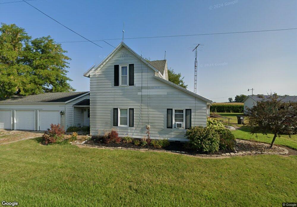
961 State Route 707 Rockford, OH 45882
Estimated Value: $148,000 - $193,000
4
Beds
1
Bath
1,536
Sq Ft
$116/Sq Ft
Est. Value
About This Home
This home is located at 961 State Route 707, Rockford, OH 45882 and is currently estimated at $177,420, approximately $115 per square foot. 961 State Route 707 is a home located in Mercer County with nearby schools including Parkway Elementary School, Parkway Middle School, and Parkway High School.
Ownership History
Date
Name
Owned For
Owner Type
Purchase Details
Closed on
Sep 17, 2011
Sold by
Estate Of Dorothy J Bader
Bought by
Bader Arthur E
Current Estimated Value
Purchase Details
Closed on
Aug 11, 2005
Sold by
Estate Of Robert E Bader
Bought by
Bader Dorothy
Create a Home Valuation Report for This Property
The Home Valuation Report is an in-depth analysis detailing your home's value as well as a comparison with similar homes in the area
Home Values in the Area
Average Home Value in this Area
Purchase History
| Date | Buyer | Sale Price | Title Company |
|---|---|---|---|
| Bader Arthur E | -- | None Available | |
| Bader Dorothy | -- | Attorney |
Source: Public Records
Tax History Compared to Growth
Tax History
| Year | Tax Paid | Tax Assessment Tax Assessment Total Assessment is a certain percentage of the fair market value that is determined by local assessors to be the total taxable value of land and additions on the property. | Land | Improvement |
|---|---|---|---|---|
| 2024 | $1,324 | $49,530 | $5,320 | $44,210 |
| 2023 | $1,324 | $49,530 | $5,320 | $44,210 |
| 2022 | $950 | $31,990 | $5,320 | $26,670 |
| 2021 | $944 | $31,990 | $5,320 | $26,670 |
| 2020 | $958 | $31,990 | $5,320 | $26,670 |
| 2019 | $704 | $26,670 | $5,040 | $21,630 |
| 2018 | $686 | $26,670 | $5,040 | $21,630 |
| 2017 | $578 | $26,670 | $5,040 | $21,630 |
| 2016 | $475 | $22,120 | $4,200 | $17,920 |
| 2015 | $470 | $22,120 | $4,200 | $17,920 |
| 2014 | $472 | $22,160 | $4,200 | $17,960 |
| 2013 | $599 | $24,160 | $4,590 | $19,570 |
Source: Public Records
Map
Nearby Homes
- 11164 Erastus Durbin Rd
- 12223 Ohio 49
- 18892 Ohio 49
- 0 Wilson Unit 1037059
- 0 Wilson Unit 306333
- 0 Rockford West Rd Unit Lots 14- 28
- 200 Sprague St
- 100 Sprague St
- 208 W Pearl St
- 403 Riley St
- 208 Market St
- 7957 W Bridge St
- 2332 State Route 29
- 5828 E 150 N
- TBD Hahnemann Ct
- 155 Oregon St
- 2067 N US Highway 33
- 6699 Gause Rd
- 609 Welty St
- 1835 N Salem Rd
- 946 State Route 707
- 905 Ohio 707
- 905 State Route 707
- 1041 State Route 707
- 10752 Grauberger Rd
- 830 State Route 707
- 761 State Route 707
- 761 Ohio 707
- 1119 State Route 707
- 668 State Route 707
- 10789 Grauberger Rd
- 1317 State Route 707
- 1317 Ohio 707
- 1318 State Route 707
- 556 State Route 707
- 10490 State Route 49
- 10560 Ohio 49
- 10400 Ohio 49
- 10400 State Route 49
- 10560 State Route 49