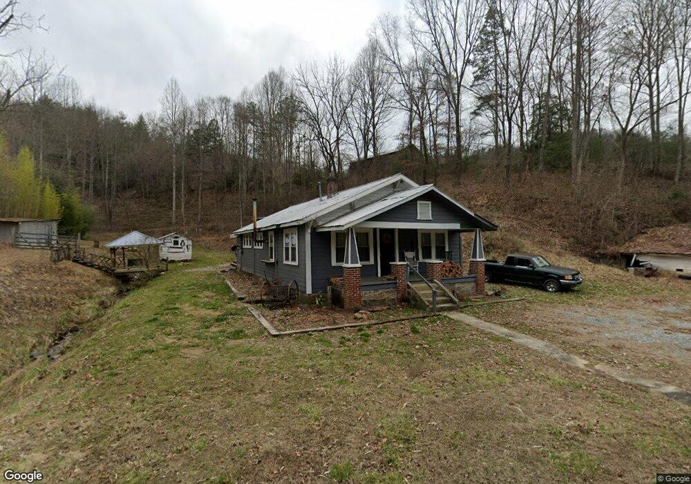
9644 Lower Alarka Rd Bryson City, NC 28713
Estimated Value: $419,000 - $590,000
2
Beds
1
Bath
1,204
Sq Ft
$419/Sq Ft
Est. Value
About This Home
This home is located at 9644 Lower Alarka Rd, Bryson City, NC 28713 and is currently estimated at $504,497, approximately $419 per square foot. 9644 Lower Alarka Rd is a home located in Swain County with nearby schools including Swain County Middle School, Swain County West Elementary School, and Swain County High School.
Ownership History
Date
Name
Owned For
Owner Type
Purchase Details
Closed on
Feb 19, 2007
Sold by
Landrum Lina and Freeman Caroline L
Bought by
Brendle William Lonnie and Brendle Jessie M
Current Estimated Value
Home Financials for this Owner
Home Financials are based on the most recent Mortgage that was taken out on this home.
Original Mortgage
$170,000
Interest Rate
6.08%
Mortgage Type
New Conventional
Purchase Details
Closed on
Nov 27, 2005
Sold by
Panebianco Thomas F and Thomas John Perry
Bought by
Landrum Lina and Frerman Caroline L
Create a Home Valuation Report for This Property
The Home Valuation Report is an in-depth analysis detailing your home's value as well as a comparison with similar homes in the area
Home Values in the Area
Average Home Value in this Area
Purchase History
| Date | Buyer | Sale Price | Title Company |
|---|---|---|---|
| Brendle William Lonnie | $300,000 | -- | |
| Landrum Lina | -- | -- |
Source: Public Records
Mortgage History
| Date | Status | Borrower | Loan Amount |
|---|---|---|---|
| Closed | Brendle William Lonnie | $170,000 |
Source: Public Records
Tax History Compared to Growth
Tax History
| Year | Tax Paid | Tax Assessment Tax Assessment Total Assessment is a certain percentage of the fair market value that is determined by local assessors to be the total taxable value of land and additions on the property. | Land | Improvement |
|---|---|---|---|---|
| 2025 | $1,433 | $321,410 | $214,360 | $107,050 |
| 2024 | $1,433 | $321,410 | $214,360 | $107,050 |
| 2023 | $1,272 | $321,410 | $214,360 | $107,050 |
| 2022 | $1,272 | $321,410 | $214,360 | $107,050 |
| 2021 | $1,272 | $321,410 | $0 | $0 |
| 2020 | $821 | $207,110 | $139,670 | $67,440 |
| 2019 | $821 | $207,110 | $139,670 | $67,440 |
| 2018 | $821 | $207,110 | $139,670 | $67,440 |
| 2017 | $821 | $207,110 | $139,670 | $67,440 |
| 2016 | $821 | $207,110 | $139,670 | $67,440 |
| 2015 | -- | $207,110 | $139,670 | $67,440 |
| 2014 | -- | $207,110 | $139,670 | $67,440 |
Source: Public Records
Map
Nearby Homes
- 4160 U S 19
- 65 Cunningham Rd
- 1955 Sam Davis Rd
- 315 Big Rockys Rd
- 73 Robinson Gap Ln
- Lot 64 Bobcat Trail
- 3.8 AC Bobcat Trail
- 166 Almond School Rd
- Lot 72 Bobcat
- 9999 Mountainside Dr
- 999 Mountainside Dr
- 0 Hwy 28 S Unit 26040479
- 67 Trent Field Rd
- 210 Oak Hill Dr
- 3.32 AC Mountainside Dr
- 135 W Skycove Cir
- 1028 Big Rockys Rd
- 10 Ridge Place
- Lot 16 Bryson Gap Preserve
- Lot 15 Bryson Gap Preserve
- 9544 Lower Alarka Rd
- 44 Lower Alarka Rd
- 285 Lower Alarka Rd
- 2550 Sam Davis Rd
- 9531 Lower Alarka Rd
- 9801 Lower Alarka Rd
- 45 Gospel Rd
- 2601 Sam Davis Rd
- 9461 Lower Alarka Rd
- 260 Gospel Rd
- 2373 Sam Davis Rd
- 200 Gospel Rd
- 2295 Sam Davis Rd
- 0 Gospel Rd
- 50 Gospel Rd
- 440 Gospel Rd
- 9911 Lower Alarka Rd
- 2261 Sam Davis Rd
- 2165 Sam Davis Rd
- 272 Gospel Rd