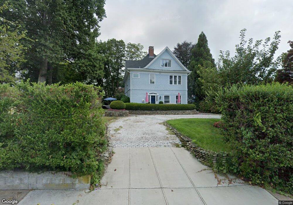
97 Kingstown Rd Narragansett, RI 02882
Estimated Value: $847,888 - $1,491,000
7
Beds
4
Baths
3,761
Sq Ft
$316/Sq Ft
Est. Value
About This Home
This home is located at 97 Kingstown Rd, Narragansett, RI 02882 and is currently estimated at $1,187,972, approximately $315 per square foot. 97 Kingstown Rd is a home located in Washington County with nearby schools including Narragansett Elementary School, Narragansett Pier Middle School, and Narragansett High School.
Ownership History
Date
Name
Owned For
Owner Type
Purchase Details
Closed on
Aug 25, 1995
Sold by
Struck Harry C and Conway James F
Bought by
Novins Susan D and Novins Jeffrey A
Current Estimated Value
Home Financials for this Owner
Home Financials are based on the most recent Mortgage that was taken out on this home.
Original Mortgage
$170,400
Interest Rate
7.32%
Create a Home Valuation Report for This Property
The Home Valuation Report is an in-depth analysis detailing your home's value as well as a comparison with similar homes in the area
Home Values in the Area
Average Home Value in this Area
Purchase History
| Date | Buyer | Sale Price | Title Company |
|---|---|---|---|
| Novins Susan D | $213,000 | -- |
Source: Public Records
Mortgage History
| Date | Status | Borrower | Loan Amount |
|---|---|---|---|
| Open | Novins Susan D | $143,000 | |
| Closed | Novins Susan D | $170,400 |
Source: Public Records
Tax History Compared to Growth
Tax History
| Year | Tax Paid | Tax Assessment Tax Assessment Total Assessment is a certain percentage of the fair market value that is determined by local assessors to be the total taxable value of land and additions on the property. | Land | Improvement |
|---|---|---|---|---|
| 2025 | $6,927 | $1,020,200 | $568,900 | $451,300 |
| 2024 | $6,682 | $1,020,200 | $568,900 | $451,300 |
| 2023 | $6,692 | $718,800 | $387,000 | $331,800 |
| 2022 | $6,469 | $718,800 | $387,000 | $331,800 |
| 2021 | $6,369 | $718,800 | $387,000 | $331,800 |
| 2020 | $5,849 | $558,100 | $291,600 | $266,500 |
| 2019 | $5,709 | $558,100 | $291,600 | $266,500 |
| 2018 | $5,196 | $522,200 | $291,600 | $230,600 |
| 2017 | $5,512 | $522,000 | $256,600 | $265,400 |
| 2016 | $5,262 | $522,000 | $256,600 | $265,400 |
| 2015 | $5,189 | $522,000 | $256,600 | $265,400 |
| 2014 | $5,419 | $539,700 | $256,600 | $283,100 |
Source: Public Records
Map
Nearby Homes
- 14 Robinson St
- 20 5th Ave
- 137 Kingstown Rd
- 137A Kingstown Rd
- 56 Wanda St
- 20 Narragansett Ave Unit 905
- 16 Courtway St
- 126 Boon St
- 31 Avice St
- 49 Westmoreland St
- 27 Westmoreland St
- 30 Sweet Meadows Ct Unit 26
- 19 Castle Rd
- 150 Camden Ct
- 73 Camden Ct
- 275 Boston Neck Rd
- 0 Hazard Ave
- 6 Pendleton Place
- 45 Cherry Ln Unit E
- 45 Cherry Ln Unit C
- 91 Kingstown Rd
- 96 Kingstown Rd
- 98 Kingstown Rd
- 87 Kingstown Rd
- 21 Atlantic Ave
- 100 Kingstown Rd
- 17 Atlantic Ave
- 3 5th Ave
- 8 Atlantic Ave
- 2 5th Ave
- 86 Kingstown Rd
- 13 Robinson St Unit A
- 13 Robinson St
- 5 5th Ave
- 83 Kingstown Rd
- 6 Atlantic Ave
- 7 5th Ave
- 109 Kingstown Rd
- 82 Kingstown Rd
- 108 Kingstown Rd