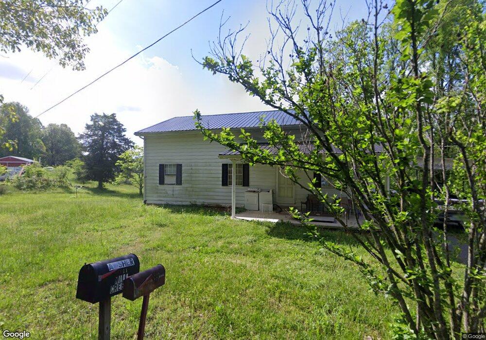
97 Winsfred Ln Campbellsville, KY 42718
Estimated Value: $105,000 - $172,000
--
Bed
--
Bath
1,170
Sq Ft
$123/Sq Ft
Est. Value
About This Home
This home is located at 97 Winsfred Ln, Campbellsville, KY 42718 and is currently estimated at $143,999, approximately $123 per square foot. 97 Winsfred Ln is a home located in Taylor County with nearby schools including Taylor County Elementary School, Taylor County Middle School, and Taylor County High School.
Ownership History
Date
Name
Owned For
Owner Type
Purchase Details
Closed on
Apr 24, 2008
Sold by
Wilhoit Kevin and Wilhoit Kimberly
Bought by
Skaggs Roy C
Current Estimated Value
Home Financials for this Owner
Home Financials are based on the most recent Mortgage that was taken out on this home.
Original Mortgage
$50,000
Interest Rate
5.56%
Mortgage Type
Future Advance Clause Open End Mortgage
Create a Home Valuation Report for This Property
The Home Valuation Report is an in-depth analysis detailing your home's value as well as a comparison with similar homes in the area
Home Values in the Area
Average Home Value in this Area
Purchase History
| Date | Buyer | Sale Price | Title Company |
|---|---|---|---|
| Skaggs Roy C | $47,500 | None Available |
Source: Public Records
Mortgage History
| Date | Status | Borrower | Loan Amount |
|---|---|---|---|
| Closed | Skaggs Roy C | $50,000 |
Source: Public Records
Tax History Compared to Growth
Tax History
| Year | Tax Paid | Tax Assessment Tax Assessment Total Assessment is a certain percentage of the fair market value that is determined by local assessors to be the total taxable value of land and additions on the property. | Land | Improvement |
|---|---|---|---|---|
| 2025 | $477 | $49,150 | $0 | $0 |
| 2024 | $483 | $49,150 | $0 | $0 |
| 2023 | $500 | $49,150 | $0 | $0 |
| 2022 | $508 | $49,150 | $0 | $0 |
| 2021 | $506 | $49,150 | $0 | $0 |
| 2020 | $517 | $49,150 | $0 | $0 |
| 2019 | $518 | $49,150 | $0 | $0 |
| 2018 | $509 | $49,150 | $0 | $0 |
| 2017 | $498 | $49,150 | $0 | $0 |
| 2016 | $486 | $49,150 | $0 | $0 |
| 2015 | $484 | $49,150 | $0 | $0 |
| 2014 | $473 | $84,150 | $0 | $0 |
| 2012 | -- | $99,000 | $0 | $0 |
Source: Public Records
Map
Nearby Homes
- 428 Social Band Rd
- 0 Fuller Harding Rd Unit Parcel O
- 863 Fuller Harding Rd Unit Parcel P
- 366 William Hash Rd
- Tract 7 Attilla Rd
- 1123 Mount Carmel Church Rd
- 9888 Hodgenville Rd
- 0 Sprowles Ridge Rd
- 778 Sprowles Ridge Rd
- TRACT 4 Price Hill Spur Rd
- TRACT 3 Price Hill Spur Rd
- 1820 Attilla Rd
- 3337 Chaney Pike
- 923 Price Hill Spur Rd
- 354 Pleasant Valley Rd
- 420 Pleasant Valley Rd
- 9701 Saloma Rd
- 0 Big Brush Creek Rd
- 39 Pickerell Rd
- 6 Corinth Rd
- 496 Mill Creek Rd
- 2500 Social Band Rd
- 2200 Social Band Rd
- 2230 Social Band Rd
- 480 David Bell Rd
- 126 Wagon Wheel Trail
- 2630 Social Band Rd
- 249 Bentley Rd
- 0 Tax Id 07-012a On Social Band Rd
- 2185 Social Band Rd
- 747 Bentley Rd
- 1840 Social Band Rd
- 1508 Social Band Rd
- 828 Cr-1398
- 1565 Hedgespeth Rd
- 1325 Hedgespeth Rd
- 2950 Social Band Rd
- 1501 Hedgespeth Rd
- 3170 Social Band Rd
- 995 Hedgepath Rd