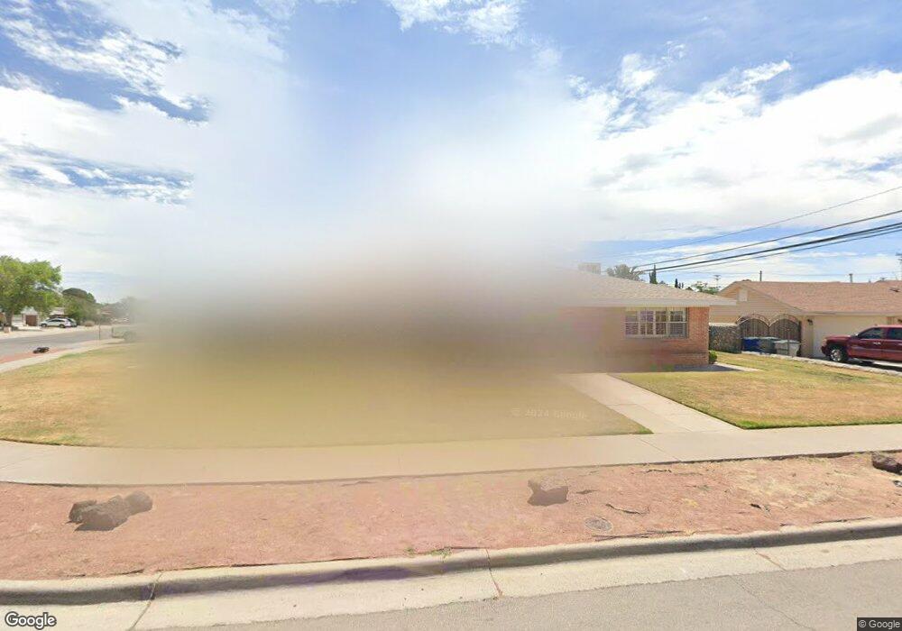
9712 Trinidad Dr El Paso, TX 79925
Eastwood NeighborhoodEstimated Value: $283,000 - $325,000
4
Beds
2
Baths
2,618
Sq Ft
$114/Sq Ft
Est. Value
About This Home
This home is located at 9712 Trinidad Dr, El Paso, TX 79925 and is currently estimated at $299,547, approximately $114 per square foot. 9712 Trinidad Dr is a home located in El Paso County with nearby schools including Scotsdale Elementary School, Eastwood Middle School, and Eastwood High School.
Ownership History
Date
Name
Owned For
Owner Type
Purchase Details
Closed on
Feb 21, 2000
Sold by
Rollins Karen H
Bought by
Mendez Ricardo and Mendez Ivonne Alicia
Current Estimated Value
Home Financials for this Owner
Home Financials are based on the most recent Mortgage that was taken out on this home.
Original Mortgage
$89,600
Interest Rate
8.19%
Purchase Details
Closed on
Feb 29, 1996
Sold by
Myers Baxter E and Myers Carol Ann
Bought by
Rollins Karen H
Home Financials for this Owner
Home Financials are based on the most recent Mortgage that was taken out on this home.
Original Mortgage
$78,000
Interest Rate
6.99%
Create a Home Valuation Report for This Property
The Home Valuation Report is an in-depth analysis detailing your home's value as well as a comparison with similar homes in the area
Home Values in the Area
Average Home Value in this Area
Purchase History
| Date | Buyer | Sale Price | Title Company |
|---|---|---|---|
| Mendez Ricardo | -- | -- | |
| Rollins Karen H | -- | -- |
Source: Public Records
Mortgage History
| Date | Status | Borrower | Loan Amount |
|---|---|---|---|
| Closed | Mendez Ricardo | $89,600 | |
| Previous Owner | Rollins Karen H | $78,000 |
Source: Public Records
Tax History Compared to Growth
Tax History
| Year | Tax Paid | Tax Assessment Tax Assessment Total Assessment is a certain percentage of the fair market value that is determined by local assessors to be the total taxable value of land and additions on the property. | Land | Improvement |
|---|---|---|---|---|
| 2025 | $3,840 | $284,448 | -- | -- |
| 2024 | $3,840 | $258,589 | -- | -- |
| 2023 | $3,753 | $235,081 | $0 | $0 |
| 2022 | $6,636 | $213,710 | $0 | $0 |
| 2021 | $6,315 | $194,282 | $33,524 | $160,758 |
| 2020 | $6,341 | $200,769 | $25,787 | $174,982 |
| 2018 | $6,166 | $198,295 | $25,787 | $172,508 |
| 2017 | $5,673 | $185,576 | $25,787 | $159,789 |
| 2016 | $5,673 | $185,576 | $25,787 | $159,789 |
| 2015 | $4,555 | $185,576 | $25,787 | $159,789 |
| 2014 | $4,555 | $186,019 | $25,787 | $160,232 |
Source: Public Records
Map
Nearby Homes
- 2425 Fir St
- 9917 Honolulu Dr
- 9674 Stonehaven Dr
- 9801 Eastridge Dr
- 2636 Prestwick Rd
- 9500 Mcintosh Dr
- 9525 Desert Ridge Dr
- 10145 Camwood Dr
- 10145 Singapore Ave
- 10140 Suez Dr
- 2801 Hawick Rd
- 2716 Catnip St
- 2736 Dunoon Dr
- 9941 Debbie Dr
- 2121 Jonwood St
- 10401 Springwood Dr
- 10304 Woodruff Ct
- 10233 Byway Dr
- 10309 Woodruff Ct
- 9505 Cosmos Ave
- 9728 Trinidad Dr
- 9708 Trinidad Dr
- 9807 Honolulu Dr
- 9725 Trinidad Dr
- 9713 Trinidad Dr
- 9729 Trinidad Dr
- 9717 Trinidad Dr
- 9709 Trinidad Dr
- 9804 Trinidad Dr
- 9700 Trinidad Dr
- 9815 Honolulu Dr
- 9801 9801 Dr
- 9803 Honolulu Dr
- 9712 Saigon Dr
- 9701 Trinidad Dr
- 2412 Fir St
- 9805 Trinidad Dr
- 9708 Saigon Dr
- 9716 Saigon Dr
- 2416 Fir St