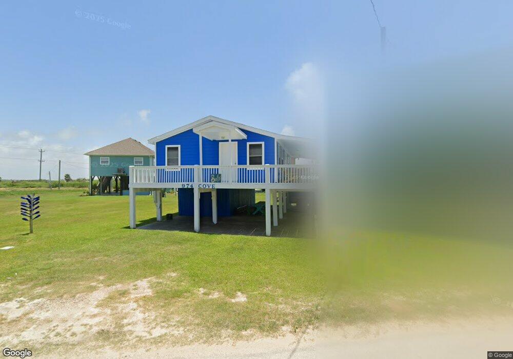
974 S Cove Dr Port Bolivar, TX 77650
Crystal Beach NeighborhoodEstimated Value: $242,440 - $340,000
--
Bed
--
Bath
864
Sq Ft
$333/Sq Ft
Est. Value
About This Home
This home is located at 974 S Cove Dr, Port Bolivar, TX 77650 and is currently estimated at $287,610, approximately $332 per square foot. 974 S Cove Dr is a home with nearby schools including Morgan Elementary Magnet School, Burnet STREAM Magnet School, and Parker Elementary School.
Ownership History
Date
Name
Owned For
Owner Type
Purchase Details
Closed on
May 15, 2009
Sold by
Carnright Ginger and Carnright Richard
Bought by
Harrison Linda and Harrison William
Current Estimated Value
Purchase Details
Closed on
Apr 24, 2007
Sold by
Lejune John E
Bought by
Carnright Ginger
Home Financials for this Owner
Home Financials are based on the most recent Mortgage that was taken out on this home.
Original Mortgage
$91,200
Interest Rate
6.1%
Mortgage Type
Purchase Money Mortgage
Purchase Details
Closed on
Feb 27, 2001
Sold by
Bennett Sterling and Bennett Monica E
Bought by
Lejune John E
Home Financials for this Owner
Home Financials are based on the most recent Mortgage that was taken out on this home.
Original Mortgage
$49,500
Interest Rate
6.97%
Mortgage Type
Purchase Money Mortgage
Purchase Details
Closed on
Feb 7, 2000
Sold by
Lovelace Robert C
Bought by
Bennett Sterling
Home Financials for this Owner
Home Financials are based on the most recent Mortgage that was taken out on this home.
Original Mortgage
$35,200
Interest Rate
8.09%
Mortgage Type
Purchase Money Mortgage
Create a Home Valuation Report for This Property
The Home Valuation Report is an in-depth analysis detailing your home's value as well as a comparison with similar homes in the area
Home Values in the Area
Average Home Value in this Area
Purchase History
| Date | Buyer | Sale Price | Title Company |
|---|---|---|---|
| Harrison Linda | -- | Stewart Title | |
| Carnright Ginger | -- | None Available | |
| Lejune John E | -- | -- | |
| Bennett Sterling | -- | Chicago Title |
Source: Public Records
Mortgage History
| Date | Status | Borrower | Loan Amount |
|---|---|---|---|
| Previous Owner | Carnright Ginger | $91,200 | |
| Previous Owner | Lejune John E | $49,500 | |
| Previous Owner | Bennett Sterling | $35,200 |
Source: Public Records
Tax History Compared to Growth
Tax History
| Year | Tax Paid | Tax Assessment Tax Assessment Total Assessment is a certain percentage of the fair market value that is determined by local assessors to be the total taxable value of land and additions on the property. | Land | Improvement |
|---|---|---|---|---|
| 2025 | $3,482 | $249,935 | $75,870 | $174,065 |
| 2024 | $3,482 | $256,780 | $75,870 | $180,910 |
| 2023 | $3,482 | $282,350 | $20,660 | $261,690 |
| 2022 | $3,148 | $195,390 | $20,660 | $174,730 |
| 2021 | $2,070 | $118,660 | $20,660 | $98,000 |
| 2020 | $2,138 | $115,200 | $20,660 | $94,540 |
| 2019 | $2,242 | $115,200 | $20,660 | $94,540 |
| 2018 | $2,138 | $109,250 | $20,660 | $88,590 |
| 2017 | $2,158 | $110,340 | $20,660 | $89,680 |
| 2016 | $2,152 | $110,000 | $20,660 | $89,340 |
| 2015 | $2,055 | $109,160 | $20,660 | $88,500 |
| 2014 | $1,519 | $75,120 | $13,500 | $61,620 |
Source: Public Records
Map
Nearby Homes
- 975 S Cove Dr
- 975 Fisherman Dr S
- 981 S Gateway Rd
- 941 S Gateway Rd
- 984 S Stingaree Dr
- 1012 S Stingaree Dr
- abst 65 B franks sur S Stingaree Dr
- 1001 S Stingaree Dr
- 970 S Redfish
- 972 S Redfish
- 982 S Redfish St
- 983 S Redfish St
- 974 S Stingaree Dr
- 976 Nassau Dr
- 981 S Stingaree Dr
- 956 S Redfish
- 3009 Sheron Ln
- 2904 Shady Ln
- 2906 Shady Ln
- 997 S Redfish