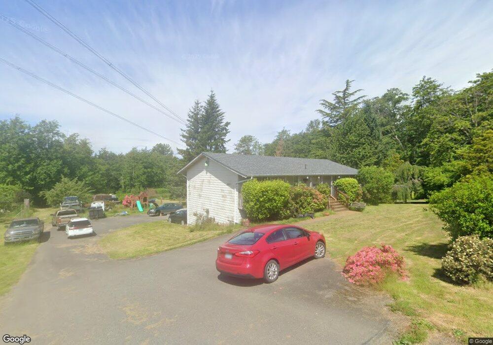
9767 Allan St Blaine, WA 98230
Estimated Value: $513,105 - $607,000
3
Beds
3
Baths
1,248
Sq Ft
$438/Sq Ft
Est. Value
About This Home
This home is located at 9767 Allan St, Blaine, WA 98230 and is currently estimated at $546,026, approximately $437 per square foot. 9767 Allan St is a home located in Whatcom County with nearby schools including Blaine Primary School, Blaine Elementary School, and Blaine Middle School.
Ownership History
Date
Name
Owned For
Owner Type
Purchase Details
Closed on
Oct 30, 2020
Sold by
Thomas Spence Edward
Bought by
Spence James Dean
Current Estimated Value
Purchase Details
Closed on
Feb 22, 2019
Sold by
Spence Judy Mae
Bought by
Spence Edward T
Home Financials for this Owner
Home Financials are based on the most recent Mortgage that was taken out on this home.
Original Mortgage
$44,975
Interest Rate
4.4%
Mortgage Type
New Conventional
Create a Home Valuation Report for This Property
The Home Valuation Report is an in-depth analysis detailing your home's value as well as a comparison with similar homes in the area
Home Values in the Area
Average Home Value in this Area
Purchase History
| Date | Buyer | Sale Price | Title Company |
|---|---|---|---|
| Spence James Dean | $10,000 | Carmichael Clark Ps | |
| Spence James Dean | -- | None Available | |
| Spence Edward T | -- | Nationalink |
Source: Public Records
Mortgage History
| Date | Status | Borrower | Loan Amount |
|---|---|---|---|
| Previous Owner | Spence Edward T | $44,975 |
Source: Public Records
Tax History Compared to Growth
Tax History
| Year | Tax Paid | Tax Assessment Tax Assessment Total Assessment is a certain percentage of the fair market value that is determined by local assessors to be the total taxable value of land and additions on the property. | Land | Improvement |
|---|---|---|---|---|
| 2024 | $2,937 | $436,130 | $159,840 | $276,290 |
| 2023 | $2,937 | $436,130 | $159,840 | $276,290 |
| 2022 | $3,039 | $392,910 | $144,000 | $248,910 |
| 2021 | $2,898 | $348,192 | $127,818 | $220,374 |
| 2020 | $703 | $302,776 | $111,146 | $191,630 |
| 2019 | $2,568 | $277,264 | $101,781 | $175,483 |
| 2018 | $578 | $251,962 | $92,493 | $159,469 |
| 2017 | $614 | $210,847 | $77,400 | $133,447 |
| 2016 | $609 | $210,847 | $77,400 | $133,447 |
| 2015 | $1,011 | $211,594 | $90,333 | $121,261 |
| 2014 | -- | $202,489 | $86,445 | $116,044 |
| 2013 | -- | $200,280 | $85,500 | $114,780 |
Source: Public Records
Map
Nearby Homes
- 2051 Lexington Ave
- 4475 D St
- 9695 Terrace Ave
- 4415 Harborview Dr
- 850 Ludwick Ave
- 811 Odell St
- 4280 H Street Rd
- 4279 H Street Rd
- 250 15th St
- 2791 Hazelwood Dr
- 508 Shore Pine Place
- 1710 Plan at East Maple Ridge
- 2319 Plan at East Maple Ridge
- 2194 Plan at East Maple Ridge
- 2850 Sandwood Ln
- 2832 Hazelwood Dr
- 2845 Oleander Dr
- 2991 Oleander Ln
- 3009 Oleander Ln
- 501 Shore Pine (Lot 1) Ct