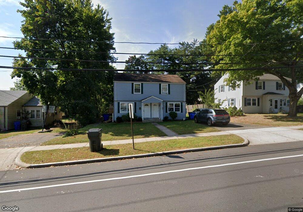
99 Mayflower St West Hartford, CT 06110
Estimated Value: $355,121 - $417,000
4
Beds
2
Baths
1,551
Sq Ft
$256/Sq Ft
Est. Value
About This Home
This home is located at 99 Mayflower St, West Hartford, CT 06110 and is currently estimated at $397,030, approximately $255 per square foot. 99 Mayflower St is a home located in Hartford County with nearby schools including Webster Hill School, Sedgwick Middle School, and Conard High School.
Ownership History
Date
Name
Owned For
Owner Type
Purchase Details
Closed on
Feb 12, 2021
Sold by
Mayflower Properties Llc
Bought by
Chang Rocio and Angulo Rory
Current Estimated Value
Purchase Details
Closed on
Sep 24, 1997
Sold by
Mckeever Brian
Bought by
Chang Rocio and Chang Cecilia
Home Financials for this Owner
Home Financials are based on the most recent Mortgage that was taken out on this home.
Original Mortgage
$116,769
Interest Rate
2.75%
Mortgage Type
Unknown
Create a Home Valuation Report for This Property
The Home Valuation Report is an in-depth analysis detailing your home's value as well as a comparison with similar homes in the area
Home Values in the Area
Average Home Value in this Area
Purchase History
| Date | Buyer | Sale Price | Title Company |
|---|---|---|---|
| Chang Rocio | -- | None Available | |
| Chang Rocio | $117,000 | -- | |
| Chang Rocio | $117,000 | -- |
Source: Public Records
Mortgage History
| Date | Status | Borrower | Loan Amount |
|---|---|---|---|
| Previous Owner | Chang Rocio | $110,001 | |
| Previous Owner | Chang Rocio | $116,769 |
Source: Public Records
Tax History Compared to Growth
Tax History
| Year | Tax Paid | Tax Assessment Tax Assessment Total Assessment is a certain percentage of the fair market value that is determined by local assessors to be the total taxable value of land and additions on the property. | Land | Improvement |
|---|---|---|---|---|
| 2025 | $7,120 | $159,010 | $44,000 | $115,010 |
| 2024 | $6,565 | $155,020 | $44,000 | $111,020 |
| 2023 | $6,343 | $155,020 | $44,000 | $111,020 |
| 2022 | $6,306 | $155,020 | $44,000 | $111,020 |
| 2021 | $5,155 | $121,520 | $40,000 | $81,520 |
| 2020 | $5,080 | $121,520 | $30,900 | $90,620 |
| 2019 | $5,080 | $121,520 | $30,870 | $90,650 |
| 2018 | $4,997 | $121,870 | $30,870 | $91,000 |
| 2017 | $5,002 | $121,870 | $30,870 | $91,000 |
| 2016 | $5,354 | $135,520 | $46,060 | $89,460 |
| 2015 | $5,192 | $135,520 | $46,060 | $89,460 |
| 2014 | $5,064 | $135,520 | $46,060 | $89,460 |
Source: Public Records
Map
Nearby Homes
- 39 Cortland St
- 67 Mayflower St
- 422 S Main St
- 1145 New Britain Ave
- 18 Federal St
- 16 School House Dr
- 62 Grove St
- 204 Trout Brook Dr
- 41 Page Ave
- 91 Shadow Ln Unit A2
- 83 Newington Rd
- 741 Quaker Ln S
- 24 Thorne Rd Unit 24
- 521 S Main St
- 54 Jackson Ave
- 274 Newington Rd
- 63 Rumford St
- 32 Miles Standish Dr
- 21 Echo Ln
- 26 Baldwin St
- 105 Mayflower St
- 95 Mayflower St
- 74 Cortland Cir
- 78 Cortland Cir
- 91 Mayflower St
- 72 Cortland Cir
- 84 Cortland Cir
- 115 Mayflower St
- 88 Cortland Cir
- 112 Mayflower St
- 83 Mayflower St
- 119 Mayflower St
- 71 Cortland Cir
- 118 Mayflower St
- 81 Cortland Cir
- 60 Cortland St
- 90 Mayflower St
- 92 Cortland Cir
- 77 Mayflower St
- 89 Cortland Cir