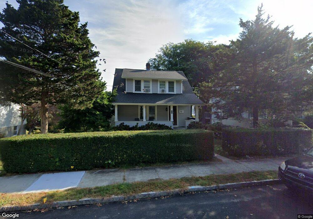
99 Oneco Ave New London, CT 06320
Estimated Value: $327,000 - $349,000
3
Beds
6
Baths
1,400
Sq Ft
$243/Sq Ft
Est. Value
About This Home
This home is located at 99 Oneco Ave, New London, CT 06320 and is currently estimated at $340,128, approximately $242 per square foot. 99 Oneco Ave is a home located in New London County with nearby schools including Harbor Elementary School, Bennie Dover Jackson Middle School, and New London High School.
Ownership History
Date
Name
Owned For
Owner Type
Purchase Details
Closed on
Mar 18, 2011
Sold by
Us Bank
Bought by
Hull-Manwaring John
Current Estimated Value
Home Financials for this Owner
Home Financials are based on the most recent Mortgage that was taken out on this home.
Original Mortgage
$110,300
Outstanding Balance
$75,965
Interest Rate
4.84%
Estimated Equity
$264,163
Purchase Details
Closed on
Dec 7, 2010
Sold by
Regan Thomas
Bought by
Us Bk
Create a Home Valuation Report for This Property
The Home Valuation Report is an in-depth analysis detailing your home's value as well as a comparison with similar homes in the area
Home Values in the Area
Average Home Value in this Area
Purchase History
| Date | Buyer | Sale Price | Title Company |
|---|---|---|---|
| Hull-Manwaring John | $137,900 | -- | |
| Hull-Manwaring John | $137,900 | -- | |
| Us Bk | -- | -- | |
| Us Bk | -- | -- |
Source: Public Records
Mortgage History
| Date | Status | Borrower | Loan Amount |
|---|---|---|---|
| Open | Hull-Manwaring John | $110,300 | |
| Closed | Us Bk | $110,300 | |
| Previous Owner | Us Bk | $251,750 | |
| Previous Owner | Us Bk | $30,000 |
Source: Public Records
Tax History Compared to Growth
Tax History
| Year | Tax Paid | Tax Assessment Tax Assessment Total Assessment is a certain percentage of the fair market value that is determined by local assessors to be the total taxable value of land and additions on the property. | Land | Improvement |
|---|---|---|---|---|
| 2025 | $5,138 | $188,900 | $70,500 | $118,400 |
| 2024 | $5,195 | $188,900 | $70,500 | $118,400 |
| 2023 | $4,082 | $109,620 | $46,270 | $63,350 |
| 2022 | $4,090 | $109,620 | $46,270 | $63,350 |
| 2021 | $4,160 | $109,620 | $46,270 | $63,350 |
| 2020 | $4,186 | $109,620 | $46,270 | $63,350 |
| 2019 | $4,374 | $109,620 | $46,270 | $63,350 |
| 2018 | $4,666 | $106,680 | $54,600 | $52,080 |
| 2017 | $4,722 | $106,680 | $54,600 | $52,080 |
| 2016 | $4,316 | $106,680 | $54,600 | $52,080 |
| 2015 | $4,213 | $106,680 | $54,600 | $52,080 |
| 2014 | $3,656 | $106,680 | $54,600 | $52,080 |
Source: Public Records
Map
Nearby Homes
- 271 Crystal Ave
- 265 Crystal Ave
- 62 Benham Ave
- 19 Hawthorne Dr Unit 104
- 621 Military Hwy
- 30 Margaret St
- 23 Whittlesey St
- 171 Norwood Ave
- 140 Norwood Ave
- 1 E Lake Dr
- 141 Starr Hill Rd
- 9 James Ave
- 139 Vauxhall St
- 430 Vauxhall St
- 385 Broad St
- 21 Grove Ave
- 47 Phillips St
- 118 Bloomingdale Rd
- 14 N Phillips St
- 1 Chapman Ave
- 105 Oneco Ave
- 95 Oneco Ave
- 87 Oneco Ave
- 111 Oneco Ave
- 111 Oneco Ave Unit A
- 111 Oneco Ave Unit A
- 111 Oneco Ave Unit C
- 111 Oneco Ave Unit D
- 85 Oneco Ave
- 86 Oneco Ave
- 109 Nameaug Ave
- 107 Nameaug Ave Unit 2
- 75 Oneco Ave
- 5 Farnsworth St
- 9 Farnsworth St
- 111 Nameaug Ave
- 93 Nameaug Ave
- 1 Farnsworth St
- 1 Farnsworth St Unit 1
- 1 Farnsworth St Unit 3