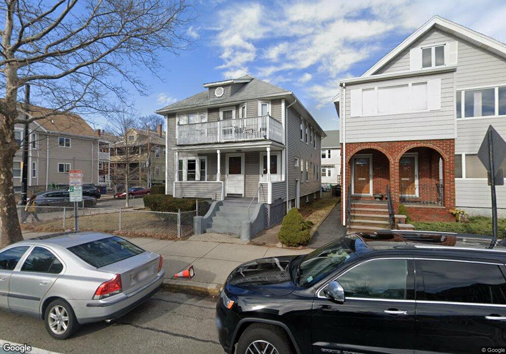
993 Broadway Somerville, MA 02144
Davis Square NeighborhoodEstimated Value: $1,250,000 - $1,593,000
4
Beds
2
Baths
2,177
Sq Ft
$634/Sq Ft
Est. Value
About This Home
This home is located at 993 Broadway, Somerville, MA 02144 and is currently estimated at $1,381,238, approximately $634 per square foot. 993 Broadway is a home located in Middlesex County with nearby schools including Somerville High School, St. Clement Elementary School, and International School of Boston.
Ownership History
Date
Name
Owned For
Owner Type
Purchase Details
Closed on
Jul 3, 2013
Sold by
Verity Joseph S
Bought by
Verity Joseph S and Verity James W
Current Estimated Value
Home Financials for this Owner
Home Financials are based on the most recent Mortgage that was taken out on this home.
Original Mortgage
$220,000
Interest Rate
3.59%
Mortgage Type
New Conventional
Purchase Details
Closed on
Jun 7, 2010
Sold by
Verity Joseph S
Bought by
Verity James W and Verity Joseph S
Create a Home Valuation Report for This Property
The Home Valuation Report is an in-depth analysis detailing your home's value as well as a comparison with similar homes in the area
Home Values in the Area
Average Home Value in this Area
Purchase History
| Date | Buyer | Sale Price | Title Company |
|---|---|---|---|
| Verity Joseph S | -- | -- | |
| Verity James W | -- | -- |
Source: Public Records
Mortgage History
| Date | Status | Borrower | Loan Amount |
|---|---|---|---|
| Closed | Verity Joseph S | $220,000 |
Source: Public Records
Tax History Compared to Growth
Tax History
| Year | Tax Paid | Tax Assessment Tax Assessment Total Assessment is a certain percentage of the fair market value that is determined by local assessors to be the total taxable value of land and additions on the property. | Land | Improvement |
|---|---|---|---|---|
| 2025 | $11,908 | $1,091,500 | $715,400 | $376,100 |
| 2024 | $11,274 | $1,071,700 | $715,400 | $356,300 |
| 2023 | $11,019 | $1,065,700 | $715,400 | $350,300 |
| 2022 | $10,200 | $1,002,000 | $681,300 | $320,700 |
| 2021 | $9,978 | $979,200 | $676,400 | $302,800 |
| 2020 | $9,825 | $973,700 | $676,800 | $296,900 |
| 2019 | $9,401 | $873,700 | $616,100 | $257,600 |
| 2018 | $9,119 | $806,300 | $560,100 | $246,200 |
| 2017 | $8,795 | $753,600 | $528,400 | $225,200 |
| 2016 | $8,893 | $709,700 | $471,900 | $237,800 |
Source: Public Records
Map
Nearby Homes
- 20 Electric Ave Unit 2
- 23 Ossipee Rd
- 29 Packard Ave
- 55 Packard Ave Unit 1
- 26 Warner St
- 50 Howard St Unit 5
- 11 Watson St Unit 1
- 11 Watson St Unit 2
- 67-69 Cameron Ave
- 69 Clarendon Ave Unit A
- 202 Powder House Blvd Unit 2
- 39 Seven Pines Ave
- 33 Conwell Ave
- 32 Cameron Ave
- 24 Washburn Ave Unit 1
- 15 Colby St
- 34 Belknap St
- 34 Day St
- 17 Shea Rd
- 235 Powder House Blvd
- 991 Broadway
- 985 Broadway
- 999 Broadway
- 998 Broadway
- 998 Broadway Unit 1
- 998 Broadway Unit 3
- 9 Mason St
- 1007 Broadway
- 1001 Broadway
- 1000 Broadway
- 987 Broadway
- 987 Broadway Unit 1
- 2 Whitman St
- 2 Whitman St
- 2 Whitman St Unit 1
- 983 Broadway
- 1002 Broadway
- 1002 Broadway Unit 3
- 1002 Broadway Unit 2
- 1005 Broadway