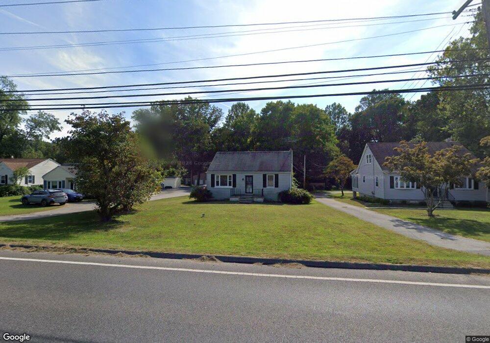
994 Generals Hwy Crownsville, MD 21032
Estimated Value: $383,587 - $509,000
--
Bed
1
Bath
1,216
Sq Ft
$360/Sq Ft
Est. Value
About This Home
This home is located at 994 Generals Hwy, Crownsville, MD 21032 and is currently estimated at $437,897, approximately $360 per square foot. 994 Generals Hwy is a home located in Anne Arundel County with nearby schools including Millersville Elementary School, Old Mill High School, and Indian Creek School.
Ownership History
Date
Name
Owned For
Owner Type
Purchase Details
Closed on
Jan 20, 2010
Sold by
Parsons Carrie E
Bought by
Parsons Carrie E and White Kimberly L
Current Estimated Value
Home Financials for this Owner
Home Financials are based on the most recent Mortgage that was taken out on this home.
Original Mortgage
$163,000
Outstanding Balance
$110,496
Interest Rate
6.47%
Mortgage Type
New Conventional
Estimated Equity
$327,401
Purchase Details
Closed on
Jan 31, 2008
Sold by
Parsons Walter N
Bought by
Parsons Carrie E
Home Financials for this Owner
Home Financials are based on the most recent Mortgage that was taken out on this home.
Original Mortgage
$441,000
Interest Rate
4.04%
Mortgage Type
Reverse Mortgage Home Equity Conversion Mortgage
Purchase Details
Closed on
Jan 18, 2008
Sold by
Parsons Walter N
Bought by
Parsons Carrie E
Home Financials for this Owner
Home Financials are based on the most recent Mortgage that was taken out on this home.
Original Mortgage
$441,000
Interest Rate
4.04%
Mortgage Type
Reverse Mortgage Home Equity Conversion Mortgage
Create a Home Valuation Report for This Property
The Home Valuation Report is an in-depth analysis detailing your home's value as well as a comparison with similar homes in the area
Home Values in the Area
Average Home Value in this Area
Purchase History
| Date | Buyer | Sale Price | Title Company |
|---|---|---|---|
| Parsons Carrie E | -- | -- | |
| Parsons Carrie E | -- | -- | |
| Parsons Carrie E | -- | -- |
Source: Public Records
Mortgage History
| Date | Status | Borrower | Loan Amount |
|---|---|---|---|
| Open | Parsons Carrie E | $163,000 | |
| Previous Owner | Parsons Carrie E | $441,000 | |
| Previous Owner | Parsons Carrie E | $441,000 |
Source: Public Records
Tax History Compared to Growth
Tax History
| Year | Tax Paid | Tax Assessment Tax Assessment Total Assessment is a certain percentage of the fair market value that is determined by local assessors to be the total taxable value of land and additions on the property. | Land | Improvement |
|---|---|---|---|---|
| 2025 | $2,913 | $335,300 | -- | -- |
| 2024 | $2,913 | $314,200 | $0 | $0 |
| 2023 | $2,814 | $293,100 | $204,600 | $88,500 |
| 2022 | $2,640 | $291,567 | $0 | $0 |
| 2021 | $5,209 | $290,033 | $0 | $0 |
| 2020 | $2,528 | $288,500 | $204,600 | $83,900 |
| 2019 | $2,492 | $283,700 | $0 | $0 |
| 2018 | $2,828 | $278,900 | $0 | $0 |
| 2017 | $2,362 | $274,100 | $0 | $0 |
| 2016 | -- | $268,333 | $0 | $0 |
| 2015 | -- | $262,567 | $0 | $0 |
| 2014 | -- | $256,800 | $0 | $0 |
Source: Public Records
Map
Nearby Homes
- 1080 Generals Hwy
- 1400 Lower View Ct
- 983 Wayside Dr
- 1013 Waterbury Heights Dr
- 1220 Indian Landing Rd
- 1404 Cotton Ct
- 771 Generals Hwy
- 1458 Wilderness Ridge Trail
- 1184 Tanager Dr
- 1759 Daisey Ct
- 30 Highland Dr
- 626 Evergreen Rd
- 605, 607 Crain Hwy N
- 1610 Hog Farm Rd
- 397 Charles Hall Dr
- 610 Echo Cove Dr
- 1270 Dorothy Rd
- 1158 Blue Bird Ln
- 0 Old Herald Harbor Rd Unit MDAA2109542
- 0 Old Herald Harbor Rd Unit MDAA2115958
- 992 Generals Hwy
- 996 Generals Hwy
- 998 Generals Hwy
- 991 Generals Hwy
- 1000 Generals Hwy
- 986 Generals Hwy
- 982 Generals Hwy
- 1313 Suburban Way
- 1314 Suburban Way
- 1010 Generals Hwy
- 988 Generals Hwy
- 1015 Generals Hwy
- 1015 Generals Hwy Unit SUITE 1
- 1012 Generals Hwy
- 1418 Paddocks Ct
- 1416 Paddocks Ct
- 1310 Suburban Way
- 1017 Generals Hwy
- 1309 Suburban Way
- 1016 Generals Hwy