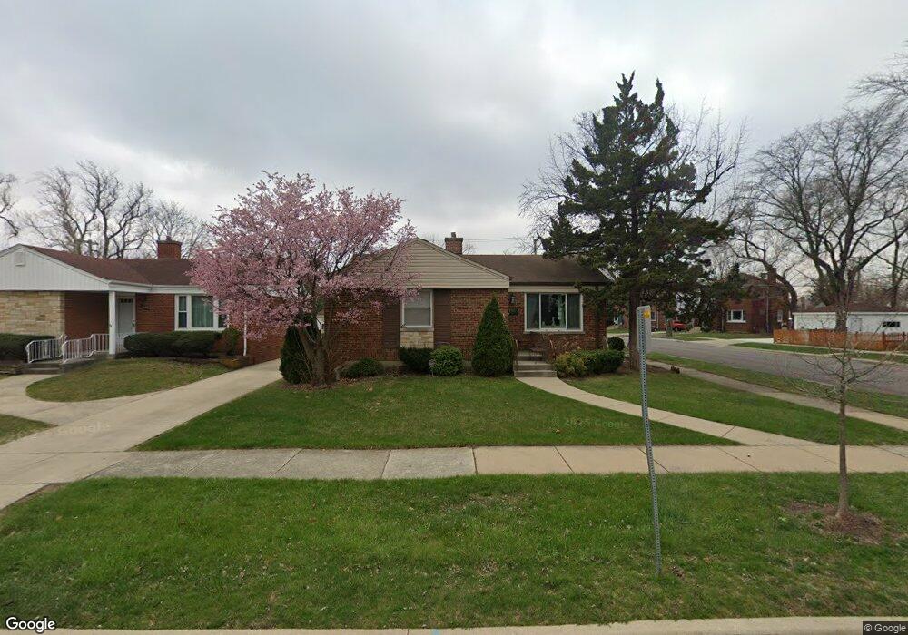
9965 Drury Ln Westchester, IL 60154
Estimated Value: $317,032 - $373,000
3
Beds
1
Bath
1,112
Sq Ft
$308/Sq Ft
Est. Value
About This Home
This home is located at 9965 Drury Ln, Westchester, IL 60154 and is currently estimated at $342,008, approximately $307 per square foot. 9965 Drury Ln is a home located in Cook County with nearby schools including Westchester Primary School, Westchester Intermediate School, and Westchester Middle School.
Ownership History
Date
Name
Owned For
Owner Type
Purchase Details
Closed on
Jul 19, 2005
Sold by
Stanger Edward A and Straube Hans
Bought by
Flynn Catherine M
Current Estimated Value
Home Financials for this Owner
Home Financials are based on the most recent Mortgage that was taken out on this home.
Original Mortgage
$200,000
Outstanding Balance
$104,739
Interest Rate
5.71%
Mortgage Type
Fannie Mae Freddie Mac
Estimated Equity
$237,269
Purchase Details
Closed on
Jan 26, 2005
Sold by
Reed Steven
Bought by
Stanger Edward A and Straube Hans
Create a Home Valuation Report for This Property
The Home Valuation Report is an in-depth analysis detailing your home's value as well as a comparison with similar homes in the area
Home Values in the Area
Average Home Value in this Area
Purchase History
| Date | Buyer | Sale Price | Title Company |
|---|---|---|---|
| Flynn Catherine M | $250,000 | Multiple | |
| Stanger Edward A | $200,000 | Multiple |
Source: Public Records
Mortgage History
| Date | Status | Borrower | Loan Amount |
|---|---|---|---|
| Open | Flynn Catherine M | $200,000 |
Source: Public Records
Tax History Compared to Growth
Tax History
| Year | Tax Paid | Tax Assessment Tax Assessment Total Assessment is a certain percentage of the fair market value that is determined by local assessors to be the total taxable value of land and additions on the property. | Land | Improvement |
|---|---|---|---|---|
| 2024 | $4,470 | $23,000 | $4,628 | $18,372 |
| 2023 | $4,115 | $23,000 | $4,628 | $18,372 |
| 2022 | $4,115 | $19,645 | $3,967 | $15,678 |
| 2021 | $4,031 | $19,643 | $3,966 | $15,677 |
| 2020 | $5,668 | $19,643 | $3,966 | $15,677 |
| 2019 | $3,248 | $17,669 | $3,636 | $14,033 |
| 2018 | $4,569 | $19,824 | $3,636 | $16,188 |
| 2017 | $4,498 | $19,824 | $3,636 | $16,188 |
| 2016 | $3,647 | $15,003 | $3,305 | $11,698 |
| 2015 | $3,564 | $15,003 | $3,305 | $11,698 |
| 2014 | $4,046 | $16,955 | $3,305 | $13,650 |
| 2013 | $4,189 | $19,293 | $3,305 | $15,988 |
Source: Public Records
Map
Nearby Homes
- 10072 Drury Ln
- 1500 Bristol Ave
- 1119 Newcastle Ave
- 920 Suffolk Ave
- 923 Manchester Ave
- 1601 Bristol Ave
- 1623 Manchester Ave
- 814 Norfolk Ave
- 805 Norfolk Ave
- 750 Bristol Ave
- 1816 Manchester Ave
- 1247 S Mannheim Rd Unit 3
- 1840 Gardner Rd
- 1900 Manchester Ave
- 626 Manchester Ave
- 1907 Suffolk Ave
- 2320 S 22nd Ave
- 723 Balmoral Ave
- 2237 S 22nd Ave
- 2003 S 24th Ave
- 9959 Drury Ln
- 1317 Suffolk Ave
- 10001 Drury Ln
- 9947 Drury Ln
- 10007 Drury Ln
- 1325 Suffolk Ave
- 9964 Derby Ln
- 1310 Suffolk Ave
- 9958 Drury Ln
- 9943 Drury Ln
- 9964 Drury Ln
- 1316 Suffolk Ave
- 10011 Drury Ln
- 9970 Drury Ln
- 9954 Drury Ln
- 1331 Suffolk Ave
- 1320 Suffolk Ave
- 9976 Drury Ln
- 1326 Norfolk Ave
- 9950 Drury Ln